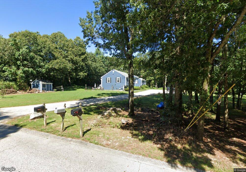
5 Clark Rd Wrentham, MA 02093
Estimated Value: $334,649 - $407,000
2
Beds
1
Bath
958
Sq Ft
$387/Sq Ft
Est. Value
About This Home
This home is located at 5 Clark Rd, Wrentham, MA 02093 and is currently estimated at $370,912, approximately $387 per square foot. 5 Clark Rd is a home located in Norfolk County with nearby schools including Delaney Elementary School, Charles E Roderick, and Discovery Daycare Center.
Ownership History
Date
Name
Owned For
Owner Type
Purchase Details
Closed on
Dec 20, 1993
Sold by
Usa Va
Bought by
Sweeney John T and Sweeney Jean M
Current Estimated Value
Purchase Details
Closed on
Sep 17, 1992
Sold by
Flaherty Paul R V
Bought by
Empire Of Amer Rlty Cr
Purchase Details
Closed on
Nov 10, 1988
Sold by
Volpiecli Joseph
Bought by
Flaherty Paul R
Create a Home Valuation Report for This Property
The Home Valuation Report is an in-depth analysis detailing your home's value as well as a comparison with similar homes in the area
Purchase History
| Date | Buyer | Sale Price | Title Company |
|---|---|---|---|
| Sweeney John T | $93,003 | -- | |
| Empire Of Amer Rlty Cr | $89,000 | -- | |
| Flaherty Paul R | $139,900 | -- |
Source: Public Records
Mortgage History
| Date | Status | Borrower | Loan Amount |
|---|---|---|---|
| Open | Flaherty Paul R | $191,550 | |
| Closed | Flaherty Paul R | $177,500 |
Source: Public Records
Tax History
| Year | Tax Paid | Tax Assessment Tax Assessment Total Assessment is a certain percentage of the fair market value that is determined by local assessors to be the total taxable value of land and additions on the property. | Land | Improvement |
|---|---|---|---|---|
| 2025 | $3,093 | $266,900 | $0 | $266,900 |
| 2024 | $3,203 | $266,900 | $0 | $266,900 |
| 2023 | $3,281 | $260,000 | $0 | $260,000 |
| 2022 | $3,311 | $242,200 | $0 | $242,200 |
| 2021 | $3,157 | $224,400 | $0 | $224,400 |
| 2020 | $3,078 | $216,000 | $0 | $216,000 |
| 2019 | $3,050 | $216,000 | $0 | $216,000 |
| 2018 | $3,110 | $218,400 | $0 | $218,400 |
| 2017 | $3,028 | $212,500 | $0 | $212,500 |
| 2016 | $2,920 | $204,500 | $0 | $204,500 |
| 2015 | $2,569 | $171,500 | $0 | $171,500 |
| 2014 | $2,655 | $173,400 | $0 | $173,400 |
Source: Public Records
Map
Nearby Homes
- 10 Nature View Dr
- 15 Nature View Dr
- 282 Thurston St
- 135 Creek St Unit 2
- 3 Earle Stewart Ln
- 483 Thurston St
- 2 Earle Stewart Ln
- 12 Earle Stewart Ln
- 10 Earle Stewart Ln Unit Lot 5
- 576 Dedham St
- 1 Weber Farm Rd Unit 1
- 500 Franklin St
- 11 Weber Farm Rd Unit 11
- 8 Weber Farm Rd Unit 8
- 25 Foxboro Rd
- 30 Weber Farm Rd Unit 30
- 131 Washington St Unit 42
- 131 Washington St Unit 50
- 246 Forest Grove Ave
- 75 Foxboro Rd
Your Personal Tour Guide
Ask me questions while you tour the home.