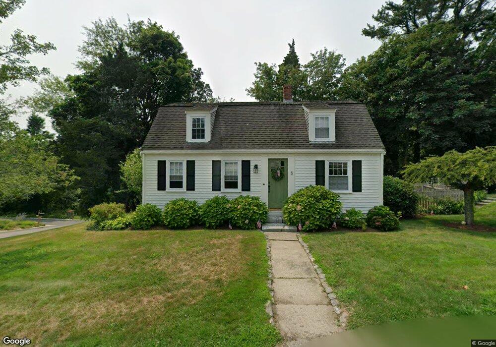
5 Columbia Rd Unit 5 Marshfield, MA 02050
Estimated Value: $795,000 - $921,000
3
Beds
2
Baths
1,992
Sq Ft
$435/Sq Ft
Est. Value
About This Home
This home is located at 5 Columbia Rd Unit 5, Marshfield, MA 02050 and is currently estimated at $866,328, approximately $434 per square foot. 5 Columbia Rd Unit 5 is a home located in Plymouth County with nearby schools including Eames Way School, Furnace Brook Middle School, and Marshfield High School.
Ownership History
Date
Name
Owned For
Owner Type
Purchase Details
Closed on
Sep 15, 2022
Sold by
Robichau Jason A and Durkin Slobhan M
Bought by
Garrity Brendan and Garrity Giovanna
Current Estimated Value
Home Financials for this Owner
Home Financials are based on the most recent Mortgage that was taken out on this home.
Original Mortgage
$614,700
Outstanding Balance
$584,306
Interest Rate
4.99%
Mortgage Type
Purchase Money Mortgage
Estimated Equity
$282,022
Purchase Details
Closed on
Jan 17, 2013
Sold by
Gorham Catherine G
Bought by
Robichau Jason A and Durkin Siobhan M
Home Financials for this Owner
Home Financials are based on the most recent Mortgage that was taken out on this home.
Original Mortgage
$356,425
Interest Rate
3.39%
Mortgage Type
New Conventional
Purchase Details
Closed on
Nov 15, 2004
Sold by
Daniels Andrew and Daniels Laura
Bought by
Gosian Catherine G
Purchase Details
Closed on
Sep 10, 2004
Sold by
Gosian Mark S and Gosian Catherine G
Bought by
Gosian Catherine G
Purchase Details
Closed on
May 8, 1998
Sold by
Oconnor Ellen
Bought by
Daniels Andrew and Daniels Laura
Purchase Details
Closed on
Aug 28, 1987
Sold by
Mafera Robert K
Bought by
Oconnor Ellen
Create a Home Valuation Report for This Property
The Home Valuation Report is an in-depth analysis detailing your home's value as well as a comparison with similar homes in the area
Home Values in the Area
Average Home Value in this Area
Purchase History
| Date | Buyer | Sale Price | Title Company |
|---|---|---|---|
| Garrity Brendan | $683,000 | None Available | |
| Robichau Jason A | $363,000 | -- | |
| Gosian Catherine G | $469,900 | -- | |
| Gosian Catherine G | $469,900 | -- | |
| Gosian Catherine G | -- | -- | |
| Daniels Andrew | $179,900 | -- | |
| Daniels Andrew | $179,900 | -- | |
| Oconnor Ellen | $139,900 | -- |
Source: Public Records
Mortgage History
| Date | Status | Borrower | Loan Amount |
|---|---|---|---|
| Open | Garrity Brendan | $614,700 | |
| Closed | Garrity Brendan | $614,700 | |
| Previous Owner | Oconnor Ellen | $356,425 |
Source: Public Records
Tax History
| Year | Tax Paid | Tax Assessment Tax Assessment Total Assessment is a certain percentage of the fair market value that is determined by local assessors to be the total taxable value of land and additions on the property. | Land | Improvement |
|---|---|---|---|---|
| 2025 | $7,137 | $720,900 | $260,900 | $460,000 |
| 2024 | $6,893 | $663,400 | $250,900 | $412,500 |
| 2023 | $5,698 | $513,800 | $230,800 | $283,000 |
| 2022 | $5,698 | $440,000 | $200,700 | $239,300 |
| 2021 | $5,473 | $414,900 | $200,700 | $214,200 |
| 2020 | $5,313 | $398,600 | $190,700 | $207,900 |
| 2019 | $5,166 | $386,100 | $190,700 | $195,400 |
| 2018 | $5,106 | $381,900 | $190,700 | $191,200 |
| 2017 | $4,828 | $351,900 | $180,600 | $171,300 |
| 2016 | $4,711 | $339,400 | $180,600 | $158,800 |
| 2015 | $4,455 | $335,200 | $180,600 | $154,600 |
| 2014 | $4,346 | $327,000 | $180,600 | $146,400 |
Source: Public Records
Map
Nearby Homes
- 4 Summer St
- 3 Summer St
- 255 Ridge Rd
- 566 Holly Rd
- 16 Schooner Way
- 39 High Beacon Way
- 76 Macombers Way
- 55 Macombers Way
- 480 Pleasant St
- 155 Quincy Ave
- 38 Winthrop Dr
- 1155 Main St
- 92 Salt Meadow Waye
- 235 Main St
- 1 Valley Path
- 30 Chandler Dr
- 2 Collier Rd
- 32 Gratto Rd
- 40 Driftway Unit 27
- 40 Driftway Unit 13