
Seller's Agent in 2025
Jermaine English
Expressway Realty LLC
(609) 330-8792
10 in this area
102 Total Sales
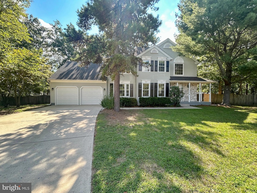
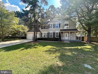
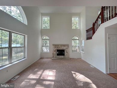
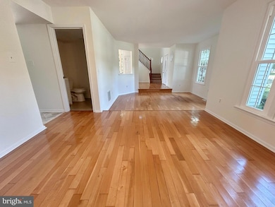
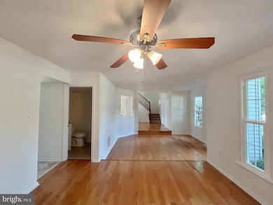
This recently refreshed home features three bedrooms and two and a half bathrooms, situated on a quiet cul-de-sac. The home features practical living spaces designed for comfort and functional rooms that provide a pleasant residential experience for all occupants. Home has new carpet and paint throughout creating a move-in ready environment.
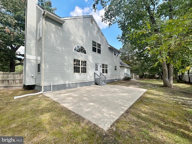
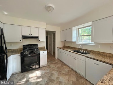
The sun-filled breakfast nook provides a cheerful dining space, while the eat-in kitchen and formal dining room offer additional options for meals and entertaining. The full basement provides extra storage and potential living space, complemented by an attached two-car garage with interior access.
The wrap around porch creates welcoming outdoor space, while the private backyard offers a secure area for relaxation and activities. The Wiltons Corner Community offers a clubhouse, pool, basketball & tennis courts, walking trails, playgrounds and so much to enjoy. The location provides excellent access to major roads and highways, ensuring convenient commuting throughout the area. Home is being sold as is. Purchaser is responsible to complete their own due diligence and will be responsible for all lender and/or municipal required inspections, certifications and CO. State realty transfer tax will be split between the buyer(s) and the seller at the time of closing. All information is deemed reliable but not guaranteed. Property must be listed in the MLS for 7 days before the seller will review, negotiate or accept any offers.
Last Agent to Sell the Property
(856) 740-2955 expresswayrealty@gmail.com Expressway Realty LLC Listed on: 09/06/2025
Co-Listed By
(856) 740-2955 expresswayrealty@gmail.com Expressway Realty LLC License #0673540
Last Buyer's Agent
(856) 446-0405 bob.krupa@myskrg.com Ovation Realty LLC License #2551786
| Date | Type | Sale Price | Title Company |
|---|---|---|---|
| Deed | $492,000 | Coastal Title Agency | |
| Sheriffs Deed | -- | None Available | |
| Deed | $289,900 | -- | |
| Deed | $161,900 | -- |
| Date | Status | Loan Amount | Loan Type |
|---|---|---|---|
| Open | $10,000 | No Value Available | |
| Previous Owner | $491,000 | VA | |
| Previous Owner | $190,000 | No Value Available | |
| Previous Owner | $75,000 | No Value Available |
| Date | Event | Price | List to Sale | Price per Sq Ft |
|---|---|---|---|---|
| 12/02/2025 12/02/25 | Sold | $492,000 | -0.6% | $232 / Sq Ft |
| 10/26/2025 10/26/25 | Pending | -- | -- | -- |
| 10/01/2025 10/01/25 | Price Changed | $494,900 | -2.9% | $234 / Sq Ft |
| 09/06/2025 09/06/25 | For Sale | $509,900 | -- | $241 / Sq Ft |
| Year | Tax Paid | Tax Assessment Tax Assessment Total Assessment is a certain percentage of the fair market value that is determined by local assessors to be the total taxable value of land and additions on the property. | Land | Improvement |
|---|---|---|---|---|
| 2025 | $9,193 | $235,600 | $55,000 | $180,600 |
| 2024 | $8,950 | $235,600 | $55,000 | $180,600 |
| 2023 | $8,950 | $235,600 | $55,000 | $180,600 |
| 2022 | $8,675 | $235,600 | $55,000 | $180,600 |
| 2021 | $8,370 | $235,600 | $55,000 | $180,600 |
| 2020 | $8,706 | $241,300 | $55,000 | $186,300 |
| 2019 | $8,653 | $241,300 | $55,000 | $186,300 |
| 2018 | $8,535 | $241,300 | $55,000 | $186,300 |
| 2017 | $8,383 | $241,300 | $55,000 | $186,300 |
| 2016 | $8,277 | $241,300 | $55,000 | $186,300 |
| 2015 | $8,156 | $241,300 | $55,000 | $186,300 |
| 2014 | $7,975 | $241,300 | $55,000 | $186,300 |
Seller's Agent in 2025
Jermaine English
Expressway Realty LLC
(609) 330-8792
10 in this area
102 Total Sales
J
Seller Co-Listing Agent in 2025
JENNIFER DILLARD
Expressway Realty LLC
(609) 352-2014
6 in this area
40 Total Sales
T
Buyer's Agent in 2025
Tommy Palmer
Ovation Realty LLC
1 in this area
3 Total Sales
Source: Bright MLS
MLS Number: NJCD2101404
APN: 36-01105-02-00007
Disclaimer: Certain information contained herein is derived from information provided by parties other than Homes.com. All information provided is deemed reliable, but is not guaranteed to be accurate and should be independently verified.
![]() The data relating to real estate for sale on this website appears in part through the BRIGHT Internet Data Exchange program, a voluntary cooperative exchange of property listing data between licensed real estate brokerage firms, and is provided by BRIGHT through a licensing agreement.
The data relating to real estate for sale on this website appears in part through the BRIGHT Internet Data Exchange program, a voluntary cooperative exchange of property listing data between licensed real estate brokerage firms, and is provided by BRIGHT through a licensing agreement.
Listing information is from various brokers who participate in the Bright MLS IDX program and not all listings may be visible on the site.
The property information being provided on or through the website is for the personal, non-commercial use of consumers and such information may not be used for any purpose other than to identify prospective properties consumers may be interested in purchasing.
Some properties which appear for sale on the website may no longer be available because they are for instance, under contract, sold or are no longer being offered for sale.
Property information displayed is deemed reliable but is not guaranteed.
Copyright 2026 Bright MLS, Inc.
Ask me questions while you tour the home.