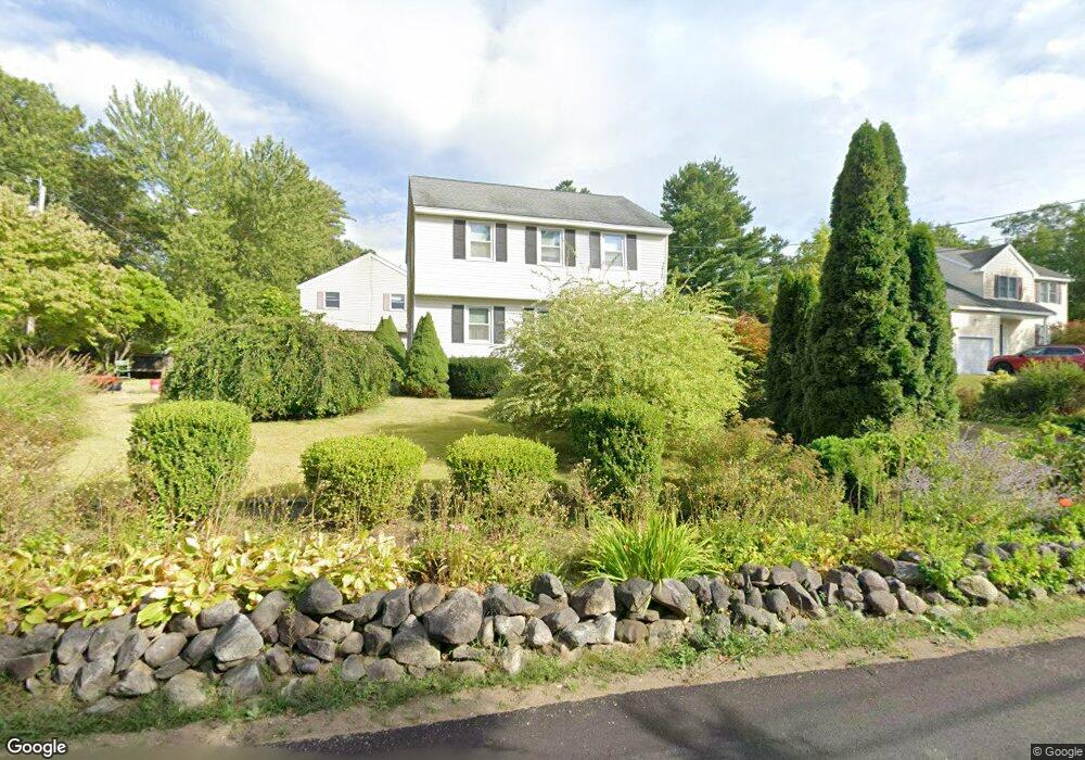
5 Cypress Rd Groton, MA 01450
Estimated Value: $502,000 - $546,000
3
Beds
2
Baths
1,568
Sq Ft
$337/Sq Ft
Est. Value
About This Home
This home is located at 5 Cypress Rd, Groton, MA 01450 and is currently estimated at $528,590, approximately $337 per square foot. 5 Cypress Rd is a home located in Middlesex County with nearby schools including Groton Dunstable Regional High School, Groton Community School, and Seven Hills At Groton.
Ownership History
Date
Name
Owned For
Owner Type
Purchase Details
Closed on
Sep 8, 2022
Sold by
Magaletta Josephine J
Bought by
Mattera Stacey A and Quigg John J
Current Estimated Value
Home Financials for this Owner
Home Financials are based on the most recent Mortgage that was taken out on this home.
Original Mortgage
$276,000
Outstanding Balance
$263,791
Interest Rate
5.3%
Mortgage Type
Purchase Money Mortgage
Estimated Equity
$264,799
Purchase Details
Closed on
Jan 16, 1992
Sold by
B Squared Corp
Bought by
Magaletta Roger M and Magaletta Josephine
Home Financials for this Owner
Home Financials are based on the most recent Mortgage that was taken out on this home.
Original Mortgage
$95,200
Interest Rate
8.57%
Mortgage Type
Purchase Money Mortgage
Purchase Details
Closed on
Oct 16, 1987
Sold by
Smith Donald P
Bought by
Rappoport William D
Home Financials for this Owner
Home Financials are based on the most recent Mortgage that was taken out on this home.
Original Mortgage
$100,000
Interest Rate
10.63%
Mortgage Type
Purchase Money Mortgage
Create a Home Valuation Report for This Property
The Home Valuation Report is an in-depth analysis detailing your home's value as well as a comparison with similar homes in the area
Home Values in the Area
Average Home Value in this Area
Purchase History
| Date | Buyer | Sale Price | Title Company |
|---|---|---|---|
| Mattera Stacey A | $400,000 | None Available | |
| Mattera Stacey A | $400,000 | None Available | |
| Mattera Stacey A | $400,000 | None Available | |
| Magaletta Roger M | $119,000 | -- | |
| Rappoport William D | $30,000 | -- |
Source: Public Records
Mortgage History
| Date | Status | Borrower | Loan Amount |
|---|---|---|---|
| Open | Mattera Stacey A | $276,000 | |
| Closed | Mattera Stacey A | $276,000 | |
| Previous Owner | Rappoport William D | $90,000 | |
| Previous Owner | Rappoport William D | $95,200 | |
| Previous Owner | Rappoport William D | $100,000 |
Source: Public Records
Tax History Compared to Growth
Tax History
| Year | Tax Paid | Tax Assessment Tax Assessment Total Assessment is a certain percentage of the fair market value that is determined by local assessors to be the total taxable value of land and additions on the property. | Land | Improvement |
|---|---|---|---|---|
| 2025 | $6,843 | $448,700 | $150,800 | $297,900 |
| 2024 | $6,694 | $443,600 | $150,800 | $292,800 |
| 2023 | $6,459 | $413,000 | $150,800 | $262,200 |
| 2022 | $6,011 | $349,700 | $132,500 | $217,200 |
| 2021 | $5,891 | $334,700 | $124,800 | $209,900 |
| 2020 | $5,374 | $309,200 | $116,500 | $192,700 |
| 2019 | $5,308 | $293,100 | $116,500 | $176,600 |
| 2018 | $5,189 | $272,300 | $124,800 | $147,500 |
| 2017 | $4,843 | $265,200 | $117,700 | $147,500 |
| 2016 | $4,877 | $259,700 | $118,900 | $140,800 |
| 2015 | $4,745 | $259,700 | $118,900 | $140,800 |
Source: Public Records
Map
Nearby Homes
- 0 Arrow Trail
- 49 Boat House Rd
- 40 Hemlock Park Dr
- 12 Oriole Dr
- 21 Heritage Ln
- 6 Little Hollow Ln
- 23 Mccarthy Dr
- 35 Oxbow Ln
- 100 Whitman Rd
- 227 Boston Rd
- 523 Martins Pond Rd
- 52 Chestnut Hill Rd
- 65 Skyfields Dr
- 284 Martins Pond Rd
- 95 Hummingbird Ln Unit 22
- 10 Groton Rd Unit C1
- 0 Old Dunstable Rd
- 12 Brookfield Dr Unit A
- PL 639 Indian Hill Rd
- 222 Forge Village Rd
- 0 Lost Lake Dr
- 174 Lost Lake Dr
- 9 Cypress Rd
- 9 Cypress Rd Unit single fam
- 176 Lost Lake Dr
- 8 Cypress Rd
- 4 Fir Rd
- 4 Fir Rd
- 175 Lost Lake Dr
- 10 Cypress Rd
- 11 Cypress Rd
- 159 Lost Lake Dr
- 0 Hemlock Rd Unit 72216471
- 0 Hemlock Rd
- 12 Cypress Rd
- 7 Fir Rd
- 15 Rhodenda Rd
- 9 Whitewood Rd
- 14 Cypress Rd
- 14 Whitewood Rd