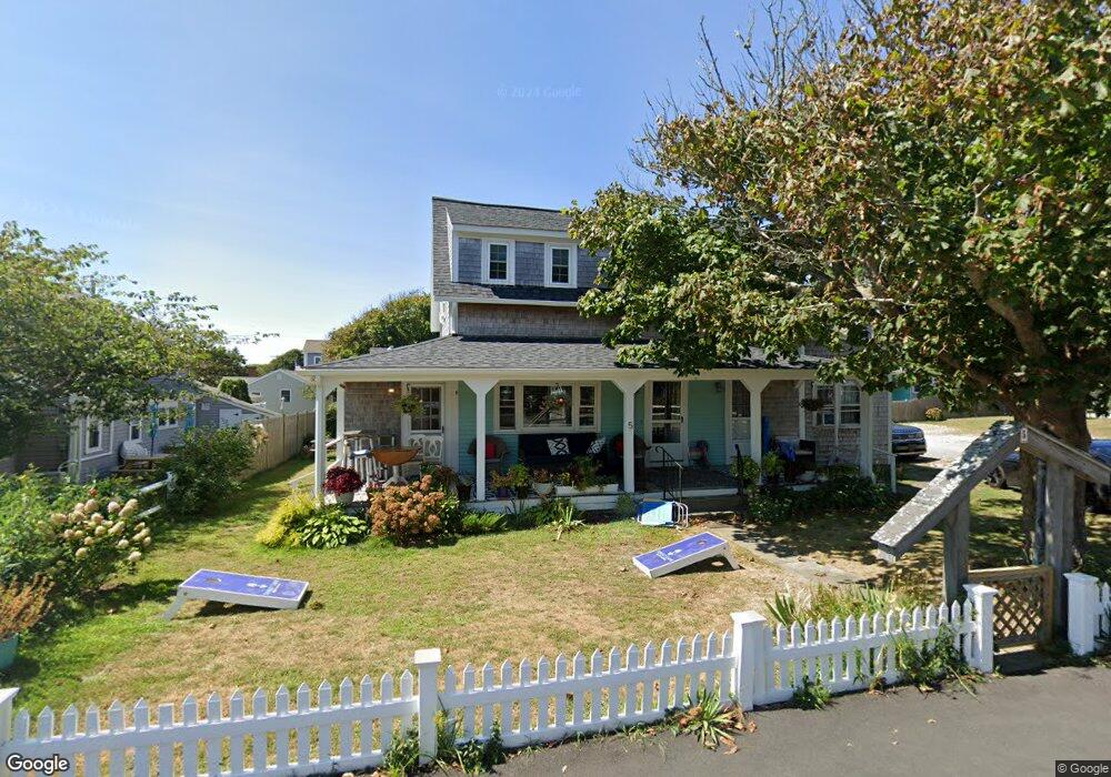
5 Depot St Dennis Port, MA 02639
Dennis Port NeighborhoodEstimated Value: $1,099,000 - $1,360,870
--
Bed
2
Baths
--
Sq Ft
0.3
Acres
About This Home
This home is located at 5 Depot St, Dennis Port, MA 02639 and is currently estimated at $1,217,468. 5 Depot St is a home located in Barnstable County with nearby schools including Dennis-Yarmouth Regional High School and St. Pius X. School.
Ownership History
Date
Name
Owned For
Owner Type
Purchase Details
Closed on
Dec 11, 2020
Sold by
Valente Rt and Valente
Bought by
Ocean View Lodge Llc
Current Estimated Value
Home Financials for this Owner
Home Financials are based on the most recent Mortgage that was taken out on this home.
Original Mortgage
$382,500
Outstanding Balance
$338,967
Interest Rate
2.7%
Mortgage Type
New Conventional
Estimated Equity
$878,501
Purchase Details
Closed on
May 7, 2014
Sold by
Valente Ilidio F and Valente Ilidio F
Bought by
Valente Rt and Valente
Purchase Details
Closed on
Mar 1, 1979
Bought by
Valente Rt
Create a Home Valuation Report for This Property
The Home Valuation Report is an in-depth analysis detailing your home's value as well as a comparison with similar homes in the area
Home Values in the Area
Average Home Value in this Area
Purchase History
| Date | Buyer | Sale Price | Title Company |
|---|---|---|---|
| Ocean View Lodge Llc | $765,000 | None Available | |
| Valente Rt | -- | -- | |
| Valente Rt | -- | -- | |
| Valente Rt | -- | -- |
Source: Public Records
Mortgage History
| Date | Status | Borrower | Loan Amount |
|---|---|---|---|
| Open | Ocean View Lodge Llc | $382,500 |
Source: Public Records
Tax History Compared to Growth
Tax History
| Year | Tax Paid | Tax Assessment Tax Assessment Total Assessment is a certain percentage of the fair market value that is determined by local assessors to be the total taxable value of land and additions on the property. | Land | Improvement |
|---|---|---|---|---|
| 2025 | $5,453 | $1,259,400 | $346,000 | $913,400 |
| 2024 | $4,977 | $1,133,700 | $332,700 | $801,000 |
| 2023 | $4,642 | $994,100 | $302,500 | $691,600 |
| 2022 | $4,384 | $782,800 | $285,200 | $497,600 |
| 2021 | $4,161 | $690,100 | $268,100 | $422,000 |
| 2020 | $4,067 | $666,800 | $297,900 | $368,900 |
| 2019 | $3,948 | $639,800 | $294,400 | $345,400 |
| 2018 | $4,056 | $639,700 | $280,300 | $359,400 |
| 2017 | $3,969 | $645,400 | $280,300 | $365,100 |
| 2016 | $4,081 | $624,900 | $320,300 | $304,600 |
| 2015 | $3,999 | $624,900 | $320,300 | $304,600 |
| 2014 | $3,747 | $590,100 | $320,300 | $269,800 |
Source: Public Records
Map
Nearby Homes
- 26 Manning Rd
- 12 Cross St
- 159 Center St Unit 22
- 102 Sea St
- 11 Ocean Park W
- 402 Old Wharf Rd
- 402 Old Wharf Rd
- 405 Old Wharf Rd Unit B204
- 405 Old Wharf Rd Unit B204
- 9 Chase Ave Unit 6
- 22 Ferncliff Rd
- 73 Division St
- 1 E Belmont Unit 630
- 1 Belmont Rd Unit 630
- 1 Belmont Rd Unit 513
- 12 Candlewood Ln Unit 2-9
- 221 Upper County Rd Unit 2A
- 221 Upper County Rd Unit 2A
- 148 Belmont Rd
- 3 Fairbanks Dr
- 91 Depot St Unit 14
- 91 Depot St Unit 12
- 91 Depot St Unit 11
- 91 Depot St Unit 9
- 91 Depot St Unit 8
- 91 Depot St Unit 5
- 91 Depot St Unit 4
- 91 Depot St Unit 3
- 91 Depot St Unit 2
- 91 Depot St Unit 1
- 91 Depot St
- 91 Depot St Unit 7
- 91 Depot St Unit 6
- 91 Depot
- 396 Lower County Rd Unit 4
- 396 Lower County Rd Unit 3
- 396 Lower County Rd Unit 12
- 396 Lower County Rd Unit 2
- 396 Lower County Rd Unit 8
- 396 Lower County Rd Unit 11