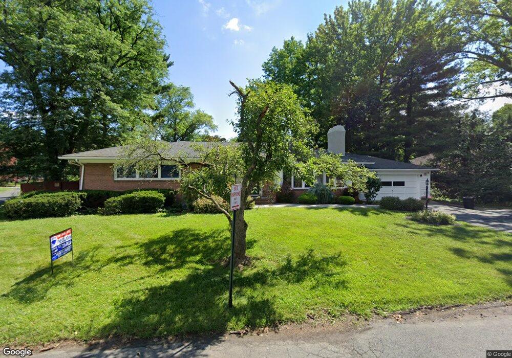
5 Dewey Dr New Brunswick, NJ 08901
Estimated Value: $562,000 - $756,000
3
Beds
3
Baths
2,239
Sq Ft
$304/Sq Ft
Est. Value
About This Home
This home is located at 5 Dewey Dr, New Brunswick, NJ 08901 and is currently estimated at $681,182, approximately $304 per square foot. 5 Dewey Dr is a home located in Middlesex County with nearby schools including New Brunswick High School and St. Mary of Mount Virgin School.
Ownership History
Date
Name
Owned For
Owner Type
Purchase Details
Closed on
Jul 30, 2018
Sold by
Maloney Kimbrlee A
Bought by
Spinelli Michael
Current Estimated Value
Home Financials for this Owner
Home Financials are based on the most recent Mortgage that was taken out on this home.
Original Mortgage
$150,000
Outstanding Balance
$130,269
Interest Rate
4.5%
Mortgage Type
New Conventional
Estimated Equity
$550,913
Purchase Details
Closed on
Apr 14, 2011
Sold by
Maloney Kimberlee A
Bought by
Maloney Kimberlee A
Home Financials for this Owner
Home Financials are based on the most recent Mortgage that was taken out on this home.
Original Mortgage
$195,000
Interest Rate
4.9%
Mortgage Type
New Conventional
Purchase Details
Closed on
Jun 2, 2005
Sold by
Attinger Alan
Bought by
Maloney Shawn and Maloney Kimberlee
Home Financials for this Owner
Home Financials are based on the most recent Mortgage that was taken out on this home.
Original Mortgage
$337,500
Interest Rate
5.78%
Mortgage Type
New Conventional
Create a Home Valuation Report for This Property
The Home Valuation Report is an in-depth analysis detailing your home's value as well as a comparison with similar homes in the area
Home Values in the Area
Average Home Value in this Area
Purchase History
| Date | Buyer | Sale Price | Title Company |
|---|---|---|---|
| Spinelli Michael | $410,000 | Old Republic National Title | |
| Maloney Kimberlee A | -- | None Available | |
| Maloney Shawn | $375,000 | -- |
Source: Public Records
Mortgage History
| Date | Status | Borrower | Loan Amount |
|---|---|---|---|
| Open | Spinelli Michael | $150,000 | |
| Previous Owner | Maloney Kimberlee A | $195,000 | |
| Previous Owner | Maloney Shawn | $337,500 |
Source: Public Records
Tax History Compared to Growth
Tax History
| Year | Tax Paid | Tax Assessment Tax Assessment Total Assessment is a certain percentage of the fair market value that is determined by local assessors to be the total taxable value of land and additions on the property. | Land | Improvement |
|---|---|---|---|---|
| 2025 | $9,161 | $349,800 | $174,000 | $175,800 |
| 2024 | $8,895 | $349,800 | $174,000 | $175,800 |
| 2023 | $8,895 | $349,800 | $174,000 | $175,800 |
| 2022 | $8,707 | $349,800 | $174,000 | $175,800 |
| 2021 | $6,459 | $349,800 | $174,000 | $175,800 |
| 2020 | $8,640 | $349,800 | $174,000 | $175,800 |
| 2019 | $8,476 | $349,800 | $174,000 | $175,800 |
| 2018 | $8,283 | $349,800 | $174,000 | $175,800 |
| 2017 | $7,954 | $349,800 | $174,000 | $175,800 |
| 2016 | $11,028 | $188,000 | $67,900 | $120,100 |
| 2015 | $10,765 | $188,000 | $67,900 | $120,100 |
| 2014 | $10,573 | $188,000 | $67,900 | $120,100 |
Source: Public Records
Map
Nearby Homes
- 11 Cotter Dr
- 628 Sadie Cir
- 602 Sadie Cir
- 521 Sadie Cir
- 513 Sadie Cir
- 509 Sadie Cir
- 228 Jessie Place
- 220 Jessie Place
- 202 Jessie Place
- Union Plan at Scarlet Place
- Greenwich Plan at Scarlet Place
- Murray Hill Plan at Scarlet Place
- Bowery Plan at Scarlet Place
- 216 Lyla Ln
- 40 Phelps Ave
- 53 Patton Dr
- 33 Lawrence Brook Dr
- 63 Pennington Rd
- 414 Graham St
- 116 Graham St