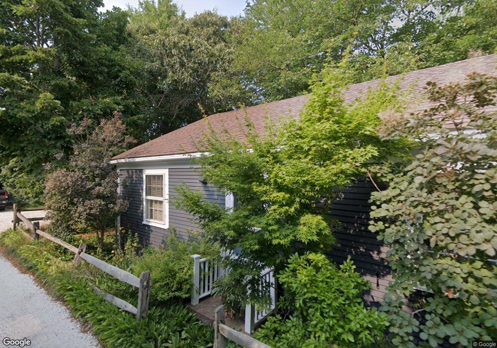
5 Duncan Ln Provincetown, MA 02657
Estimated Value: $850,117 - $1,324,000
2
Beds
1
Bath
720
Sq Ft
$1,378/Sq Ft
Est. Value
About This Home
This home is located at 5 Duncan Ln, Provincetown, MA 02657 and is currently estimated at $992,029, approximately $1,377 per square foot. 5 Duncan Ln is a home located in Barnstable County with nearby schools including Provincetown Schools.
Ownership History
Date
Name
Owned For
Owner Type
Purchase Details
Closed on
Dec 18, 1995
Sold by
Miller Gary N and Miller Jilter G
Bought by
Sormani Ross J
Current Estimated Value
Home Financials for this Owner
Home Financials are based on the most recent Mortgage that was taken out on this home.
Original Mortgage
$106,400
Interest Rate
7.43%
Mortgage Type
Purchase Money Mortgage
Purchase Details
Closed on
May 13, 1992
Sold by
Drake Gillian H
Bought by
Miller Gary N
Create a Home Valuation Report for This Property
The Home Valuation Report is an in-depth analysis detailing your home's value as well as a comparison with similar homes in the area
Home Values in the Area
Average Home Value in this Area
Purchase History
| Date | Buyer | Sale Price | Title Company |
|---|---|---|---|
| Sormani Ross J | $133,000 | -- | |
| Sormani Ross J | $133,000 | -- | |
| Miller Gary N | $110,000 | -- | |
| Miller Gary N | $110,000 | -- |
Source: Public Records
Mortgage History
| Date | Status | Borrower | Loan Amount |
|---|---|---|---|
| Open | Miller Gary N | $100,000 | |
| Closed | Miller Gary N | $135,000 | |
| Closed | Miller Gary N | $106,400 |
Source: Public Records
Tax History Compared to Growth
Tax History
| Year | Tax Paid | Tax Assessment Tax Assessment Total Assessment is a certain percentage of the fair market value that is determined by local assessors to be the total taxable value of land and additions on the property. | Land | Improvement |
|---|---|---|---|---|
| 2025 | $3,520 | $628,500 | $386,300 | $242,200 |
| 2024 | $3,360 | $602,200 | $368,100 | $234,100 |
| 2023 | $3,124 | $522,400 | $320,100 | $202,300 |
| 2022 | $3,115 | $467,700 | $299,200 | $168,500 |
| 2021 | $3,033 | $428,400 | $272,000 | $156,400 |
| 2020 | $2,864 | $432,700 | $282,100 | $150,600 |
| 2019 | $2,926 | $414,400 | $273,800 | $140,600 |
| 2018 | $2,906 | $390,000 | $269,000 | $121,000 |
| 2017 | $2,907 | $377,000 | $263,700 | $113,300 |
| 2016 | $2,851 | $365,500 | $256,000 | $109,500 |
| 2015 | $2,601 | $352,500 | $250,900 | $101,600 |
Source: Public Records
Map
Nearby Homes
- 262 Bradford St Unit 2
- 580 Commercial St
- 592 Commercial St
- 561 Commercial St
- 289 Bradford St
- 594 Commercial St
- 290A Bradford St
- 593 Commercial St
- 539 Commercial St Unit 1
- 613 Commercial St
- 616 Commercial St Unit 10
- 616 Commercial St Unit 14
- 616 Commercial St Unit 15
- 616 Commercial St Unit 5
- 624 Commercial St
- 521 Commercial St Unit 2
- 633 Commercial St Unit 2
- 2 1/2 Duncan Ln
- 4 Duncan Ln
- 7 Duncan Ln
- 2 Duncan Ln
- 3 Duncan Ln
- 280 Bradford St
- 6 Duncan Ln
- 282 Bradford St
- 1 Duncan Ln
- 274 Bradford St
- 9-11 Duncan Ln
- 264-A Bradford St
- 264 Bradford St
- 264-R Bradford St
- 262 Bradford St
- 8 Duncan Ln
- 1 Conway St
- 269A Bradford St
- 262A Bradford St Unit 1
- 262A Bradford St Unit 3