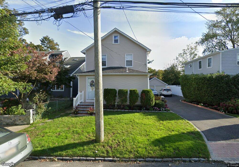
5 E 8th St Huntington Station, NY 11746
Estimated Value: $512,000 - $602,000
3
Beds
2
Baths
--
Sq Ft
5,227
Sq Ft Lot
About This Home
This home is located at 5 E 8th St, Huntington Station, NY 11746 and is currently estimated at $550,763. 5 E 8th St is a home located in Suffolk County with nearby schools including Washington School, Woodhull Intermediate School, and J Taylor Finley Middle School.
Ownership History
Date
Name
Owned For
Owner Type
Purchase Details
Closed on
Jan 2, 2015
Sold by
Holt Thomas J and Holt Marie J
Bought by
Velasquez Carlos and Unanzor Olivia
Current Estimated Value
Home Financials for this Owner
Home Financials are based on the most recent Mortgage that was taken out on this home.
Original Mortgage
$230,463
Outstanding Balance
$176,720
Interest Rate
3.87%
Mortgage Type
FHA
Estimated Equity
$374,043
Purchase Details
Closed on
Mar 16, 1999
Sold by
Losito Thomas G
Bought by
Holt Thomas J and Holt Marie J
Home Financials for this Owner
Home Financials are based on the most recent Mortgage that was taken out on this home.
Original Mortgage
$74,200
Interest Rate
6.39%
Create a Home Valuation Report for This Property
The Home Valuation Report is an in-depth analysis detailing your home's value as well as a comparison with similar homes in the area
Home Values in the Area
Average Home Value in this Area
Purchase History
| Date | Buyer | Sale Price | Title Company |
|---|---|---|---|
| Velasquez Carlos | $238,500 | None Available | |
| Holt Thomas J | $106,000 | Washington Title Insurance C |
Source: Public Records
Mortgage History
| Date | Status | Borrower | Loan Amount |
|---|---|---|---|
| Open | Velasquez Carlos | $230,463 | |
| Previous Owner | Holt Thomas J | $74,200 |
Source: Public Records
Tax History Compared to Growth
Tax History
| Year | Tax Paid | Tax Assessment Tax Assessment Total Assessment is a certain percentage of the fair market value that is determined by local assessors to be the total taxable value of land and additions on the property. | Land | Improvement |
|---|---|---|---|---|
| 2024 | $6,875 | $1,750 | $150 | $1,600 |
| 2023 | $3,438 | $1,750 | $150 | $1,600 |
| 2022 | $5,879 | $1,750 | $150 | $1,600 |
| 2021 | $5,792 | $1,750 | $150 | $1,600 |
| 2020 | $5,708 | $1,750 | $150 | $1,600 |
| 2019 | $11,416 | $0 | $0 | $0 |
| 2018 | $5,313 | $1,750 | $150 | $1,600 |
| 2017 | $5,313 | $1,750 | $150 | $1,600 |
| 2016 | $5,248 | $1,750 | $150 | $1,600 |
| 2015 | -- | $1,750 | $150 | $1,600 |
| 2014 | -- | $1,750 | $150 | $1,600 |
Source: Public Records
Map
Nearby Homes
- 95 E Pulaski Rd
- 1 Varney Ave
- 57 E Pulaski Rd
- 107 E 9th St
- 0 E 12th St
- 148 Lenox Rd
- 26 E 12th St
- 122 E 12th St
- 30 3rd Ave
- 53 E 13th St
- 126 E 12th St
- 25 E 13th St
- 71 Biltmore Cir
- 19 W 11th St
- 54 E 14th St
- 280 Lowndes Ave Unit 208
- 280 Lowndes Ave Unit 305G
- 280 Lowndes Ave Unit 111G
- 24 Columbia St
- 26 Townhouse Rd S Unit 26