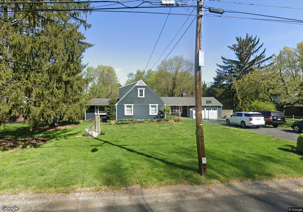
5 E Spruce Ave Moorestown, NJ 08057
Estimated Value: $921,000 - $977,000
Studio
--
Bath
2,215
Sq Ft
$425/Sq Ft
Est. Value
About This Home
This home is located at 5 E Spruce Ave, Moorestown, NJ 08057 and is currently estimated at $942,084, approximately $425 per square foot. 5 E Spruce Ave is a home located in Burlington County with nearby schools including George C. Baker Elementary School, Moorestown Upper Elementary School, and William Allen Middle School.
Ownership History
Date
Name
Owned For
Owner Type
Purchase Details
Closed on
Mar 17, 2006
Sold by
Johnson Patricia Fahrenbruch
Bought by
Murphy John H and Murphy Rebecca S
Current Estimated Value
Home Financials for this Owner
Home Financials are based on the most recent Mortgage that was taken out on this home.
Original Mortgage
$472,000
Outstanding Balance
$269,113
Interest Rate
6.32%
Mortgage Type
Fannie Mae Freddie Mac
Estimated Equity
$672,971
Purchase Details
Closed on
Jul 5, 2005
Sold by
Johnson Walter F and Shomo Susan
Bought by
Johnson Patricia Fahrenbruch
Create a Home Valuation Report for This Property
The Home Valuation Report is an in-depth analysis detailing your home's value as well as a comparison with similar homes in the area
Home Values in the Area
Average Home Value in this Area
Purchase History
| Date | Buyer | Sale Price | Title Company |
|---|---|---|---|
| Murphy John H | $590,000 | Group 21 Title Agency | |
| Johnson Patricia Fahrenbruch | -- | -- | |
| Johnson Walter F | -- | -- |
Source: Public Records
Mortgage History
| Date | Status | Borrower | Loan Amount |
|---|---|---|---|
| Open | Murphy John H | $472,000 |
Source: Public Records
Tax History Compared to Growth
Tax History
| Year | Tax Paid | Tax Assessment Tax Assessment Total Assessment is a certain percentage of the fair market value that is determined by local assessors to be the total taxable value of land and additions on the property. | Land | Improvement |
|---|---|---|---|---|
| 2025 | $14,418 | $508,200 | $291,100 | $217,100 |
| 2024 | $13,981 | $508,200 | $291,100 | $217,100 |
| 2023 | $13,981 | $508,200 | $291,100 | $217,100 |
| 2022 | $13,838 | $508,200 | $291,100 | $217,100 |
| 2021 | $13,655 | $508,200 | $291,100 | $217,100 |
| 2020 | $13,569 | $508,200 | $291,100 | $217,100 |
| 2019 | $13,330 | $508,200 | $291,100 | $217,100 |
| 2018 | $12,969 | $508,200 | $291,100 | $217,100 |
| 2017 | $13,081 | $508,200 | $291,100 | $217,100 |
| 2016 | $12,202 | $508,200 | $291,100 | $217,100 |
| 2015 | $12,054 | $508,200 | $291,100 | $217,100 |
| 2014 | $11,445 | $508,200 | $291,100 | $217,100 |
Source: Public Records
Map
Nearby Homes
- 543 Bethel Ave
- 228 Mill St
- 66 E 3rd St
- 80 E 3rd St
- 205 E Central Ave
- 133 Plum St Unit 6
- 308 Farmdale Rd
- 316 Farmdale Rd
- 863 Golf View Rd
- 308 Elm St
- 129 S Church St
- 15 W Close Unit 15
- 4 W Close
- 744 Signal Light Rd
- 104 Mount Laurel Rd
- 8 S Close Unit 8
- 444 Shady Ln
- 531 Covington Terrace
- 2 Oriole Way
- 437 Windrow Clusters Dr
- 673 Mill St
- 9 E Spruce Ave
- 1 E Spruce Ave
- 677 Mill St
- 17 E Spruce Ave
- 6 E Spruce Ave
- 10 E Spruce Ave
- 2 E Spruce Ave
- 660 Lippincott Ave
- 1 W Spruce Ave
- 14 E Spruce Ave
- 648 Lippincott Ave
- 681 Mill St
- 2 W Spruce Ave
- 3 E Maple Ave
- 676 Mill St
- 680 Lippincott Ave
- 18 E Spruce Ave
- 13 E Maple Ave
- 5 W Spruce Ave