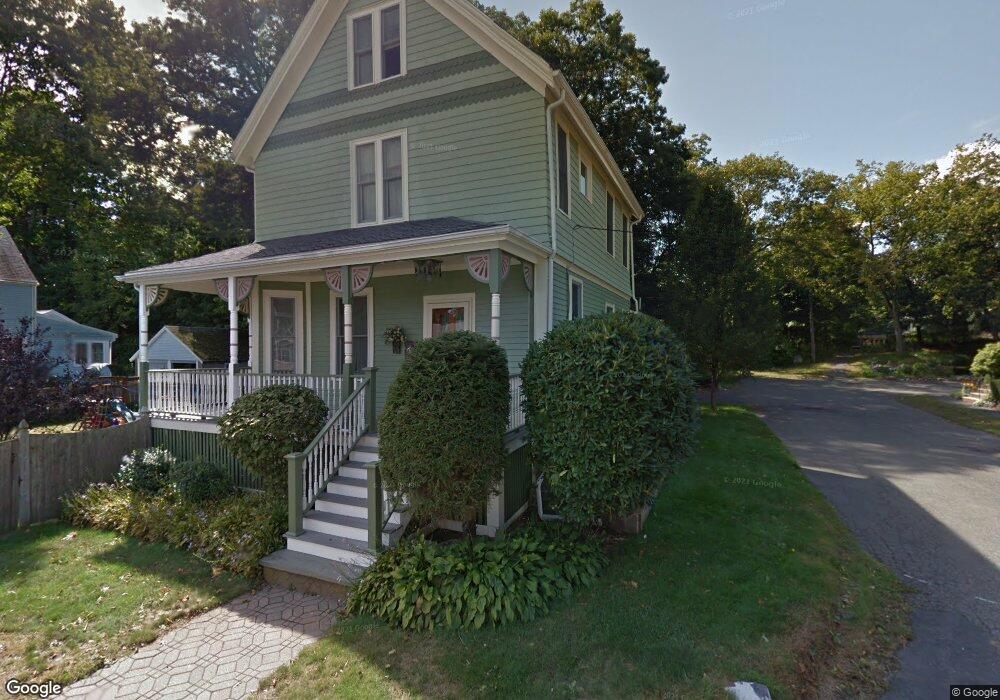
5 Edmunds Place Wakefield, MA 01880
Greenwood NeighborhoodEstimated Value: $857,000 - $1,239,000
4
Beds
3
Baths
2,231
Sq Ft
$457/Sq Ft
Est. Value
About This Home
This home is located at 5 Edmunds Place, Wakefield, MA 01880 and is currently estimated at $1,019,894, approximately $457 per square foot. 5 Edmunds Place is a home located in Middlesex County with nearby schools including Wakefield Memorial High School, St Joseph School, and Melrose Montessori School.
Ownership History
Date
Name
Owned For
Owner Type
Purchase Details
Closed on
Oct 12, 2022
Sold by
Larrow Jay F and Larrow Allison M
Bought by
5 Edmunds Place Rt
Current Estimated Value
Purchase Details
Closed on
Jun 18, 1999
Sold by
Emery James C and Emery Carol A
Bought by
Larrow Jay F and Larrow Allison M
Create a Home Valuation Report for This Property
The Home Valuation Report is an in-depth analysis detailing your home's value as well as a comparison with similar homes in the area
Home Values in the Area
Average Home Value in this Area
Purchase History
| Date | Buyer | Sale Price | Title Company |
|---|---|---|---|
| 5 Edmunds Place Rt | -- | None Available | |
| Larrow Jay F | $313,000 | -- |
Source: Public Records
Mortgage History
| Date | Status | Borrower | Loan Amount |
|---|---|---|---|
| Previous Owner | Larrow Jay F | $150,000 | |
| Previous Owner | Larrow Jay F | $352,000 |
Source: Public Records
Tax History Compared to Growth
Tax History
| Year | Tax Paid | Tax Assessment Tax Assessment Total Assessment is a certain percentage of the fair market value that is determined by local assessors to be the total taxable value of land and additions on the property. | Land | Improvement |
|---|---|---|---|---|
| 2025 | $10,540 | $928,600 | $365,600 | $563,000 |
| 2024 | $10,388 | $923,400 | $363,500 | $559,900 |
| 2023 | $9,892 | $843,300 | $331,500 | $511,800 |
| 2022 | $9,478 | $769,300 | $301,900 | $467,400 |
| 2021 | $9,359 | $735,200 | $281,400 | $453,800 |
| 2020 | $8,778 | $687,400 | $263,100 | $424,300 |
| 2019 | $8,384 | $653,500 | $250,100 | $403,400 |
| 2018 | $7,805 | $602,700 | $230,700 | $372,000 |
| 2017 | $7,340 | $563,300 | $215,600 | $347,700 |
| 2016 | $7,436 | $551,200 | $204,000 | $347,200 |
| 2015 | $6,953 | $515,800 | $190,600 | $325,200 |
| 2014 | $6,327 | $495,100 | $183,300 | $311,800 |
Source: Public Records
Map
Nearby Homes
- 24 Myrtle Ave
- 3 Hickory Hill Rd Unit 1
- 95 Greenwood Ave
- 18 Crosby Rd
- 61 Forest St
- 9 Lovis Ave
- 12 Lovis Ave
- 6 Lovis Ave
- 1 Ludlow Ave
- 772 Main St Unit 2
- 81 Spring St
- 19 Fellsmere Ave
- 2 Overlook Rd
- 762 Main St
- 1 Sidney St
- 22 Mount Zion Rd
- 6 Castle Clare Cir
- 15 Shore Rd
- 119 W Highland Ave Unit 1
- 27 Pratt St
- 9 Edmunds Place
- 56 Greenwood Ave
- 54 Greenwood Ave
- 1 Edmunds Place
- 3 Edmunds Place
- 13 Edmunds Place
- 52 Greenwood Ave
- 58-60 Greenwood Ave
- 58 Greenwood Ave Unit 60
- 50 Greenwood Ave
- 1000 Main St
- 1000 Main St Unit 2
- 59 Greenwood Ave
- 57 Greenwood Ave
- 9 Oak St
- 1 Francis Ave
- 1 Francis Ave Unit 1
- 5 Francis Ave
- 7 Francis Ave
- 55 Greenwood Ave