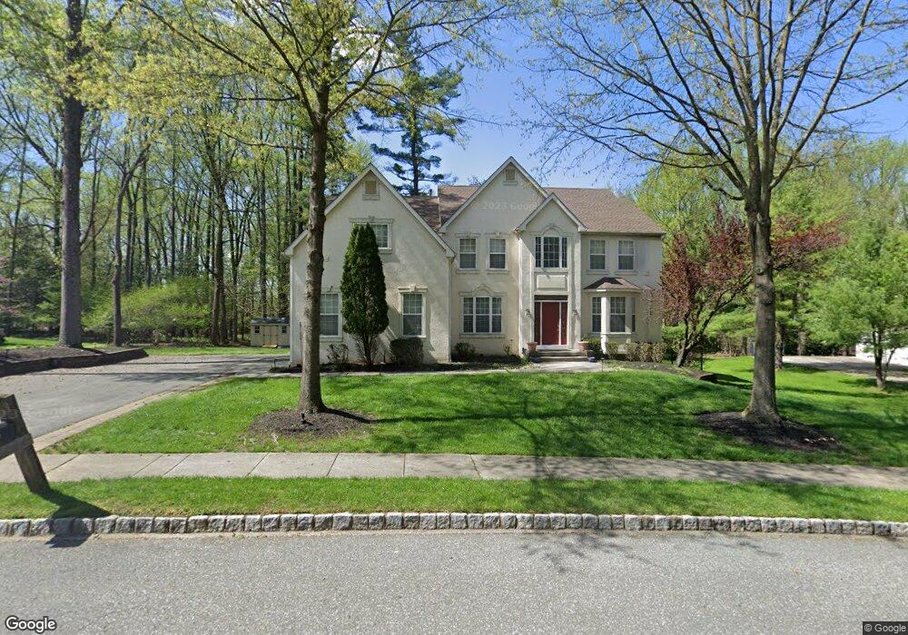
5 Forrest Ct Mount Laurel, NJ 08054
Estimated Value: $863,000 - $950,000
--
Bed
--
Bath
3,332
Sq Ft
$270/Sq Ft
Est. Value
About This Home
This home is located at 5 Forrest Ct, Mount Laurel, NJ 08054 and is currently estimated at $898,839, approximately $269 per square foot. 5 Forrest Ct is a home located in Burlington County with nearby schools including Hillside Elementary School, T.E. Harrington Middle School, and Mount Laurel Hartford School.
Ownership History
Date
Name
Owned For
Owner Type
Purchase Details
Closed on
Jun 11, 1998
Sold by
Pond & Spitz Bldg Division Inc
Bought by
Rodis Angel and Rodis Christina M
Current Estimated Value
Home Financials for this Owner
Home Financials are based on the most recent Mortgage that was taken out on this home.
Original Mortgage
$289,000
Outstanding Balance
$57,665
Interest Rate
7.02%
Estimated Equity
$841,174
Create a Home Valuation Report for This Property
The Home Valuation Report is an in-depth analysis detailing your home's value as well as a comparison with similar homes in the area
Home Values in the Area
Average Home Value in this Area
Purchase History
| Date | Buyer | Sale Price | Title Company |
|---|---|---|---|
| Rodis Angel | $340,000 | -- |
Source: Public Records
Mortgage History
| Date | Status | Borrower | Loan Amount |
|---|---|---|---|
| Open | Rodis Angel | $289,000 |
Source: Public Records
Tax History Compared to Growth
Tax History
| Year | Tax Paid | Tax Assessment Tax Assessment Total Assessment is a certain percentage of the fair market value that is determined by local assessors to be the total taxable value of land and additions on the property. | Land | Improvement |
|---|---|---|---|---|
| 2025 | $15,877 | $502,900 | $140,800 | $362,100 |
| 2024 | $15,278 | $502,900 | $140,800 | $362,100 |
| 2023 | $15,278 | $502,900 | $140,800 | $362,100 |
| 2022 | $15,228 | $502,900 | $140,800 | $362,100 |
| 2021 | $14,941 | $502,900 | $140,800 | $362,100 |
| 2020 | $14,649 | $502,900 | $140,800 | $362,100 |
| 2019 | $14,499 | $502,900 | $140,800 | $362,100 |
| 2018 | $14,388 | $502,900 | $140,800 | $362,100 |
| 2017 | $14,016 | $502,900 | $140,800 | $362,100 |
| 2016 | $13,805 | $502,900 | $140,800 | $362,100 |
| 2015 | $13,644 | $502,900 | $140,800 | $362,100 |
| 2014 | $13,508 | $502,900 | $140,800 | $362,100 |
Source: Public Records
Map
Nearby Homes
- 132 Peppergrass Dr S
- 17 Peppergrass Dr N
- 10 Yarrow Place
- 15 Pecan Ct
- 71 Peppergrass Dr S
- 89 Peppergrass Dr S
- 11 Rolling Glen Ct
- 7 Buttonbush Ct
- 329 Mount Laurel Rd
- 212 Dogwood Dr
- 21 Hillside Ln
- 570 Walton Ave
- 422 Elderberry Ct
- 420 Elderberry Ct
- 324 Mount Laurel Rd
- 5 Hilltop Dr
- 1302 Ginger Dr
- 2 Watson Dr
- 1201A Ginger Ct
- 810 Mount Laurel Rd
- 3 Forrest Ct
- 7 Forrest Ct
- 6 Forrest Ct
- 9 Forrest Ct
- 408 Mount Laurel Rd
- 1 Forrest Ct
- 4 Forrest Ct
- 11 Forrest Ct
- 2 Forrest Ct
- 10 Forrest Ct
- 400 Mount Laurel Rd
- 0 Forrest Ct Unit 1000333779
- 0 Forrest Ct Unit 1006325236
- 0 Forrest Ct Unit 1002225802
- 0 Forrest Ct
- 12 Forrest Ct
- 13 Forrest Ct
- 411 Mount Laurel Rd
- 14 Forrest Ct
- 40 Clifford Ct