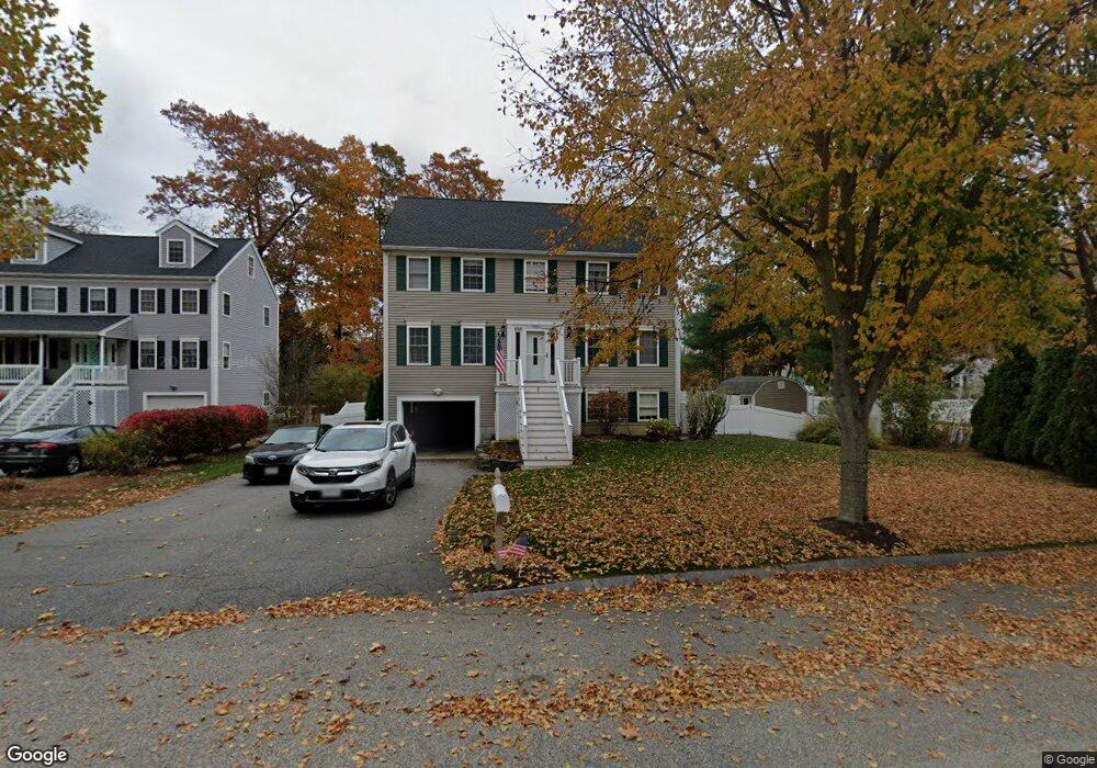
5 Goss Ave Amesbury, MA 01913
Estimated Value: $708,000 - $816,000
3
Beds
3
Baths
1,882
Sq Ft
$402/Sq Ft
Est. Value
About This Home
This home is located at 5 Goss Ave, Amesbury, MA 01913 and is currently estimated at $757,001, approximately $402 per square foot. 5 Goss Ave is a home located in Essex County with nearby schools including Amesbury High School and Amesbury Seventh-Day Adventist School.
Ownership History
Date
Name
Owned For
Owner Type
Purchase Details
Closed on
Jun 26, 2015
Sold by
Genualdo Craig C and Levy-Genualdo Danielle
Bought by
Bongo Richard J
Current Estimated Value
Purchase Details
Closed on
Dec 8, 1998
Sold by
Bc Rt
Bought by
Bannon Michael D and Bannon Donna M
Create a Home Valuation Report for This Property
The Home Valuation Report is an in-depth analysis detailing your home's value as well as a comparison with similar homes in the area
Home Values in the Area
Average Home Value in this Area
Purchase History
| Date | Buyer | Sale Price | Title Company |
|---|---|---|---|
| Bongo Richard J | $345,000 | -- | |
| Bannon Michael D | $210,000 | -- |
Source: Public Records
Mortgage History
| Date | Status | Borrower | Loan Amount |
|---|---|---|---|
| Previous Owner | Bannon Michael D | $362,000 | |
| Previous Owner | Bannon Michael D | $354,000 | |
| Previous Owner | Bannon Michael D | $30,000 | |
| Previous Owner | Bannon Michael D | $250,000 |
Source: Public Records
Tax History
| Year | Tax Paid | Tax Assessment Tax Assessment Total Assessment is a certain percentage of the fair market value that is determined by local assessors to be the total taxable value of land and additions on the property. | Land | Improvement |
|---|---|---|---|---|
| 2025 | $10,153 | $663,600 | $234,600 | $429,000 |
| 2024 | $9,686 | $619,300 | $221,300 | $398,000 |
| 2022 | $8,700 | $491,800 | $167,300 | $324,500 |
| 2020 | $7,355 | $428,100 | $129,700 | $298,400 |
| 2019 | $5,825 | $405,900 | $129,700 | $276,200 |
| 2018 | $7,342 | $386,600 | $123,600 | $263,000 |
| 2017 | $7,529 | $377,400 | $123,600 | $253,800 |
| 2016 | $7,329 | $361,400 | $123,600 | $237,800 |
| 2015 | $7,173 | $349,200 | $123,600 | $225,600 |
| 2014 | -- | $333,200 | $123,600 | $209,600 |
Source: Public Records
Map
Nearby Homes
- 82 Monroe St
- 3 Birchwood Point Unit 202
- 24 Collins St
- 35 Huntington Ave
- 21 River St
- 10 Congress St Unit 302
- 21 Congress St
- 53 Rabbit Rd
- 382 Main St
- 54 Rabbit Rd
- 97 Elm St
- 25 Cedar St Unit 4
- 253 Main St
- 4 Boardman St
- 4 Greenwood St
- 15 Wells Ave
- 101 Market St Unit B
- 20 Lincoln Ct
- 191 Elm St
- 4 Larnard Ct
Your Personal Tour Guide
Ask me questions while you tour the home.