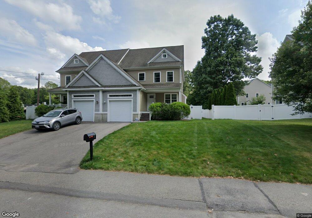
5 H F Brown Way Natick, MA 01760
Estimated Value: $1,002,739 - $1,066,000
3
Beds
3
Baths
2,400
Sq Ft
$431/Sq Ft
Est. Value
About This Home
This home is located at 5 H F Brown Way, Natick, MA 01760 and is currently estimated at $1,033,935, approximately $430 per square foot. 5 H F Brown Way is a home located in Middlesex County with nearby schools including Natick High School, J F Kennedy Middle School, and Brown Elementary School.
Ownership History
Date
Name
Owned For
Owner Type
Purchase Details
Closed on
Jan 9, 2014
Sold by
Lot 13B H F Brown Way
Bought by
Carter-Finch Annabelle S
Current Estimated Value
Home Financials for this Owner
Home Financials are based on the most recent Mortgage that was taken out on this home.
Original Mortgage
$487,200
Outstanding Balance
$347,262
Interest Rate
3%
Mortgage Type
New Conventional
Estimated Equity
$686,673
Create a Home Valuation Report for This Property
The Home Valuation Report is an in-depth analysis detailing your home's value as well as a comparison with similar homes in the area
Home Values in the Area
Average Home Value in this Area
Purchase History
| Date | Buyer | Sale Price | Title Company |
|---|---|---|---|
| Carter-Finch Annabelle S | $609,000 | -- |
Source: Public Records
Mortgage History
| Date | Status | Borrower | Loan Amount |
|---|---|---|---|
| Open | Carter-Finch Annabelle S | $487,200 |
Source: Public Records
Tax History Compared to Growth
Tax History
| Year | Tax Paid | Tax Assessment Tax Assessment Total Assessment is a certain percentage of the fair market value that is determined by local assessors to be the total taxable value of land and additions on the property. | Land | Improvement |
|---|---|---|---|---|
| 2025 | $10,634 | $889,100 | $0 | $889,100 |
| 2024 | $10,403 | $848,500 | $0 | $848,500 |
| 2023 | $9,788 | $774,400 | $0 | $774,400 |
| 2022 | $9,866 | $739,600 | $0 | $739,600 |
| 2021 | $9,662 | $709,900 | $0 | $709,900 |
| 2020 | $9,662 | $709,900 | $0 | $709,900 |
| 2019 | $9,023 | $709,900 | $0 | $709,900 |
| 2018 | $8,706 | $667,100 | $0 | $667,100 |
| 2017 | $8,195 | $607,500 | $0 | $607,500 |
| 2016 | $8,074 | $595,000 | $0 | $595,000 |
| 2015 | $8,255 | $597,300 | $0 | $597,300 |
Source: Public Records
Map
Nearby Homes
- 11 Village Hill Ln Unit 9
- 44 Village Hill Ln
- 7 Orchard View Cir Unit 7
- 9 Village Hill Ln Unit 24
- 6 Village Rock Ln Unit 17
- 20 Walden Dr Unit 16
- 1 Glen St Unit B
- 57 Village Brook Ln Unit 5
- 50 Village Brook Ln Unit 4
- 12 Walden Dr Unit 19
- 6 Post Oak Ln Unit 10
- 24 Silver Hill Ln
- 11 Post Oak Ln Unit 6
- 7 Village Way Unit 4
- 131 2nd St
- 9 Silver Hill Ln Unit 19
- 150 2nd St Unit 310
- 150 2nd St Unit 204
- 32 Silver Hill Ln Unit 1
- 38 Silver Hill Ln Unit 8
- 3 H F Brown Way Unit 3
- 3 H F Brown Way
- 74 Kendall Ln
- 9 H F Brown Way Unit 9
- 76 Kendall Ln
- 7 H F Brown Way Unit 7
- 78 Kendall Ln
- 80 Kendall Ln
- 71 A Kendall Ln Unit 2
- 71 Kendall Ln
- 1 H F Brown Way
- 73 Kendall Ln
- 69 Kendall Ln
- 84 Kendall Ln
- 84 Kendall Ln Unit A
- 84 Kendall Ln Unit B
- 1 Mohegan Trail
- 79 Kendall Ln
- 86 Kendall Ln
- 86 Kendall Ln Unit A