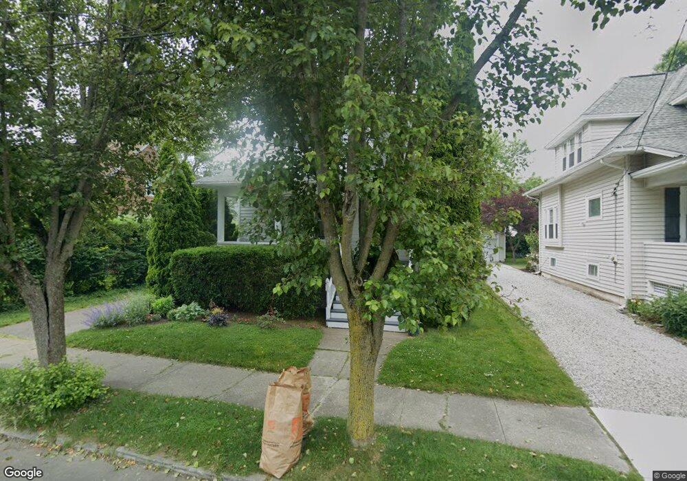
5 Harborview Place Bridgeport, CT 06605
Black Rock NeighborhoodEstimated Value: $332,000 - $655,000
3
Beds
2
Baths
1,460
Sq Ft
$370/Sq Ft
Est. Value
About This Home
This home is located at 5 Harborview Place, Bridgeport, CT 06605 and is currently estimated at $540,549, approximately $370 per square foot. 5 Harborview Place is a home located in Fairfield County with nearby schools including Black Rock School, Bassick High School, and Park City Prep Charter School.
Ownership History
Date
Name
Owned For
Owner Type
Purchase Details
Closed on
May 16, 1996
Sold by
Terry Charles H Est
Bought by
Falvey Timothy L and Falvey Patricia A
Current Estimated Value
Home Financials for this Owner
Home Financials are based on the most recent Mortgage that was taken out on this home.
Original Mortgage
$93,800
Interest Rate
7.77%
Mortgage Type
Unknown
Create a Home Valuation Report for This Property
The Home Valuation Report is an in-depth analysis detailing your home's value as well as a comparison with similar homes in the area
Home Values in the Area
Average Home Value in this Area
Purchase History
| Date | Buyer | Sale Price | Title Company |
|---|---|---|---|
| Falvey Timothy L | $98,750 | -- | |
| Falvey Timothy L | $98,750 | -- |
Source: Public Records
Mortgage History
| Date | Status | Borrower | Loan Amount |
|---|---|---|---|
| Open | Falvey Timothy L | $120,045 | |
| Closed | Falvey Timothy L | $93,800 |
Source: Public Records
Tax History
| Year | Tax Paid | Tax Assessment Tax Assessment Total Assessment is a certain percentage of the fair market value that is determined by local assessors to be the total taxable value of land and additions on the property. | Land | Improvement |
|---|---|---|---|---|
| 2025 | $9,969 | $229,430 | $153,800 | $75,630 |
| 2024 | $10,221 | $235,230 | $153,800 | $81,430 |
| 2023 | $10,221 | $235,230 | $153,800 | $81,430 |
| 2022 | $10,221 | $235,230 | $153,800 | $81,430 |
| 2021 | $10,221 | $235,230 | $153,800 | $81,430 |
| 2020 | $10,550 | $195,410 | $126,200 | $69,210 |
| 2019 | $10,550 | $195,410 | $126,200 | $69,210 |
| 2018 | $10,624 | $195,410 | $126,200 | $69,210 |
| 2017 | $10,624 | $195,410 | $126,200 | $69,210 |
| 2016 | $10,624 | $195,410 | $126,200 | $69,210 |
| 2015 | $9,629 | $228,170 | $133,910 | $94,260 |
| 2014 | $9,629 | $228,170 | $133,910 | $94,260 |
Source: Public Records
Map
Nearby Homes
- 97 Fayerweather Terrace
- 377 Midland St
- 132 Gilman St
- 8 Jetland Place Unit 10
- 315 Seaside Ave
- 90 Clarkson St
- 318 Grovers Ave
- 554 Brewster St Unit 4
- 27 Nash Ln Unit 5
- 65 Ellsworth St Unit 302
- 37 Rowsley St Unit 6
- 78 Rowsley St Unit 4
- 165 Bennett St
- 117 Nash Ln
- 3250 Fairfield Ave Unit 302
- 148 Alfred St
- 855 Brewster St Unit 857
- 115 King St Unit 117
- 22 Monroe St Unit 24
- 188 Monroe St Unit 190
- 15 Harborview Place
- 9 Harborview Place
- 408 Courtland Ave
- 137 Fayerweather Terrace
- 33 Harborview Place
- 420 Courtland Ave
- 4 Harborview Place
- 129 Fayerweather Terrace
- 398 Midland St
- 41 Harborview Place
- 401 Courtland Ave Unit 403
- 395 Courtland Ave
- 385 Courtland Ave
- 121 Fayerweather Terrace
- 51 Harborview Place
- 375 Courtland Ave
- 386 Midland St Unit 388
- 423 Courtland Ave Unit 425
- 425 Courtland Ave Unit 2-3
- 423 Courtland Ave Unit 1
Your Personal Tour Guide
Ask me questions while you tour the home.