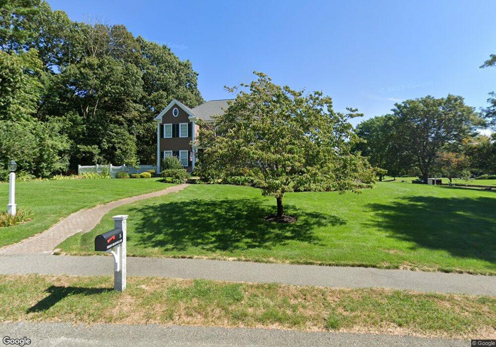
5 Hidden Meadows Ln Wrentham, MA 02093
Estimated Value: $1,032,000 - $1,257,000
4
Beds
3
Baths
3,364
Sq Ft
$333/Sq Ft
Est. Value
About This Home
This home is located at 5 Hidden Meadows Ln, Wrentham, MA 02093 and is currently estimated at $1,118,631, approximately $332 per square foot. 5 Hidden Meadows Ln is a home located in Norfolk County with nearby schools including Delaney Elementary School, Charles E Roderick, and Foxborough Regional Charter School.
Ownership History
Date
Name
Owned For
Owner Type
Purchase Details
Closed on
Feb 17, 1998
Sold by
Voyager Bldg Corp
Bought by
Miller Charles F and Miller Marie F
Current Estimated Value
Home Financials for this Owner
Home Financials are based on the most recent Mortgage that was taken out on this home.
Original Mortgage
$325,000
Outstanding Balance
$53,629
Interest Rate
6.95%
Mortgage Type
Purchase Money Mortgage
Estimated Equity
$1,065,002
Create a Home Valuation Report for This Property
The Home Valuation Report is an in-depth analysis detailing your home's value as well as a comparison with similar homes in the area
Purchase History
| Date | Buyer | Sale Price | Title Company |
|---|---|---|---|
| Miller Charles F | $495,000 | -- |
Source: Public Records
Mortgage History
| Date | Status | Borrower | Loan Amount |
|---|---|---|---|
| Open | Miller Charles F | $325,000 |
Source: Public Records
Tax History
| Year | Tax Paid | Tax Assessment Tax Assessment Total Assessment is a certain percentage of the fair market value that is determined by local assessors to be the total taxable value of land and additions on the property. | Land | Improvement |
|---|---|---|---|---|
| 2025 | $11,102 | $957,900 | $338,100 | $619,800 |
| 2024 | $10,602 | $883,500 | $338,100 | $545,400 |
| 2023 | $10,694 | $847,400 | $307,400 | $540,000 |
| 2022 | $10,032 | $733,900 | $279,300 | $454,600 |
| 2021 | $9,810 | $697,200 | $279,300 | $417,900 |
| 2020 | $9,835 | $690,200 | $229,700 | $460,500 |
| 2019 | $9,448 | $669,100 | $229,700 | $439,400 |
| 2018 | $9,965 | $699,800 | $229,700 | $470,100 |
| 2017 | $9,881 | $693,400 | $225,300 | $468,100 |
| 2016 | $9,679 | $677,800 | $218,800 | $459,000 |
| 2015 | $9,807 | $654,700 | $210,300 | $444,400 |
| 2014 | $9,645 | $630,000 | $202,300 | $427,700 |
Source: Public Records
Map
Nearby Homes
- 282 Thurston St
- 10 Nature View Dr
- 15 Nature View Dr
- 483 Thurston St
- 576 Dedham St
- 135 Creek St Unit 2
- 3 Earle Stewart Ln
- 2 Earle Stewart Ln
- 12 Earle Stewart Ln
- 10 Earle Stewart Ln Unit Lot 5
- 1 Weber Farm Rd Unit 1
- 25 Foxboro Rd
- 11 Weber Farm Rd Unit 11
- 8 Weber Farm Rd Unit 8
- 30 Weber Farm Rd Unit 30
- 131 Washington St Unit 42
- 131 Washington St Unit 50
- 500 Franklin St
- 75 Foxboro Rd
- 65 Foxboro Rd
- 5 Lot 5 Fox Run Rd
- 15 Fox Run Rd
- 11 Fox Run Rd
- 10 Fox Run Rd
- 20 Fox Run Rd
- 05 Fox Run Rd
- 330 East St
- 10 Hidden Meadows Ln
- 320 East St
- 2 Hidden Meadows Ln
- 58 Pheasant Run Ct
- 61 Pheasant Run Ct
- 20 Hidden Meadows Ln
- 20 Hidden Meadows Ln Unit LANE
- 30 Fox Run Rd
- 68 Pheasant Run Ct
- 340 East St
- 30 Hidden Meadows Ln
- 55 Cobb Rd Unit 55
- 55 Cobb Rd Unit B
Your Personal Tour Guide
Ask me questions while you tour the home.