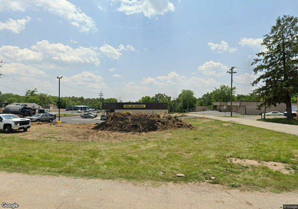
5 Highway T Foristell, MO 63348
Estimated Value: $2,001,000
Studio
1
Bath
10,668
Sq Ft
$188/Sq Ft
Est. Value
About This Home
This home is located at 5 Highway T, Foristell, MO 63348 and is currently estimated at $2,001,000, approximately $187 per square foot. 5 Highway T is a home located in St. Charles County with nearby schools including Journey Elementary.
Ownership History
Date
Name
Owned For
Owner Type
Purchase Details
Closed on
Jun 9, 2023
Sold by
First Link 17 Llc
Bought by
Leonard J Prouhet Revocable Trust
Current Estimated Value
Home Financials for this Owner
Home Financials are based on the most recent Mortgage that was taken out on this home.
Original Mortgage
$493,690
Outstanding Balance
$480,585
Interest Rate
6.43%
Mortgage Type
New Conventional
Estimated Equity
$1,520,415
Purchase Details
Closed on
Dec 28, 2022
Sold by
Cutting Edge Properties Llc
Bought by
First Link 17 Llc
Home Financials for this Owner
Home Financials are based on the most recent Mortgage that was taken out on this home.
Original Mortgage
$1,037,942
Interest Rate
6.58%
Mortgage Type
Construction
Purchase Details
Closed on
Feb 27, 2017
Sold by
Stude Homer R and Stude Wanda Dm
Bought by
Cutting Edge Properties Llc
Create a Home Valuation Report for This Property
The Home Valuation Report is an in-depth analysis detailing your home's value as well as a comparison with similar homes in the area
Purchase History
| Date | Buyer | Sale Price | Title Company |
|---|---|---|---|
| Leonard J Prouhet Revocable Trust | $1,630,000 | None Listed On Document | |
| First Link 17 Llc | -- | Chicago Title | |
| Cutting Edge Properties Llc | $115,001 | None Available |
Source: Public Records
Mortgage History
| Date | Status | Borrower | Loan Amount |
|---|---|---|---|
| Open | Leonard J Prouhet Revocable Trust | $493,690 | |
| Previous Owner | First Link 17 Llc | $1,037,942 |
Source: Public Records
Tax History Compared to Growth
Tax History
| Year | Tax Paid | Tax Assessment Tax Assessment Total Assessment is a certain percentage of the fair market value that is determined by local assessors to be the total taxable value of land and additions on the property. | Land | Improvement |
|---|---|---|---|---|
| 2025 | $24,942 | $379,969 | -- | -- |
| 2023 | $784 | $11,410 | -- | -- |
| 2022 | $1,591 | $21,725 | $0 | $0 |
Source: Public Records
Map
Nearby Homes
- 109 Lonesome Dove Way Unit Lot 3
- 136 Lonesome Dove Way Unit Lot 14
- 141 Lonesome Dove Way Unit Lot 11
- 140 Lonesome Dove Way Unit Lot 13
- 130 Lonesome Dove Way Unit Lot 15
- 121 Lonesome Dove Way Unit Lot 6
- 2 Town Centre Ct
- 117 Liberty Valley Dr
- 39 Town Center Ct
- 47 Town Center Ct
- 302 Freedom Dr
- 90 Town Centre Ct
- 710 Celebration Dr
- 708 Celebration Dr
- 808 Colony Ridge Ct
- 706 Celebration Dr
- 511 Founders Way
- 704 Celebration Dr
- 114 Town Center Ct
- 216 Liberty Valley Dr
- 0 S Main St
- 5 Highway T
- 0 Highway T
- 0 Highway T 8ac Unit 8c 15032974
- 0 Highway T 8ac Unit 8c 16002465
- 0 Highway T 4ac Unit 4AC 16005343
- 0 Highway T 8ac Unit 15033994
- 0 Highway T 8ac Unit 16001604
- 100 S Main St
- 326 Regents Park Uc Ave
- 0 Lot 31 Albany Unit 16006908
- 0 Lot 51 Albany Unit 16006901
- 22700 Veterans Memorial Pkwy
- 20 Highway T + - Ac
- 80 Highway T
- 22730 Veterans Memorial Pkwy
- 11 N Hwy T 287ac
- 22760 Veterans Memorial Pkwy
- 24 Cedar St
- 0 22350 State Highway O Unit 11036406
