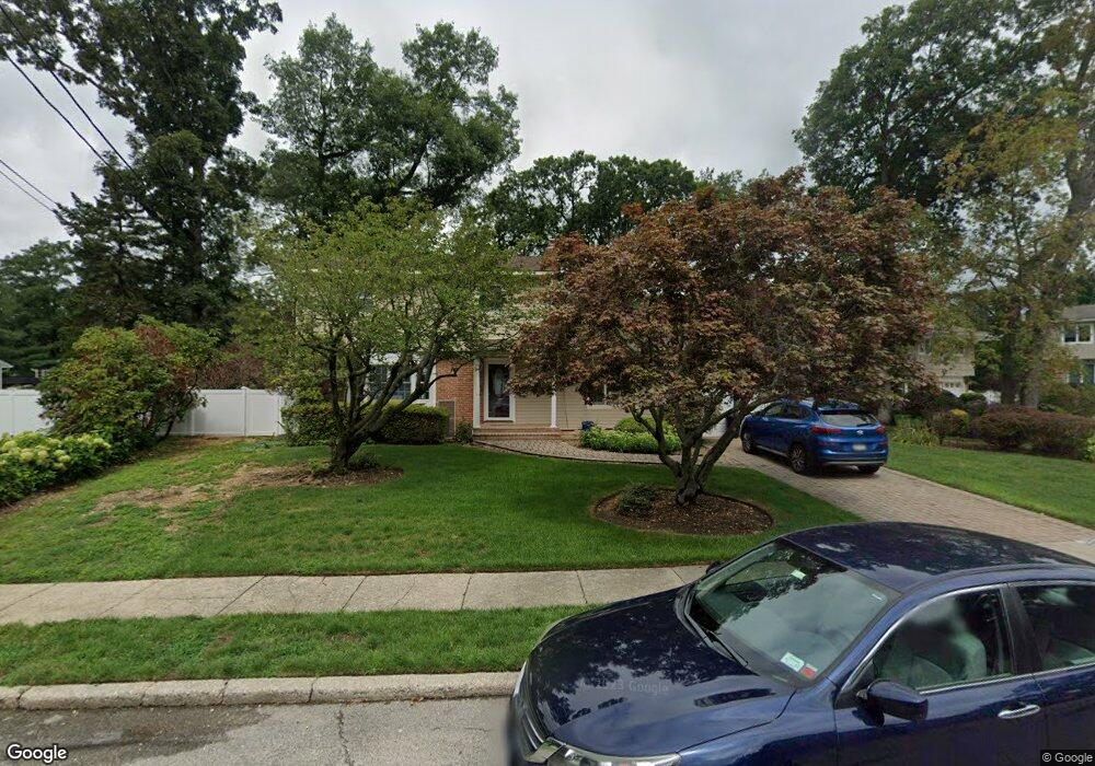
5 Isabel Ln Old Bethpage, NY 11804
Estimated Value: $1,038,000 - $1,089,886
Studio
3
Baths
2,419
Sq Ft
$440/Sq Ft
Est. Value
About This Home
This home is located at 5 Isabel Ln, Old Bethpage, NY 11804 and is currently estimated at $1,063,943, approximately $439 per square foot. 5 Isabel Ln is a home located in Nassau County with nearby schools including Old Bethpage School, Plainview Old Bethpage Middle School, and Plainview-Old Bethpage John F. Kennedy High School.
Ownership History
Date
Name
Owned For
Owner Type
Purchase Details
Closed on
May 25, 2022
Sold by
Mcchamkin Denise and Mcchamkin Joseph
Bought by
Nachamkin James S and Tallis Melissa S
Current Estimated Value
Home Financials for this Owner
Home Financials are based on the most recent Mortgage that was taken out on this home.
Original Mortgage
$560,000
Outstanding Balance
$524,615
Interest Rate
4%
Mortgage Type
New Conventional
Estimated Equity
$539,328
Create a Home Valuation Report for This Property
The Home Valuation Report is an in-depth analysis detailing your home's value as well as a comparison with similar homes in the area
Home Values in the Area
Average Home Value in this Area
Purchase History
| Date | Buyer | Sale Price | Title Company |
|---|---|---|---|
| Nachamkin James S | $750,000 | Judicial Title | |
| Nachamkin James S | $750,000 | Judicial Title | |
| Nachamkin James S | $750,000 | Judicial Title | |
| Nachamkin James S | $750,000 | Judicial Title |
Source: Public Records
Mortgage History
| Date | Status | Borrower | Loan Amount |
|---|---|---|---|
| Open | Nachamkin James S | $560,000 | |
| Closed | Nachamkin James S | $560,000 |
Source: Public Records
Tax History
| Year | Tax Paid | Tax Assessment Tax Assessment Total Assessment is a certain percentage of the fair market value that is determined by local assessors to be the total taxable value of land and additions on the property. | Land | Improvement |
|---|---|---|---|---|
| 2025 | $18,386 | $840 | $344 | $496 |
| 2024 | $4,931 | $600 | $333 | $267 |
Source: Public Records
Map
Nearby Homes
- 21105 Aspenwood Dr
- 31 Prescott Place
- 6 Adrienne Dr
- 28301 Spruce Pond Cir
- 25102 Aspenwood Dr
- 31 Seton Ct
- 43 Voorhis Dr
- 37 Santa Barbara Dr
- 5 Martin Ln
- 128 Santa Barbara Dr
- 78 Santa Barbara Dr
- 34 Gloria Place
- 85 Roundtree Dr
- 20 Briarwood Ln
- 93 Palo Alto Dr
- 4 Cranford Rd
- 2 Lee Place
- 42 Briarwood Ln
- 6 Lee Place
- 3 Dover Ln
Your Personal Tour Guide
Ask me questions while you tour the home.