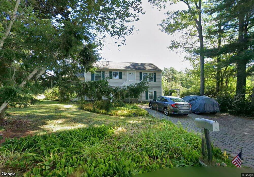
5 Island Rd Winchendon, MA 01475
Estimated Value: $469,153 - $560,000
3
Beds
2
Baths
1,624
Sq Ft
$314/Sq Ft
Est. Value
About This Home
This home is located at 5 Island Rd, Winchendon, MA 01475 and is currently estimated at $509,788, approximately $313 per square foot. 5 Island Rd is a home located in Worcester County with nearby schools including Memorial, Toy Town Elementary School, and The Winchendon School.
Ownership History
Date
Name
Owned For
Owner Type
Purchase Details
Closed on
Dec 6, 2017
Sold by
Anderson Joan C
Bought by
Joan C Anderson T
Current Estimated Value
Purchase Details
Closed on
Mar 4, 1994
Sold by
Davis Pollyanna
Bought by
Anderson Jeffrey D and Anderson Joan C
Home Financials for this Owner
Home Financials are based on the most recent Mortgage that was taken out on this home.
Original Mortgage
$48,000
Interest Rate
7.01%
Mortgage Type
Purchase Money Mortgage
Create a Home Valuation Report for This Property
The Home Valuation Report is an in-depth analysis detailing your home's value as well as a comparison with similar homes in the area
Home Values in the Area
Average Home Value in this Area
Purchase History
| Date | Buyer | Sale Price | Title Company |
|---|---|---|---|
| Joan C Anderson T | -- | -- | |
| Joan C Anderson T C | -- | -- | |
| Anderson Joan C | -- | -- | |
| Anderson Joan C | -- | -- | |
| Anderson Jeffrey D | $60,000 | -- | |
| Anderson Jeffrey D | $60,000 | -- |
Source: Public Records
Mortgage History
| Date | Status | Borrower | Loan Amount |
|---|---|---|---|
| Previous Owner | Anderson Jeffrey D | $203,000 | |
| Previous Owner | Anderson Jeffrey D | $110,600 | |
| Previous Owner | Anderson Jeffrey D | $48,000 |
Source: Public Records
Tax History Compared to Growth
Tax History
| Year | Tax Paid | Tax Assessment Tax Assessment Total Assessment is a certain percentage of the fair market value that is determined by local assessors to be the total taxable value of land and additions on the property. | Land | Improvement |
|---|---|---|---|---|
| 2025 | $4,888 | $416,000 | $209,700 | $206,300 |
| 2024 | $4,946 | $394,400 | $202,000 | $192,400 |
| 2023 | $4,954 | $369,700 | $191,900 | $177,800 |
| 2022 | $5,013 | $331,800 | $191,900 | $139,900 |
| 2021 | $4,736 | $301,300 | $174,400 | $126,900 |
| 2020 | $4,622 | $283,900 | $166,000 | $117,900 |
| 2019 | $4,393 | $262,900 | $151,500 | $111,400 |
| 2018 | $4,065 | $234,300 | $134,700 | $99,600 |
| 2017 | $4,322 | $240,500 | $144,800 | $95,700 |
| 2016 | $3,913 | $224,500 | $131,300 | $93,200 |
| 2015 | $3,754 | $224,500 | $131,300 | $93,200 |
| 2014 | $3,845 | $240,900 | $151,600 | $89,300 |
Source: Public Records
Map
Nearby Homes
- 16 2nd St
- 15 2nd St
- 125 2nd St
- 35 Hillside Dr
- 19 Monomonac Terrace
- 238 Fourth St
- 145 Monomonac Rd E
- 150 Hubbard Hill Rd
- 0 Monomonac Rd W
- 40 Maple Dr
- 150-152 Mill Cir
- 26 Park Dr Unit 59
- 30 Cattail Cir
- 0 Glenallen St
- 634 Forristall Rd
- 436 Maple St
- 80 Elmwood Rd
- 336 Main St
- lot 2-0 Saybrook Dr
- 1 Saybrook Dr