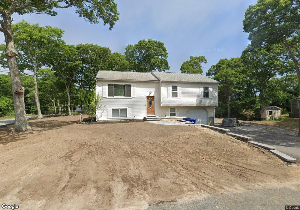
5 Keenan Rd Bourne, MA 2532
Buzzards Bay NeighborhoodEstimated Value: $438,000 - $557,000
3
Beds
2
Baths
1,678
Sq Ft
$307/Sq Ft
Est. Value
About This Home
This home is located at 5 Keenan Rd, Bourne, MA 2532 and is currently estimated at $515,051, approximately $306 per square foot. 5 Keenan Rd is a home located in Barnstable County with nearby schools including Bourne High School and St Margaret Regional School.
Ownership History
Date
Name
Owned For
Owner Type
Purchase Details
Closed on
Mar 6, 2012
Sold by
Mahony Michael J
Bought by
Mahony Michael J and Mahony Samantha O
Current Estimated Value
Purchase Details
Closed on
Jul 20, 2007
Sold by
Rogers Cherie Ann
Bought by
Mahony Michael J
Home Financials for this Owner
Home Financials are based on the most recent Mortgage that was taken out on this home.
Original Mortgage
$220,800
Interest Rate
6.54%
Mortgage Type
Purchase Money Mortgage
Purchase Details
Closed on
Jun 18, 2004
Sold by
Rogers Cherie A and Rogers Kary M
Bought by
Rogers Cherie A
Purchase Details
Closed on
Sep 24, 1996
Sold by
Matta James
Bought by
Rogers Kary M and Rogers Cherie A
Purchase Details
Closed on
Mar 25, 1996
Sold by
Spinola Thomas W and Spinola Diana L
Bought by
Matta James
Create a Home Valuation Report for This Property
The Home Valuation Report is an in-depth analysis detailing your home's value as well as a comparison with similar homes in the area
Home Values in the Area
Average Home Value in this Area
Purchase History
| Date | Buyer | Sale Price | Title Company |
|---|---|---|---|
| Mahony Michael J | -- | -- | |
| Mahony Michael J | -- | -- | |
| Mahony Michael J | $276,000 | -- | |
| Mahony Michael J | $276,000 | -- | |
| Rogers Cherie A | -- | -- | |
| Rogers Cherie A | -- | -- | |
| Rogers Kary M | $108,000 | -- | |
| Rogers Kary M | $108,000 | -- | |
| Matta James | $73,200 | -- | |
| Matta James | $73,200 | -- |
Source: Public Records
Mortgage History
| Date | Status | Borrower | Loan Amount |
|---|---|---|---|
| Previous Owner | Mahony Michael J | $220,800 | |
| Previous Owner | Mahony Michael J | $55,200 | |
| Previous Owner | Matta James | $80,000 |
Source: Public Records
Tax History Compared to Growth
Tax History
| Year | Tax Paid | Tax Assessment Tax Assessment Total Assessment is a certain percentage of the fair market value that is determined by local assessors to be the total taxable value of land and additions on the property. | Land | Improvement |
|---|---|---|---|---|
| 2025 | $3,462 | $443,300 | $179,000 | $264,300 |
| 2024 | $3,387 | $422,300 | $170,500 | $251,800 |
| 2023 | $3,293 | $373,800 | $150,900 | $222,900 |
| 2022 | $3,005 | $297,800 | $133,500 | $164,300 |
| 2021 | $2,920 | $271,100 | $121,500 | $149,600 |
| 2020 | $2,824 | $262,900 | $120,400 | $142,500 |
| 2019 | $2,679 | $254,900 | $120,400 | $134,500 |
| 2018 | $2,583 | $245,100 | $108,900 | $136,200 |
| 2017 | $2,499 | $242,600 | $107,900 | $134,700 |
| 2016 | $2,102 | $206,900 | $96,500 | $110,400 |
| 2015 | $2,083 | $206,900 | $96,500 | $110,400 |
Source: Public Records
Map
Nearby Homes
- 17 Maple St
- 162 Puritan Rd
- 304 Main St
- 46 Holt Rd
- 46 Holt Rd Unit A
- 171 Puritan Rd
- 151 - 153 Main St
- 38 Old Bridge Rd
- 41 Lewis Point Rd
- 0 Lewis Point Rd
- 4 Knob Ln
- 34 Washington Ave
- 65 Lewis Point Rd
- 16 Washington Ave
- 73 Lewis Point Rd
- 3 Wolf Rd
- 60 Sandwich Rd
- 90-92 Sandwich Rd Unit 9C
- 90-92 Sandwich Rd Unit 2
- 56 Rip Van Winkle Way