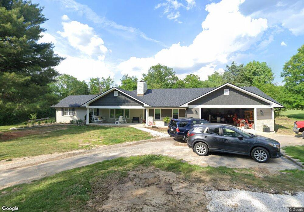
5 Lemp Rd Saint Louis, MO 63122
Estimated Value: $606,000 - $639,475
3
Beds
3
Baths
2,015
Sq Ft
$309/Sq Ft
Est. Value
About This Home
This home is located at 5 Lemp Rd, Saint Louis, MO 63122 and is currently estimated at $622,619, approximately $308 per square foot. 5 Lemp Rd is a home located in St. Louis County with nearby schools including George R. Robinson Elementary School, Nipher Middle School, and Kirkwood Senior High School.
Ownership History
Date
Name
Owned For
Owner Type
Purchase Details
Closed on
Jun 15, 2004
Sold by
Kennedy Walter D and Kennedy Karen A
Bought by
Drake Dean E and Drake Michele M
Current Estimated Value
Home Financials for this Owner
Home Financials are based on the most recent Mortgage that was taken out on this home.
Original Mortgage
$279,920
Outstanding Balance
$139,580
Interest Rate
6.3%
Mortgage Type
Purchase Money Mortgage
Estimated Equity
$483,039
Create a Home Valuation Report for This Property
The Home Valuation Report is an in-depth analysis detailing your home's value as well as a comparison with similar homes in the area
Home Values in the Area
Average Home Value in this Area
Purchase History
| Date | Buyer | Sale Price | Title Company |
|---|---|---|---|
| Drake Dean E | $349,900 | -- |
Source: Public Records
Mortgage History
| Date | Status | Borrower | Loan Amount |
|---|---|---|---|
| Open | Drake Dean E | $279,920 |
Source: Public Records
Tax History
| Year | Tax Paid | Tax Assessment Tax Assessment Total Assessment is a certain percentage of the fair market value that is determined by local assessors to be the total taxable value of land and additions on the property. | Land | Improvement |
|---|---|---|---|---|
| 2025 | $5,877 | $106,900 | $77,180 | $29,720 |
| 2024 | $5,877 | $94,620 | $53,750 | $40,870 |
| 2023 | $5,785 | $94,620 | $53,750 | $40,870 |
| 2022 | $4,708 | $71,770 | $59,130 | $12,640 |
| 2021 | $4,646 | $71,770 | $59,130 | $12,640 |
| 2020 | $4,623 | $68,670 | $57,480 | $11,190 |
| 2019 | $4,671 | $68,670 | $57,480 | $11,190 |
| 2018 | $4,703 | $61,070 | $30,610 | $30,460 |
| 2017 | $4,697 | $61,070 | $30,610 | $30,460 |
| 2016 | $4,523 | $59,260 | $26,810 | $32,450 |
Source: Public Records
Map
Nearby Homes
- 1321 Marbendale Ct
- 11922 Big Bend Rd
- 11615 Big Bend Rd
- 1016 Forest Ave
- 1889 N Signal Hills Dr
- 12685 Alberts Laumeier Ct
- 1713 Virginia Ln
- 540 Hickory Hollow Ln
- 524 Hickory Hollow Ln
- 420 W Rose Hill Ave
- 558 S Geyer Rd
- 52 Tbb Ponca Trail
- 2 Thorncliff Ln
- 338 W Rose Hill Ave
- 406 Meyer Ave
- 326 W Rose Hill Ave
- 416 S Ballas Rd
- 831 S Harrison Ave
- 810 Nirk Ave
- 1939 Hunting Lake Ct Unit 1939