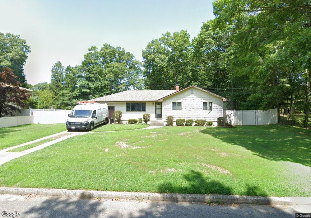
5 Mark St Port Jefferson Station, NY 11776
Estimated Value: $582,126 - $628,000
--
Bed
--
Bath
1,152
Sq Ft
$522/Sq Ft
Est. Value
About This Home
This home is located at 5 Mark St, Port Jefferson Station, NY 11776 and is currently estimated at $601,532, approximately $522 per square foot. 5 Mark St is a home located in Suffolk County with nearby schools including John F Kennedy Middle School, Comsewogue High School, and Our Lady of Wisdom Regional School.
Ownership History
Date
Name
Owned For
Owner Type
Purchase Details
Closed on
Oct 12, 2024
Sold by
Mahnken Mary L
Bought by
Mary L Mahnken Irt and Mahnken
Current Estimated Value
Purchase Details
Closed on
Sep 17, 2001
Sold by
Homes By The Timbers Inc
Bought by
Liva A William and Liva Eleanore
Home Financials for this Owner
Home Financials are based on the most recent Mortgage that was taken out on this home.
Original Mortgage
$65,000
Interest Rate
6.93%
Create a Home Valuation Report for This Property
The Home Valuation Report is an in-depth analysis detailing your home's value as well as a comparison with similar homes in the area
Home Values in the Area
Average Home Value in this Area
Purchase History
| Date | Buyer | Sale Price | Title Company |
|---|---|---|---|
| Mary L Mahnken Irt | -- | None Available | |
| Mary L Mahnken Irt | -- | None Available | |
| Liva A William | $319,990 | Commonwealth Land Title Ins | |
| Liva A William A | $319,990 | Commonwealth Land Title Ins |
Source: Public Records
Mortgage History
| Date | Status | Borrower | Loan Amount |
|---|---|---|---|
| Previous Owner | Liva A William A | $65,000 |
Source: Public Records
Tax History Compared to Growth
Tax History
| Year | Tax Paid | Tax Assessment Tax Assessment Total Assessment is a certain percentage of the fair market value that is determined by local assessors to be the total taxable value of land and additions on the property. | Land | Improvement |
|---|---|---|---|---|
| 2024 | $9,226 | $2,700 | $300 | $2,400 |
| 2023 | $9,226 | $2,700 | $300 | $2,400 |
| 2022 | $8,092 | $2,700 | $300 | $2,400 |
| 2021 | $8,092 | $2,700 | $300 | $2,400 |
| 2020 | $8,299 | $2,700 | $300 | $2,400 |
| 2019 | $8,299 | $0 | $0 | $0 |
| 2018 | $7,892 | $2,700 | $300 | $2,400 |
| 2017 | $7,892 | $2,700 | $300 | $2,400 |
| 2016 | $7,838 | $2,700 | $300 | $2,400 |
| 2015 | -- | $2,700 | $300 | $2,400 |
| 2014 | -- | $2,700 | $300 | $2,400 |
Source: Public Records
Map
Nearby Homes
- 172 Norwood Ave
- 16 Maryanne Ave
- 22 Washington Ave
- 17 Katherine St
- 4 Forest Ave
- 203 Sterling St
- 26 Forest Ave
- 171 Minrol St
- 24 Kennedy Rd
- 191 Bergen St
- 105 Commodore Cir
- 1107 Sara Cir Unit "B"
- 148 Captains Way
- 1209 Sara Cir
- 236 Woodhull Ave
- 45 Gaymore Rd
- 155 Jayne Blvd
- 106 Montrose Dr
- 26 Weldon Ln
- 4 Linda St