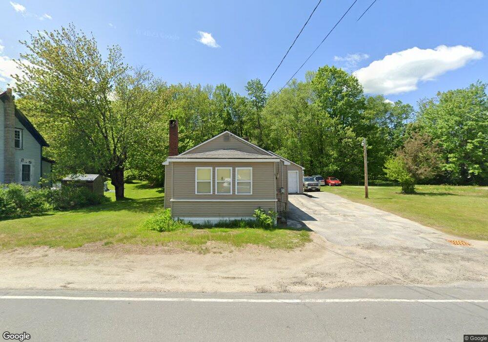
5 Maxwell Rd Wilton, ME 04294
Estimated Value: $176,000 - $221,000
2
Beds
1
Bath
948
Sq Ft
$203/Sq Ft
Est. Value
About This Home
This home is located at 5 Maxwell Rd, Wilton, ME 04294 and is currently estimated at $192,872, approximately $203 per square foot. 5 Maxwell Rd is a home located in Franklin County with nearby schools including Mt. Blue High School and Western Maine Christian Academy.
Ownership History
Date
Name
Owned For
Owner Type
Purchase Details
Closed on
Dec 11, 2008
Sold by
Chapman Catherine D Est
Bought by
Corbin Karen R
Current Estimated Value
Home Financials for this Owner
Home Financials are based on the most recent Mortgage that was taken out on this home.
Original Mortgage
$70,900
Outstanding Balance
$48,677
Interest Rate
6.49%
Mortgage Type
Unknown
Estimated Equity
$144,195
Create a Home Valuation Report for This Property
The Home Valuation Report is an in-depth analysis detailing your home's value as well as a comparison with similar homes in the area
Home Values in the Area
Average Home Value in this Area
Purchase History
| Date | Buyer | Sale Price | Title Company |
|---|---|---|---|
| Corbin Karen R | -- | -- |
Source: Public Records
Mortgage History
| Date | Status | Borrower | Loan Amount |
|---|---|---|---|
| Open | Corbin Karen R | $70,900 |
Source: Public Records
Tax History
| Year | Tax Paid | Tax Assessment Tax Assessment Total Assessment is a certain percentage of the fair market value that is determined by local assessors to be the total taxable value of land and additions on the property. | Land | Improvement |
|---|---|---|---|---|
| 2025 | $1,834 | $83,929 | $17,888 | $66,041 |
| 2024 | $1,788 | $83,929 | $17,888 | $66,041 |
| 2023 | $1,712 | $83,929 | $17,888 | $66,041 |
| 2022 | $1,628 | $83,929 | $17,888 | $66,041 |
| 2021 | $1,628 | $83,929 | $17,888 | $66,041 |
| 2020 | $1,679 | $83,929 | $17,888 | $66,041 |
| 2019 | $1,679 | $83,929 | $17,888 | $66,041 |
| 2018 | $1,708 | $83,929 | $17,888 | $66,041 |
| 2017 | $1,733 | $83,929 | $17,888 | $66,041 |
| 2016 | $1,733 | $83,929 | $17,888 | $66,041 |
| 2015 | $1,245 | $66,400 | $17,200 | $49,200 |
| 2014 | $1,152 | $66,400 | $17,200 | $49,200 |
| 2013 | $1,079 | $66,400 | $17,200 | $49,200 |
Source: Public Records
Map
Nearby Homes
- 21 Main St
- 42 Fernald St
- 530 Main St
- 5 School St
- 555 Depot St
- 25 Lake School Rd
- 9 Maple St
- 28//36&37 Us Route 2 & 4
- 269 Weld Rd
- M16 L12 Maine 4
- 22 E Dixfield Rd
- 100 Chretien Ln
- 221 More Acres Rd
- 87 Severy Hill Rd
- 916 Orchard Dr
- Lots B&C Hanslip Rd
- 8 Science Hill Rd
- 22 Old Jay Hill Rd
- 206 Livermore Falls Rd
- 299 Intervale Rd
- 7 Maxwell Rd
- 3 Maxwell Rd
- 9 Maxwell Rd
- 4 Maxwell Rd
- 6 Maxwell Rd
- 0 Route 2 Unit 866736
- 0 Rt 2 Unit 825817
- 0 Rt 2 West Lot
- 0 U S Route 2 W
- 0 Rt 2 Unit 501375
- 0 Rt 2 Unit 501359
- 0 Route 2 Unit 439125
- 0 Route 2 & 4 Unit 344867
- 0 Rt 2 Unit 275481
- 0 Route 2 Unit 252084
- 0 Rt 2 Unit 205187
- 0 Rt 2 Unit 825827
- 0 Rt 2 Unit 530175
- 0 Rt 2 Unit 273330
- 0 Route 2 & 4 Unit 255399
Your Personal Tour Guide
Ask me questions while you tour the home.