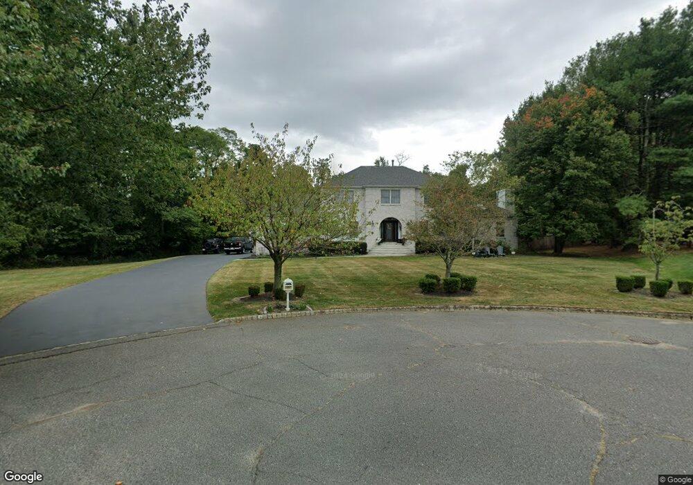
5 Mc Donald Ct Red Bank, NJ 07701
New Monmouth NeighborhoodEstimated Value: $1,156,000 - $1,382,000
4
Beds
3
Baths
2,778
Sq Ft
$450/Sq Ft
Est. Value
About This Home
This home is located at 5 Mc Donald Ct, Red Bank, NJ 07701 and is currently estimated at $1,250,165, approximately $450 per square foot. 5 Mc Donald Ct is a home located in Monmouth County with nearby schools including Fairview Elementary School, Bayshore Middle School, and Middletown High School North.
Ownership History
Date
Name
Owned For
Owner Type
Purchase Details
Closed on
Dec 12, 2000
Sold by
Maser Richard
Bought by
Kulawiak Andrew and Kulawiak Patti
Current Estimated Value
Home Financials for this Owner
Home Financials are based on the most recent Mortgage that was taken out on this home.
Original Mortgage
$300,000
Interest Rate
5.88%
Purchase Details
Closed on
Sep 17, 1993
Sold by
Saverano Frank
Bought by
Maser Richard and Maser Mary
Home Financials for this Owner
Home Financials are based on the most recent Mortgage that was taken out on this home.
Original Mortgage
$352,000
Interest Rate
7.1%
Create a Home Valuation Report for This Property
The Home Valuation Report is an in-depth analysis detailing your home's value as well as a comparison with similar homes in the area
Home Values in the Area
Average Home Value in this Area
Purchase History
| Date | Buyer | Sale Price | Title Company |
|---|---|---|---|
| Kulawiak Andrew | $700,000 | -- | |
| Maser Richard | $440,000 | -- |
Source: Public Records
Mortgage History
| Date | Status | Borrower | Loan Amount |
|---|---|---|---|
| Previous Owner | Kulawiak Andrew | $300,000 | |
| Previous Owner | Maser Richard | $352,000 |
Source: Public Records
Tax History Compared to Growth
Tax History
| Year | Tax Paid | Tax Assessment Tax Assessment Total Assessment is a certain percentage of the fair market value that is determined by local assessors to be the total taxable value of land and additions on the property. | Land | Improvement |
|---|---|---|---|---|
| 2025 | $15,858 | $975,400 | $351,800 | $623,600 |
| 2024 | $16,250 | $964,000 | $351,800 | $612,200 |
| 2023 | $16,250 | $935,000 | $325,800 | $609,200 |
| 2022 | $17,636 | $905,900 | $325,800 | $580,100 |
| 2021 | $17,636 | $847,900 | $325,800 | $522,100 |
| 2020 | $17,876 | $836,100 | $325,800 | $510,300 |
| 2019 | $17,722 | $839,100 | $325,800 | $513,300 |
| 2018 | $15,819 | $730,000 | $325,800 | $404,200 |
| 2017 | $15,505 | $730,000 | $325,800 | $404,200 |
| 2016 | $16,658 | $781,700 | $325,800 | $455,900 |
| 2015 | $16,646 | $779,300 | $325,800 | $453,500 |
| 2014 | $16,205 | $740,300 | $325,800 | $414,500 |
Source: Public Records
Map
Nearby Homes
- 152 Chapel Hill Rd
- 4 Breana Ct
- 35 Fairview Dr
- 78 Crestview Dr
- 508 Abby Rd Unit 508
- 238 Martin Place
- 310 Cooper Rd Unit C
- 3504 James Ct Unit 159
- 139 Statesir Place
- 7 Meehan Ct
- 6 Waller Dr
- 64 Augustus Dr
- 22 Waller Dr
- 16 Waller Dr
- 839 Arthur Dr
- 9 Wesleyan St
- 39 Market St
- 58 Edmund Way
- 1 Waller Dr
- 22 Edmund Way
- 192 Chapel Hill Rd
- 188 Chapel Hill Rd
- 41 Tilton Rd
- 45 Tilton Rd
- 3 Mc Donald Ct
- 37 Tilton Rd
- 184 Chapel Hill Rd
- 49 Tilton Rd
- 14 Sleepy Hollow Rd
- 16 Sleepy Hollow Rd
- 35 Tilton Rd
- 12 Sleepy Hollow Rd
- 802 Tilton Place
- 40 Sleepy Hollow Rd
- 32 Sleepy Hollow Rd
- 801 Tilton Place
- 60 Sleepy Hollow Rd
- 195 Chapel Hill Rd
- 11 Sleepy Hollow Rd
- 36 Tilton Rd