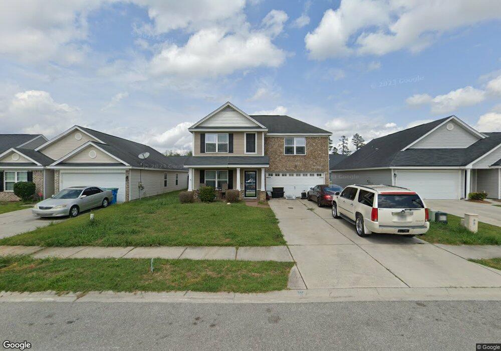
5 Milsbury Ln Port Wentworth, GA 31407
Estimated Value: $303,974 - $396,000
3
Beds
3
Baths
1,940
Sq Ft
$176/Sq Ft
Est. Value
About This Home
This home is located at 5 Milsbury Ln, Port Wentworth, GA 31407 and is currently estimated at $340,744, approximately $175 per square foot. 5 Milsbury Ln is a home with nearby schools including Godley Station School, Groves High School, and Savannah Adventist Christian School.
Ownership History
Date
Name
Owned For
Owner Type
Purchase Details
Closed on
Jul 14, 2011
Sold by
Brodie Builders Inc
Bought by
Martin Katrina L
Current Estimated Value
Home Financials for this Owner
Home Financials are based on the most recent Mortgage that was taken out on this home.
Original Mortgage
$137,594
Outstanding Balance
$94,616
Interest Rate
4.5%
Mortgage Type
FHA
Estimated Equity
$246,128
Create a Home Valuation Report for This Property
The Home Valuation Report is an in-depth analysis detailing your home's value as well as a comparison with similar homes in the area
Home Values in the Area
Average Home Value in this Area
Purchase History
| Date | Buyer | Sale Price | Title Company |
|---|---|---|---|
| Martin Katrina L | $141,175 | -- |
Source: Public Records
Mortgage History
| Date | Status | Borrower | Loan Amount |
|---|---|---|---|
| Open | Martin Katrina L | $137,594 |
Source: Public Records
Tax History Compared to Growth
Tax History
| Year | Tax Paid | Tax Assessment Tax Assessment Total Assessment is a certain percentage of the fair market value that is determined by local assessors to be the total taxable value of land and additions on the property. | Land | Improvement |
|---|---|---|---|---|
| 2025 | $2,259 | $85,600 | $12,000 | $73,600 |
| 2024 | $2,259 | $84,920 | $12,000 | $72,920 |
| 2023 | $1,478 | $88,000 | $12,000 | $76,000 |
| 2022 | $1,987 | $80,400 | $12,000 | $68,400 |
| 2021 | $1,875 | $65,520 | $12,000 | $53,520 |
| 2020 | $2,428 | $63,880 | $12,000 | $51,880 |
| 2019 | $2,428 | $70,200 | $12,000 | $58,200 |
| 2018 | $2,377 | $67,920 | $12,000 | $55,920 |
| 2017 | $1,999 | $61,040 | $12,000 | $49,040 |
| 2016 | $1,970 | $60,160 | $12,000 | $48,160 |
| 2015 | $1,991 | $60,720 | $12,000 | $48,720 |
| 2014 | $2,966 | $58,760 | $0 | $0 |
Source: Public Records
Map
Nearby Homes
- 44 Braxton Manor Dr
- 35 Braxton Manor Dr
- 629 & 631 Meinhard Rd
- 15 Amber Dr
- 430 Punkin Bridge Rd
- 22 Roseberry Cir
- 14 Roseberry Cir
- 31 Red Robin Ct
- 10 Brown Thrasher Ct
- 8 Brown Thrasher Ct
- 9 Sunnydale Ln
- 135 Fox Glen Ct
- 133 Fox Glen Ct
- 115 Fox Glen Ct
- 136 Basswood Dr Unit 8
- 76 Tiller Way
- 1 Blackberry Ln
- 18 Allen Brook Dr
- 54 Hawkhorn Ct
- 7 Corsair Cir