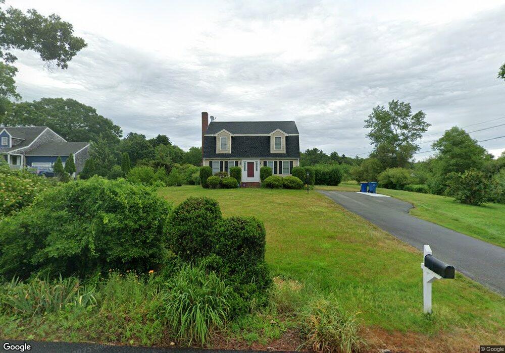
5 Natalie Dr East Bridgewater, MA 02333
Estimated Value: $610,247 - $707,000
3
Beds
2
Baths
1,700
Sq Ft
$388/Sq Ft
Est. Value
About This Home
This home is located at 5 Natalie Dr, East Bridgewater, MA 02333 and is currently estimated at $659,312, approximately $387 per square foot. 5 Natalie Dr is a home located in Plymouth County with nearby schools including Central Elementary School, Gordon W Mitchell Middle School, and East Bridgewater Jr./Sr. High School.
Ownership History
Date
Name
Owned For
Owner Type
Purchase Details
Closed on
Jan 30, 2001
Sold by
Brown Bldrs Inc
Bought by
Toomey Brian C and Toomey Judith L
Current Estimated Value
Home Financials for this Owner
Home Financials are based on the most recent Mortgage that was taken out on this home.
Original Mortgage
$199,688
Interest Rate
7.39%
Mortgage Type
Purchase Money Mortgage
Create a Home Valuation Report for This Property
The Home Valuation Report is an in-depth analysis detailing your home's value as well as a comparison with similar homes in the area
Home Values in the Area
Average Home Value in this Area
Purchase History
| Date | Buyer | Sale Price | Title Company |
|---|---|---|---|
| Toomey Brian C | $249,611 | -- |
Source: Public Records
Mortgage History
| Date | Status | Borrower | Loan Amount |
|---|---|---|---|
| Open | Toomey Brian C | $195,000 | |
| Closed | Toomey Brian C | $199,688 | |
| Closed | Toomey Brian C | $12,481 |
Source: Public Records
Tax History Compared to Growth
Tax History
| Year | Tax Paid | Tax Assessment Tax Assessment Total Assessment is a certain percentage of the fair market value that is determined by local assessors to be the total taxable value of land and additions on the property. | Land | Improvement |
|---|---|---|---|---|
| 2025 | $6,503 | $475,700 | $188,000 | $287,700 |
| 2024 | $6,383 | $461,200 | $180,800 | $280,400 |
| 2023 | $6,261 | $433,300 | $180,800 | $252,500 |
| 2022 | $6,072 | $389,200 | $164,500 | $224,700 |
| 2021 | $4,311 | $349,400 | $158,000 | $191,400 |
| 2020 | $4,073 | $338,500 | $152,000 | $186,500 |
| 2019 | $5,709 | $325,100 | $145,200 | $179,900 |
| 2018 | $3,759 | $307,900 | $145,200 | $162,700 |
| 2017 | $5,406 | $295,400 | $138,500 | $156,900 |
| 2016 | $5,252 | $289,200 | $138,500 | $150,700 |
| 2015 | $5,097 | $287,000 | $137,500 | $149,500 |
| 2014 | $4,917 | $283,100 | $134,600 | $148,500 |
Source: Public Records
Map
Nearby Homes
- 25 Plain St
- 728 Auburn St Unit F6
- 877 Auburnville Way Unit D4
- 1121 Auburn St
- 848 N Bedford St Phase III
- 848 N Bedford St Phase IV
- 848 N
- 848 N Bedford St
- 618 Auburn St
- 307 Homeland Dr
- 26 Alger St
- 262 Homeland Dr
- 416 Highland St
- 205 Bedford St
- 70 Surrey Ln
- 70 Surrey Ln
- 99 Alger St
- 611 N Bedford St
- 585 N Bedford St
- 32 Joyce Terrace
- 7 Natalie Dr
- 3 Natalie Dr
- 4 Natalie Dr
- 8 Natalie Dr
- 2 Natalie Dr
- 1 Natalie Dr
- 7 Johnson Farm Ln
- 10 Natalie Dr
- 2 Johnson Farm Ln
- Lot 1-5 Johnson Farm Ln
- Lot 5 Johnson Farm Ln
- 352 Winter St
- 368 Winter St
- 354 Winter St
- 431 Winter St
- 443 Winter St
- 4 Johnson Farm Ln
- 6 Johnson Farm Ln
- 445 Winter St
- 425 Winter St