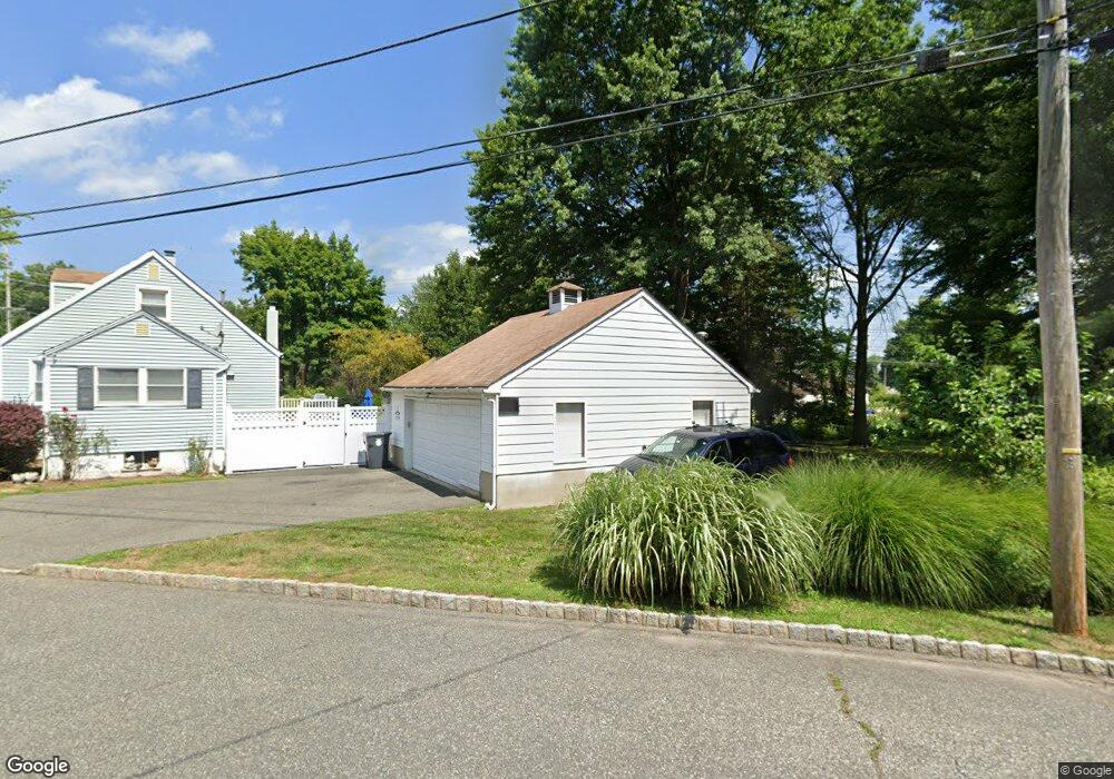
5 Nemic Ln Whippany, NJ 07981
Estimated Value: $556,328 - $657,000
--
Bed
--
Bath
1,384
Sq Ft
$441/Sq Ft
Est. Value
About This Home
This home is located at 5 Nemic Ln, Whippany, NJ 07981 and is currently estimated at $609,832, approximately $440 per square foot. 5 Nemic Ln is a home located in Morris County with nearby schools including Whippany Park High School, Arrow Academy, and The Morristown-Beard School.
Ownership History
Date
Name
Owned For
Owner Type
Purchase Details
Closed on
Nov 16, 2007
Sold by
Whitmore Kenneth and Whitmore Bonnie
Bought by
Whitmore Kenneth F
Current Estimated Value
Home Financials for this Owner
Home Financials are based on the most recent Mortgage that was taken out on this home.
Original Mortgage
$296,500
Interest Rate
6.21%
Mortgage Type
New Conventional
Create a Home Valuation Report for This Property
The Home Valuation Report is an in-depth analysis detailing your home's value as well as a comparison with similar homes in the area
Home Values in the Area
Average Home Value in this Area
Purchase History
| Date | Buyer | Sale Price | Title Company |
|---|---|---|---|
| Whitmore Kenneth F | -- | None Available | |
| Whitmore Kenneth F | -- | None Available |
Source: Public Records
Mortgage History
| Date | Status | Borrower | Loan Amount |
|---|---|---|---|
| Closed | Whitmore Kenneth F | $296,500 |
Source: Public Records
Tax History Compared to Growth
Tax History
| Year | Tax Paid | Tax Assessment Tax Assessment Total Assessment is a certain percentage of the fair market value that is determined by local assessors to be the total taxable value of land and additions on the property. | Land | Improvement |
|---|---|---|---|---|
| 2025 | $7,011 | $332,600 | $187,900 | $144,700 |
| 2024 | $6,981 | $332,600 | $187,900 | $144,700 |
| 2023 | $6,981 | $332,600 | $187,900 | $144,700 |
| 2022 | $6,386 | $332,600 | $187,900 | $144,700 |
| 2021 | $6,386 | $332,600 | $187,900 | $144,700 |
| 2020 | $6,273 | $332,600 | $187,900 | $144,700 |
| 2019 | $6,293 | $332,600 | $187,900 | $144,700 |
| 2018 | $6,183 | $332,600 | $187,900 | $144,700 |
| 2017 | $6,000 | $332,600 | $187,900 | $144,700 |
| 2016 | $5,914 | $332,600 | $187,900 | $144,700 |
| 2015 | $5,677 | $332,600 | $187,900 | $144,700 |
| 2014 | $5,554 | $332,600 | $187,900 | $144,700 |
Source: Public Records
Map
Nearby Homes
- 11 Nemic Ln
- 26 David Dr
- 39 Lefke Ln
- 96 Parsippany Rd
- 92 Sunrise Dr
- 1 Glenbrook Ct
- 26 Gladstone Ct
- 42 Gladstone Ct
- 34 Gladstone Ct
- 14 Gladstone Ct
- Monterey Plan at The Grove - The Monterey Collection
- Pershing Plan at The Grove - The Pershing Collection
- 2003 Vermont Terrace Unit 2003
- 709 Brook Hollow Dr Unit 709
- 74 Preston Rd
- 00 Algonquin Pkwy
- 53 Westminster Dr
- 72 Schindler Ct
- 89 Schindler Ct
- 3306 Appleton Way