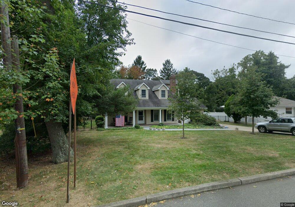
5 Osborne Ave Rumson, NJ 07760
Estimated Value: $855,000 - $1,478,000
4
Beds
3
Baths
2,772
Sq Ft
$410/Sq Ft
Est. Value
About This Home
This home is located at 5 Osborne Ave, Rumson, NJ 07760 and is currently estimated at $1,135,992, approximately $409 per square foot. 5 Osborne Ave is a home located in Monmouth County with nearby schools including Navesink Elementary School, Bayshore Middle School, and Middletown - South High School.
Ownership History
Date
Name
Owned For
Owner Type
Purchase Details
Closed on
Jun 27, 1991
Bought by
Barrett John and Barrett Moira
Current Estimated Value
Create a Home Valuation Report for This Property
The Home Valuation Report is an in-depth analysis detailing your home's value as well as a comparison with similar homes in the area
Home Values in the Area
Average Home Value in this Area
Purchase History
| Date | Buyer | Sale Price | Title Company |
|---|---|---|---|
| Barrett John | $150,000 | -- |
Source: Public Records
Tax History Compared to Growth
Tax History
| Year | Tax Paid | Tax Assessment Tax Assessment Total Assessment is a certain percentage of the fair market value that is determined by local assessors to be the total taxable value of land and additions on the property. | Land | Improvement |
|---|---|---|---|---|
| 2025 | $13,407 | $891,100 | $474,000 | $417,100 |
| 2024 | $13,984 | $815,000 | $405,600 | $409,400 |
| 2023 | $13,984 | $804,600 | $390,000 | $414,600 |
| 2022 | $13,156 | $682,900 | $288,100 | $394,800 |
| 2021 | $13,156 | $632,500 | $281,400 | $351,100 |
| 2020 | $13,418 | $627,600 | $284,400 | $343,200 |
| 2019 | $13,504 | $639,400 | $284,400 | $355,000 |
| 2018 | $12,254 | $565,500 | $262,000 | $303,500 |
| 2017 | $12,696 | $580,000 | $262,000 | $318,000 |
| 2016 | $12,647 | $580,000 | $262,000 | $318,000 |
| 2015 | $12,982 | $588,200 | $262,000 | $326,200 |
| 2014 | $11,202 | $495,000 | $262,000 | $233,000 |
Source: Public Records
Map
Nearby Homes
- 139 Monmouth Ave
- 96 East Ave Unit 75
- 96 East Ave Unit 92
- 38 East Ave
- 4 Isabella Ct
- 185 Monmouth Ave
- 502 Central Ave
- 18 Clay Ct
- 7100 Prospect Ave
- 6998 Prospect Ave
- HAMPSHIRE Plan at Central Ave
- 498 Central Ave
- 500 Central Ave
- 49 Pape Dr
- 258 Ocean Blvd
- 90 E Lincoln Ave
- 59 Asbury Ave
- 942 Navesink River Rd
- 608 Raritan Ave
- 934 Navesink River Rd
- 3 Osborne Ave
- 29 Demmert Ave
- 1 Osborne Ave
- 7 Brotherton Ave
- 7 Osborne Ave
- 11 Brotherton Ave
- 13 Brotherton Ave
- 27 Demmert Ave
- 112 Monmouth Ave
- 108 Monmouth Ave
- 15 Brotherton Ave
- 104 Monmouth Ave
- 32 Demmert Ave
- 20 Valley Dr
- 116 Monmouth Ave
- 20 Valley Dr
- 28 Valley Dr
- 19 Brotherton Ave
- 28 Demmert Ave
- 28 Demmert Ave