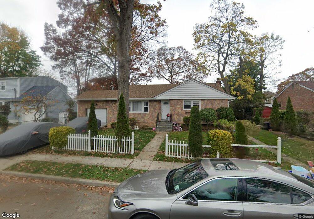
5 Oswald Place Roosevelt, NY 11575
Estimated Value: $566,000 - $724,605
5
Beds
2
Baths
1,890
Sq Ft
$341/Sq Ft
Est. Value
About This Home
This home is located at 5 Oswald Place, Roosevelt, NY 11575 and is currently estimated at $645,303, approximately $341 per square foot. 5 Oswald Place is a home located in Nassau County with nearby schools including Roosevelt Middle School, Roosevelt High School, and Roosevelt Children's Academy.
Ownership History
Date
Name
Owned For
Owner Type
Purchase Details
Closed on
Mar 2, 2017
Sold by
Thompson Gregory and Thompson Lorena
Bought by
Lloyd Ira and Lloyd Julia
Current Estimated Value
Home Financials for this Owner
Home Financials are based on the most recent Mortgage that was taken out on this home.
Original Mortgage
$343,104
Outstanding Balance
$285,098
Interest Rate
4.5%
Mortgage Type
FHA
Estimated Equity
$360,205
Purchase Details
Closed on
Mar 7, 1996
Sold by
Cobb Theodore Est
Bought by
Thompson Gregory and Thompson Lorena
Home Financials for this Owner
Home Financials are based on the most recent Mortgage that was taken out on this home.
Original Mortgage
$121,600
Interest Rate
7.81%
Create a Home Valuation Report for This Property
The Home Valuation Report is an in-depth analysis detailing your home's value as well as a comparison with similar homes in the area
Home Values in the Area
Average Home Value in this Area
Purchase History
| Date | Buyer | Sale Price | Title Company |
|---|---|---|---|
| Lloyd Ira | $315,000 | Rc Abstract Services Inc | |
| Thompson Gregory | $100,000 | -- |
Source: Public Records
Mortgage History
| Date | Status | Borrower | Loan Amount |
|---|---|---|---|
| Open | Lloyd Ira | $343,104 | |
| Previous Owner | Thompson Gregory | $121,600 |
Source: Public Records
Tax History Compared to Growth
Tax History
| Year | Tax Paid | Tax Assessment Tax Assessment Total Assessment is a certain percentage of the fair market value that is determined by local assessors to be the total taxable value of land and additions on the property. | Land | Improvement |
|---|---|---|---|---|
| 2025 | $9,774 | $361 | $120 | $241 |
| 2024 | $3,802 | $361 | $120 | $241 |
| 2023 | $9,521 | $361 | $120 | $241 |
| 2022 | $9,521 | $360 | $120 | $240 |
| 2021 | $12,503 | $340 | $113 | $227 |
| 2020 | $9,671 | $554 | $287 | $267 |
| 2019 | $9,532 | $554 | $287 | $267 |
| 2018 | $9,239 | $554 | $0 | $0 |
| 2017 | $3,905 | $554 | $287 | $267 |
| 2016 | $7,378 | $554 | $287 | $267 |
| 2015 | $3,317 | $554 | $287 | $267 |
| 2014 | $3,317 | $554 | $287 | $267 |
| 2013 | $3,141 | $554 | $287 | $267 |
Source: Public Records
Map
Nearby Homes
- 10 Sheridan Place
- 150 Stevens St
- 146 Lincoln Ave
- 89 Elmwood Ave
- 119 Lincoln Ave
- 111 Lincoln Ave
- 16 Scherer Place
- 87 Beechwood Ave
- 114 Frederick Ave
- 85 Beechwood Ave
- 16 Spring St
- 214 Elmwood Ave
- 142 Gormley Ave
- 25 Bainbridge St
- 67 Harts Ave
- 17 Denton Place
- 124 Willett Place
- 9 Bainbridge St
- 19 Bennett Ave
- 299 E Clinton Ave
- 3 Oswald Place
- 32 Hale Place
- 81 Sheridan Place
- 30 Hale Place
- 14 Sheridan Place
- 15 Sheridan Place
- 26 Hale Place
- 6 Oswald Place
- 6 Oswald Place
- 1 Oswald Place
- 2 Oswald Place
- 19 Sherman St
- 20 Hale Place
- 40 Hale Place
- 9 Sheridan Place
- 15 Sherman St
- 180 Allers Blvd
- 176 Allers Blvd
- 33 Hale Place
- 35 Sherman St