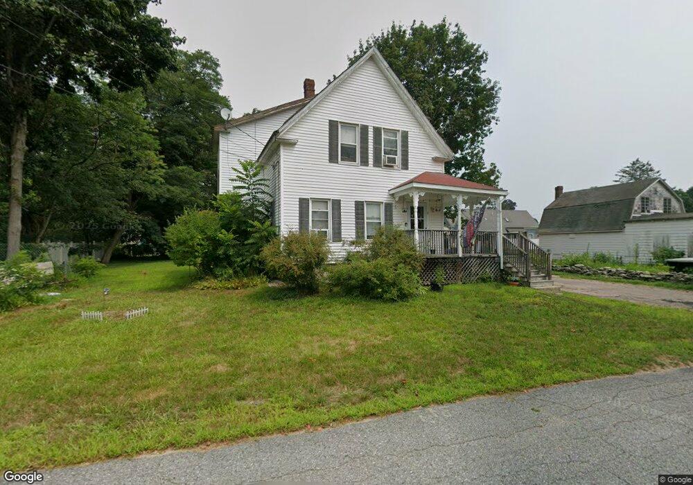
5 Park Ln Norton, MA 02766
Estimated Value: $505,000 - $558,000
3
Beds
2
Baths
1,377
Sq Ft
$378/Sq Ft
Est. Value
About This Home
This home is located at 5 Park Ln, Norton, MA 02766 and is currently estimated at $520,742, approximately $378 per square foot. 5 Park Ln is a home located in Bristol County with nearby schools including J.C. Solmonese Elementary School, Henri A. Yelle Elementary School, and Norton Middle School.
Ownership History
Date
Name
Owned For
Owner Type
Purchase Details
Closed on
Jun 16, 1995
Sold by
Dubois Jeanine D
Bought by
Blagdon Robert W and Blagdon Maureen W
Current Estimated Value
Home Financials for this Owner
Home Financials are based on the most recent Mortgage that was taken out on this home.
Original Mortgage
$124,500
Interest Rate
8.24%
Mortgage Type
Purchase Money Mortgage
Purchase Details
Closed on
Jun 23, 1989
Sold by
Gorsuch Wm H
Bought by
Dubois David L
Create a Home Valuation Report for This Property
The Home Valuation Report is an in-depth analysis detailing your home's value as well as a comparison with similar homes in the area
Home Values in the Area
Average Home Value in this Area
Purchase History
| Date | Buyer | Sale Price | Title Company |
|---|---|---|---|
| Blagdon Robert W | $125,000 | -- | |
| Dubois David L | $117,500 | -- |
Source: Public Records
Mortgage History
| Date | Status | Borrower | Loan Amount |
|---|---|---|---|
| Open | Dubois David L | $146,200 | |
| Closed | Dubois David L | $123,943 | |
| Closed | Dubois David L | $124,500 |
Source: Public Records
Tax History Compared to Growth
Tax History
| Year | Tax Paid | Tax Assessment Tax Assessment Total Assessment is a certain percentage of the fair market value that is determined by local assessors to be the total taxable value of land and additions on the property. | Land | Improvement |
|---|---|---|---|---|
| 2025 | $48 | $369,500 | $160,900 | $208,600 |
| 2024 | $4,557 | $351,900 | $153,200 | $198,700 |
| 2023 | $4,522 | $348,100 | $160,500 | $187,600 |
| 2022 | $4,395 | $308,200 | $145,900 | $162,300 |
| 2021 | $4,189 | $280,600 | $139,000 | $141,600 |
| 2020 | $4,033 | $272,500 | $134,900 | $137,600 |
| 2019 | $3,908 | $262,300 | $129,800 | $132,500 |
| 2018 | $3,814 | $251,600 | $129,800 | $121,800 |
| 2017 | $3,729 | $242,600 | $129,800 | $112,800 |
| 2016 | $3,632 | $232,700 | $129,800 | $102,900 |
| 2015 | $3,309 | $215,000 | $114,500 | $100,500 |
| 2014 | $3,151 | $205,000 | $109,100 | $95,900 |
Source: Public Records
Map
Nearby Homes
- 16 Park Ln
- 11 Edgewater Dr
- 55 Sturdy St
- 98 S Worcester St
- 108 S Worcester St
- 3 Goff Rd
- 13 Crowe Farm Ln
- 189 W Main St
- 145 S Worcester St
- 4 Stephen St
- 378 Old Colony Rd
- 97 N Worcester St
- 173 S Worcester St
- 178 S Worcester St
- 182 John Scott Blvd
- 225 S Worcester St Unit 2
- 225 S Worcester St Unit 1
- 205 S Worcester St
- 122 N Worcester St
- 130 W Main St
- 7 Park Ln
- 4 Park Ln
- 271 W Main St Unit 1
- 269 W Main St
- 269 W Main St Unit A
- 269 W Main St Unit B
- 6 Park Ln
- 267 W Main St
- 267 W Main St Unit HOUSE
- 9 Park La
- 9 Park Ln
- 273 W Main St
- 5 Shirley Ave
- 8 Park Ln
- 3 Shirley Ave
- 7 Shirley Ave
- 275 W Main St Unit 2nd floor
- 275 W Main St Unit Basement
- 265 W Main St
- 270 W Main St