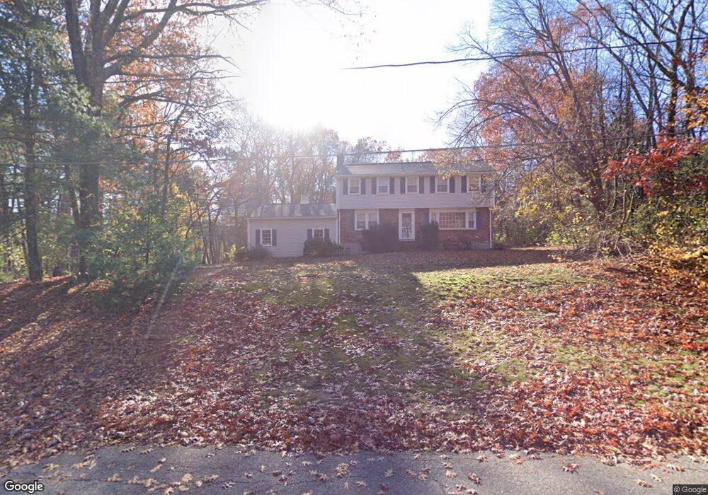
5 Partridge Ln Sudbury, MA 01776
Estimated Value: $990,026 - $1,062,000
4
Beds
3
Baths
2,000
Sq Ft
$512/Sq Ft
Est. Value
About This Home
This home is located at 5 Partridge Ln, Sudbury, MA 01776 and is currently estimated at $1,024,007, approximately $512 per square foot. 5 Partridge Ln is a home located in Middlesex County with nearby schools including Peter Noyes Elementary School, Ephraim Curtis Middle School, and Lincoln-Sudbury Regional High School.
Ownership History
Date
Name
Owned For
Owner Type
Purchase Details
Closed on
Apr 29, 2013
Sold by
Mullaney Richard F and Mullaney Kathleen F
Bought by
Watts 2Nd Robert A and Watts Ashley H
Current Estimated Value
Home Financials for this Owner
Home Financials are based on the most recent Mortgage that was taken out on this home.
Original Mortgage
$384,300
Outstanding Balance
$278,582
Interest Rate
4%
Mortgage Type
Adjustable Rate Mortgage/ARM
Estimated Equity
$745,425
Purchase Details
Closed on
Jul 31, 1998
Sold by
Brackett Elizabeth L
Bought by
Mullaney Richard F and Mullaney Kathleen E
Home Financials for this Owner
Home Financials are based on the most recent Mortgage that was taken out on this home.
Original Mortgage
$195,000
Interest Rate
6.92%
Mortgage Type
Purchase Money Mortgage
Create a Home Valuation Report for This Property
The Home Valuation Report is an in-depth analysis detailing your home's value as well as a comparison with similar homes in the area
Home Values in the Area
Average Home Value in this Area
Purchase History
| Date | Buyer | Sale Price | Title Company |
|---|---|---|---|
| Watts 2Nd Robert A | $549,000 | -- | |
| Mullaney Richard F | $385,000 | -- | |
| Mullaney Richard F | $385,000 | -- |
Source: Public Records
Mortgage History
| Date | Status | Borrower | Loan Amount |
|---|---|---|---|
| Open | Watts 2Nd Robert A | $384,300 | |
| Closed | Mullaney Richard F | $384,300 | |
| Previous Owner | Mullaney Richard F | $195,000 |
Source: Public Records
Tax History Compared to Growth
Tax History
| Year | Tax Paid | Tax Assessment Tax Assessment Total Assessment is a certain percentage of the fair market value that is determined by local assessors to be the total taxable value of land and additions on the property. | Land | Improvement |
|---|---|---|---|---|
| 2025 | $12,265 | $837,800 | $461,300 | $376,500 |
| 2024 | $11,822 | $809,200 | $447,700 | $361,500 |
| 2023 | $11,326 | $718,200 | $414,500 | $303,700 |
| 2022 | $11,339 | $628,200 | $380,100 | $248,100 |
| 2021 | $11,104 | $589,700 | $380,100 | $209,600 |
| 2020 | $10,880 | $589,700 | $380,100 | $209,600 |
| 2019 | $10,562 | $589,700 | $380,100 | $209,600 |
| 2018 | $10,620 | $592,300 | $400,100 | $192,200 |
| 2017 | $10,390 | $585,700 | $395,300 | $190,400 |
| 2016 | $10,062 | $565,300 | $380,100 | $185,200 |
| 2015 | $9,627 | $547,000 | $365,300 | $181,700 |
| 2014 | $9,605 | $532,700 | $354,500 | $178,200 |
Source: Public Records
Map
Nearby Homes
- 21 Summer St
- 143 Peakham Rd
- 7 Saddle Ridge Rd
- 123 Dutton Rd
- 30 Rolling Ln
- 47 Fairbank Rd
- 788 Main St
- 786 Main St
- 12 Hickory Rd
- 10 Shoreline Dr Unit 12
- 54 Stone Rd
- 8 Shoreline Dr Unit 11
- 14 Old County Rd Unit 21
- 3 Shore Line Dr Unit 15
- 4 Elderberry Cir
- 10 Old County Rd Unit 19
- 1 Town Line Rd
- 1 Town Line Rd Unit 18
- 0 Boston Post Rd
- Stockbridge South Shore Plan at Lakemont by Toll Brothers