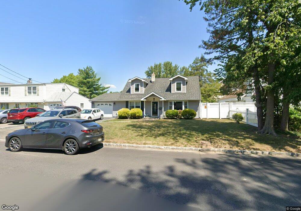
5 Paul Place Little Falls, NJ 07424
Estimated Value: $530,000 - $608,000
--
Bed
--
Bath
1,620
Sq Ft
$360/Sq Ft
Est. Value
About This Home
This home is located at 5 Paul Place, Little Falls, NJ 07424 and is currently estimated at $583,729, approximately $360 per square foot. 5 Paul Place is a home located in Passaic County with nearby schools including Little Falls Township Public School No. 2, Little Falls School No. 3, and Little Falls School No. 1.
Ownership History
Date
Name
Owned For
Owner Type
Purchase Details
Closed on
Jan 30, 2005
Sold by
Reinstra Clarence
Bought by
Cummings Robert and Cummings Jocylyn
Current Estimated Value
Home Financials for this Owner
Home Financials are based on the most recent Mortgage that was taken out on this home.
Original Mortgage
$308,750
Interest Rate
5.64%
Mortgage Type
New Conventional
Purchase Details
Closed on
Apr 2, 1999
Sold by
Reinstra Clarence N and Reinstra Pauline
Bought by
Reinstra Clarence N
Create a Home Valuation Report for This Property
The Home Valuation Report is an in-depth analysis detailing your home's value as well as a comparison with similar homes in the area
Home Values in the Area
Average Home Value in this Area
Purchase History
| Date | Buyer | Sale Price | Title Company |
|---|---|---|---|
| Cummings Robert | $325,000 | -- | |
| Reinstra Clarence N | -- | -- |
Source: Public Records
Mortgage History
| Date | Status | Borrower | Loan Amount |
|---|---|---|---|
| Previous Owner | Cummings Robert | $308,750 |
Source: Public Records
Tax History Compared to Growth
Tax History
| Year | Tax Paid | Tax Assessment Tax Assessment Total Assessment is a certain percentage of the fair market value that is determined by local assessors to be the total taxable value of land and additions on the property. | Land | Improvement |
|---|---|---|---|---|
| 2025 | $9,596 | $288,000 | $178,900 | $109,100 |
| 2024 | $9,452 | $288,000 | $178,900 | $109,100 |
| 2022 | $9,464 | $288,000 | $178,900 | $109,100 |
| 2021 | $9,251 | $288,000 | $178,900 | $109,100 |
| 2020 | $9,167 | $288,000 | $178,900 | $109,100 |
| 2019 | $9,161 | $288,000 | $178,900 | $109,100 |
| 2018 | $9,101 | $288,000 | $178,900 | $109,100 |
| 2017 | $9,109 | $288,000 | $178,900 | $109,100 |
| 2016 | $8,988 | $288,000 | $178,900 | $109,100 |
| 2015 | $8,859 | $288,000 | $178,900 | $109,100 |
| 2014 | $8,623 | $288,000 | $178,900 | $109,100 |
Source: Public Records
Map
Nearby Homes
- 163 Donato Dr
- 96 Montclair Ave
- 6 Meadow Dr
- 12 Bergen Dr
- 303 Abbe Rd
- 58 Harvest Way
- 86 Harvest Way
- 10 Harvest Way
- 84 Center Ave
- 16 Hughes Place
- 4 Mountain Ridge Dr Unit 25
- 4 Mountain Ridge Dr
- 7 Mountain Ridge Dr Unit 4B
- 35 Hughes Place
- 19 Haines Place
- 24 Van Pelt Place Unit AB&C
- 24 Van Pelt Place Unit 1
- 24 Van Pelt Place Unit D&E
- 24 Van Pelt Place Unit 4
- 82-84 Newark Pompton Turnpike
- 9 Paul Place
- 107 Montclair Ave
- 2 Paul Place
- 8 Paul Place
- 103 Montclair Ave
- 103 Montclair Ave Unit 2
- 170 Donato Dr
- 166 Donato Dr
- 119 Montclair Ave
- 108 Montclair Ave
- 101 Montclair Ave
- 49 Donato Dr
- 104 Montclair Ave
- 2 Meadow Dr
- 102 Montclair Ave
- 123 Montclair Ave
- 45 Donato Dr
- 162 Donato Dr
- 97 Montclair Ave
- 4 Meadow Dr