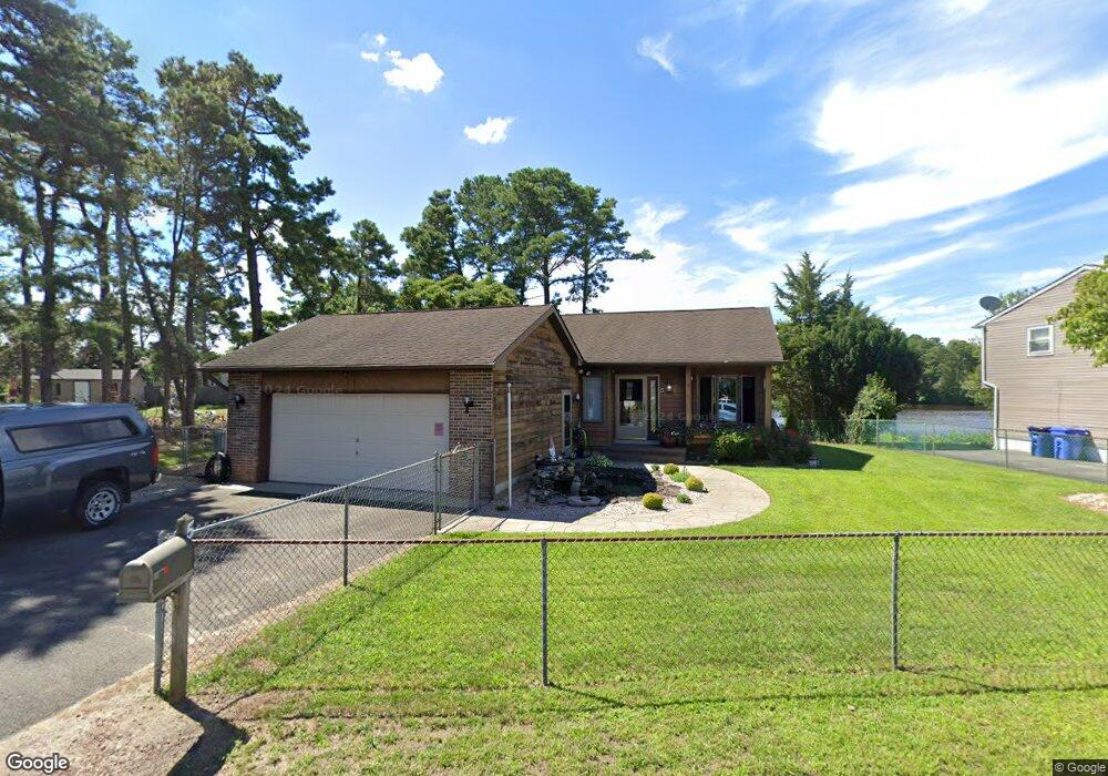
5 Pheasant Dr Browns Mills, NJ 08015
Estimated Value: $339,276 - $407,000
--
Bed
--
Bath
1,236
Sq Ft
$310/Sq Ft
Est. Value
About This Home
This home is located at 5 Pheasant Dr, Browns Mills, NJ 08015 and is currently estimated at $382,819, approximately $309 per square foot. 5 Pheasant Dr is a home located in Burlington County.
Ownership History
Date
Name
Owned For
Owner Type
Purchase Details
Closed on
Dec 6, 2005
Sold by
Kowtko Robert A and Cherry Mark S
Bought by
Newton Floyd
Current Estimated Value
Home Financials for this Owner
Home Financials are based on the most recent Mortgage that was taken out on this home.
Original Mortgage
$198,000
Outstanding Balance
$111,111
Interest Rate
6.34%
Mortgage Type
Fannie Mae Freddie Mac
Estimated Equity
$271,708
Create a Home Valuation Report for This Property
The Home Valuation Report is an in-depth analysis detailing your home's value as well as a comparison with similar homes in the area
Home Values in the Area
Average Home Value in this Area
Purchase History
| Date | Buyer | Sale Price | Title Company |
|---|---|---|---|
| Newton Floyd | $220,000 | None Available |
Source: Public Records
Mortgage History
| Date | Status | Borrower | Loan Amount |
|---|---|---|---|
| Open | Newton Floyd | $198,000 |
Source: Public Records
Tax History Compared to Growth
Tax History
| Year | Tax Paid | Tax Assessment Tax Assessment Total Assessment is a certain percentage of the fair market value that is determined by local assessors to be the total taxable value of land and additions on the property. | Land | Improvement |
|---|---|---|---|---|
| 2025 | $5,122 | $167,100 | $49,800 | $117,300 |
| 2024 | $4,806 | $167,100 | $49,800 | $117,300 |
| 2023 | $4,806 | $167,100 | $49,800 | $117,300 |
| 2022 | $4,448 | $167,100 | $49,800 | $117,300 |
| 2021 | $3,903 | $167,100 | $49,800 | $117,300 |
| 2020 | $4,106 | $167,100 | $49,800 | $117,300 |
| 2019 | $3,932 | $167,100 | $49,800 | $117,300 |
| 2018 | $3,796 | $167,000 | $49,800 | $117,200 |
| 2017 | $3,717 | $167,000 | $49,800 | $117,200 |
| 2016 | $4,093 | $109,500 | $33,700 | $75,800 |
| 2015 | $4,060 | $109,500 | $33,700 | $75,800 |
| 2014 | $3,882 | $109,500 | $33,700 | $75,800 |
Source: Public Records
Map
Nearby Homes
- 419 Chippewa Trail
- 203 Seneca Trail
- 1714 Red Feather Trail
- 224 Cherokee Dr
- 13 Muskogean Trail
- 219 Chippewa Trail
- 22 Maricopa Trail
- 77 Sepulga Dr
- 2 Kiowa Trail
- 304 Mohawk Trail
- 304 Spring Lake Blvd
- 306 Apache Trail
- 315 Algonquin Trail
- 208 Wichita Trail
- 1 S Branch Dr
- 206 Piute Trail
- 764 Lakehurst Rd
- 310 Piute Trail
- 111 Huckleberry Ln
- 258 Ridge Rd
- 7 Pheasant Dr
- 6 Pheasant Dr
- 415 Chippewa Trail
- 8 Pheasant Dr
- 4 Pheasant Dr
- 413 Chippewa Trail
- 0 Pheasant Dr
- 9 Pheasant Dr
- 2 Pheasant Dr
- 411 Chippewa Trail
- 11 Pheasant Dr
- 10 Pheasant Dr
- 417 Chippewa Trail
- 409 Chippewa Trail
- 410 Chippewa Trail
- 412 Chippewa Trail
- 408 Chippewa Trail
- 414 Chippewa Trail
- 406 Chippewa Trail
- 416 Chippewa Trail