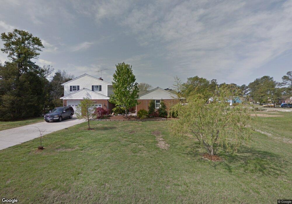
5 Phillips Rd Poquoson, VA 23662
Poquoson Shores NeighborhoodEstimated Value: $593,010 - $639,000
5
Beds
3
Baths
3,000
Sq Ft
$203/Sq Ft
Est. Value
About This Home
This home is located at 5 Phillips Rd, Poquoson, VA 23662 and is currently estimated at $608,003, approximately $202 per square foot. 5 Phillips Rd is a home located in Poquoson City.
Ownership History
Date
Name
Owned For
Owner Type
Purchase Details
Closed on
Dec 7, 2021
Sold by
Tyler Tony R and Tyler Christine M
Bought by
Avery Kevin and Avery Tracey
Current Estimated Value
Purchase Details
Closed on
Dec 23, 2014
Sold by
Bailey Russell K
Bought by
Avery Kevin P and Avery Tracey M
Home Financials for this Owner
Home Financials are based on the most recent Mortgage that was taken out on this home.
Original Mortgage
$402,850
Interest Rate
3.99%
Mortgage Type
VA
Create a Home Valuation Report for This Property
The Home Valuation Report is an in-depth analysis detailing your home's value as well as a comparison with similar homes in the area
Home Values in the Area
Average Home Value in this Area
Purchase History
| Date | Buyer | Sale Price | Title Company |
|---|---|---|---|
| Avery Kevin | $144,200 | Fidelity National Title | |
| Avery Kevin P | $390,000 | -- |
Source: Public Records
Mortgage History
| Date | Status | Borrower | Loan Amount |
|---|---|---|---|
| Previous Owner | Avery Kevin P | $402,850 |
Source: Public Records
Tax History
| Year | Tax Paid | Tax Assessment Tax Assessment Total Assessment is a certain percentage of the fair market value that is determined by local assessors to be the total taxable value of land and additions on the property. | Land | Improvement |
|---|---|---|---|---|
| 2025 | $5,963 | $523,100 | $169,400 | $353,700 |
| 2024 | $5,756 | $504,900 | $145,400 | $359,500 |
| 2023 | $5,604 | $504,900 | $145,400 | $359,500 |
| 2022 | $5,171 | $457,600 | $145,400 | $312,200 |
| 2021 | $5,171 | $457,600 | $145,400 | $312,200 |
| 2020 | -- | $426,100 | $145,400 | $280,700 |
| 2019 | -- | $426,100 | $145,400 | $280,700 |
| 2018 | -- | $421,700 | $145,400 | $276,300 |
| 2017 | -- | $388,700 | $145,400 | $243,300 |
| 2016 | -- | $388,700 | $145,400 | $243,300 |
| 2015 | -- | $388,700 | $145,400 | $243,300 |
| 2013 | -- | $325,600 | $145,400 | $180,200 |
Source: Public Records
Map
Nearby Homes
- 1 Phillips Rd
- 15+AC Browns Neck Rd
- 105 Rens Rd Unit 74
- 105 Rens Rd Unit 2
- 8 White House Dr
- 28 Pasture Rd
- 106 Blue Crab Dr
- 104 Blue Crab Dr
- 4 Wendell Cir
- 11 Valmoore (Lot #10) Dr
- 11 Valmoore Dr
- 14 Valmoore Dr
- 21 Rens Rd
- 20 Wornom Farm Rd
- 812 Poquoson Ave
- 11 Dorothy Dr
- 718C Poquoson Ave
- 5 Quail Cove
- 50 Forrest Rd
- 246 Hunts Neck Rd
- 3 Phillips Rd
- 22 E Sandy Point Rd
- 6 Phillips Rd
- 4 Phillips Rd
- 105 Browns Neck Rd
- LOT Phillips Rd
- Lot 36 Phillips Rd
- 20 E Sandy Point Rd
- 2 Phillips Rd
- 103 Browns Neck Rd
- 25 E Sandy Point Rd
- 1 Phillips Rd Unit RD.
- 12 Phillips Rd
- 27 E Sandy Point Rd
- 18 E Sandy Point Rd
- 19 E Sandy Point Rd
- 0 Browns Neck Rd
- 101 Browns Neck Rd
- 118 Browns Neck Rd
- 8 Phillips Rd
Your Personal Tour Guide
Ask me questions while you tour the home.