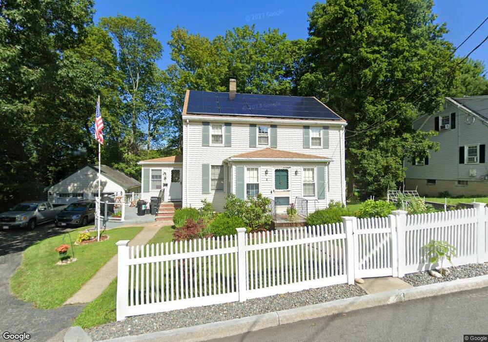
5 Playstead Ave Woburn, MA 01801
Downtown Woburn NeighborhoodEstimated Value: $676,000 - $799,000
3
Beds
2
Baths
1,664
Sq Ft
$434/Sq Ft
Est. Value
About This Home
This home is located at 5 Playstead Ave, Woburn, MA 01801 and is currently estimated at $722,386, approximately $434 per square foot. 5 Playstead Ave is a home located in Middlesex County with nearby schools including Goodyear Elementary School, Daniel L. Joyce Middle School, and Woburn High School.
Ownership History
Date
Name
Owned For
Owner Type
Purchase Details
Closed on
Apr 26, 2013
Sold by
Masterson Thomas and Masterson Elizabeth
Bought by
Chisholm 4Th Edward J
Current Estimated Value
Home Financials for this Owner
Home Financials are based on the most recent Mortgage that was taken out on this home.
Original Mortgage
$248,675
Outstanding Balance
$177,474
Interest Rate
3.64%
Mortgage Type
New Conventional
Estimated Equity
$544,912
Create a Home Valuation Report for This Property
The Home Valuation Report is an in-depth analysis detailing your home's value as well as a comparison with similar homes in the area
Home Values in the Area
Average Home Value in this Area
Purchase History
| Date | Buyer | Sale Price | Title Company |
|---|---|---|---|
| Chisholm 4Th Edward J | $285,000 | -- |
Source: Public Records
Mortgage History
| Date | Status | Borrower | Loan Amount |
|---|---|---|---|
| Open | Chisholm 4Th Edward J | $248,675 |
Source: Public Records
Tax History
| Year | Tax Paid | Tax Assessment Tax Assessment Total Assessment is a certain percentage of the fair market value that is determined by local assessors to be the total taxable value of land and additions on the property. | Land | Improvement |
|---|---|---|---|---|
| 2025 | $5,256 | $615,400 | $303,200 | $312,200 |
| 2024 | $4,723 | $586,000 | $288,700 | $297,300 |
| 2023 | $4,611 | $530,000 | $262,500 | $267,500 |
| 2022 | $4,479 | $479,600 | $228,300 | $251,300 |
| 2021 | $4,296 | $460,400 | $217,400 | $243,000 |
| 2020 | $4,152 | $445,500 | $217,400 | $228,100 |
| 2019 | $0 | $419,000 | $207,000 | $212,000 |
| 2018 | $3,842 | $388,500 | $189,900 | $198,600 |
| 2017 | $0 | $367,900 | $180,900 | $187,000 |
| 2016 | $3,492 | $347,500 | $169,000 | $178,500 |
| 2015 | $3,365 | $330,900 | $158,000 | $172,900 |
| 2014 | $3,151 | $301,800 | $158,000 | $143,800 |
Source: Public Records
Map
Nearby Homes
- 0 Mount Pleasant St
- 3 Golden Terrace
- 6 Highland St
- 6 Porter St
- 9 Charles Rd
- 39 Jefferson Ave
- 40 Pickering St
- 8 Russell Rd Unit 10
- 15 Sturgis St
- 7 Prospect St
- 35 Montvale Ave Unit 8
- 21 Eastern Ave
- 31 Montvale Ave Unit 2
- 20 Arthur St
- 29 Arlington Rd Unit 3-2
- 27 Arlington Rd Unit 2
- 171 Swanton St Unit 73
- 52 Pleasant St
- 31 Arlington Rd Unit 1-6
- 237 Swanton St
- 3 Playstead Ave
- 10 Playstead Ave
- 9 Highland Ave
- 11 Playstead Ave
- 73 Mount Pleasant St
- 69 Mount Pleasant St
- 67 Mount Pleasant St
- 40 Highland St
- 1 Highland Ave
- 12 Highland Ave
- 5 Highland Ave
- 75 Mount Pleasant St
- 13 Playstead Ave
- 47 Highland St
- 34 Highland St
- 34 Highland St Unit 2
- 34 Highland St Unit 1
- 38 Highland St
- 14 Playstead Ave
- 10 Highland Ave
Your Personal Tour Guide
Ask me questions while you tour the home.