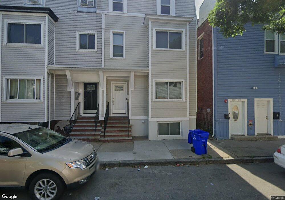
5 Prescott St Unit A Boston, MA 02128
Eagle Hill NeighborhoodEstimated Value: $406,618 - $482,000
2
Beds
1
Bath
560
Sq Ft
$768/Sq Ft
Est. Value
About This Home
This home is located at 5 Prescott St Unit A, Boston, MA 02128 and is currently estimated at $430,155, approximately $768 per square foot. 5 Prescott St Unit A is a home located in Suffolk County with nearby schools including Excel Academy East Boston and Brooke Charter Schools East Boston.
Ownership History
Date
Name
Owned For
Owner Type
Purchase Details
Closed on
Sep 19, 2008
Sold by
Us Bk
Bought by
Cartwright David A
Current Estimated Value
Home Financials for this Owner
Home Financials are based on the most recent Mortgage that was taken out on this home.
Original Mortgage
$65,000
Outstanding Balance
$43,275
Interest Rate
6.54%
Mortgage Type
Purchase Money Mortgage
Estimated Equity
$386,880
Purchase Details
Closed on
May 28, 2008
Sold by
Gonclaves Isaias
Bought by
Us Bk
Create a Home Valuation Report for This Property
The Home Valuation Report is an in-depth analysis detailing your home's value as well as a comparison with similar homes in the area
Home Values in the Area
Average Home Value in this Area
Purchase History
| Date | Buyer | Sale Price | Title Company |
|---|---|---|---|
| Cartwright David A | $90,000 | -- | |
| Us Bk | $112,425 | -- |
Source: Public Records
Mortgage History
| Date | Status | Borrower | Loan Amount |
|---|---|---|---|
| Open | Cartwright David A | $65,000 |
Source: Public Records
Tax History Compared to Growth
Tax History
| Year | Tax Paid | Tax Assessment Tax Assessment Total Assessment is a certain percentage of the fair market value that is determined by local assessors to be the total taxable value of land and additions on the property. | Land | Improvement |
|---|---|---|---|---|
| 2025 | $3,835 | $331,200 | $0 | $331,200 |
| 2024 | $3,723 | $341,600 | $0 | $341,600 |
| 2023 | $3,631 | $338,100 | $0 | $338,100 |
| 2022 | $3,570 | $328,100 | $0 | $328,100 |
| 2021 | $3,433 | $321,700 | $0 | $321,700 |
| 2020 | $2,539 | $240,400 | $0 | $240,400 |
| 2019 | $2,346 | $222,600 | $0 | $222,600 |
| 2018 | $2,083 | $198,800 | $0 | $198,800 |
| 2017 | $1,914 | $180,700 | $0 | $180,700 |
| 2016 | $1,858 | $168,900 | $0 | $168,900 |
| 2015 | $1,599 | $132,000 | $0 | $132,000 |
| 2014 | $1,550 | $123,200 | $0 | $123,200 |
Source: Public Records
Map
Nearby Homes
- 221 Trenton St
- 1 Prescott St Unit 304
- 118 White St
- 280 Lexington St
- 215 Lexington St
- 278 Princeton St Unit 2
- 212 Princeton St Unit 1
- 316 Princeton St Unit 2
- 403-405 Saratoga St
- 305R Lexington St
- 421 Saratoga St Unit 4A
- 421 Saratoga St Unit 1
- 421 Saratoga St Unit 3
- 147 Trenton St Unit 3
- 125 Putnam St
- 167 Lexington St Unit 1
- 167 Lexington St Unit 167
- 233 Bennington St
- 123 Trenton St Unit 3
- 117 Falcon St Unit 3
- 7 Prescott St Unit 2
- 5 Prescott St Unit 2
- 5 Prescott St Unit 3
- 5 Prescott St Unit C
- 5 Prescott St Unit B
- 5 Prescott St
- 5 Prescott St Unit 5B
- 3 Prescott St Unit 1
- 3 Prescott St
- 3 Prescott St Unit 2
- 209 Trenton St
- 211 Trenton St
- 211 Trenton St Unit 3
- 246 Lexington St
- 246 Lexington St Unit 2
- 213 Trenton St Unit 1
- 213 Trenton St Unit 215
- 213-215 Trenton St
- 215 Trenton St
- 213 Trenton St Unit A