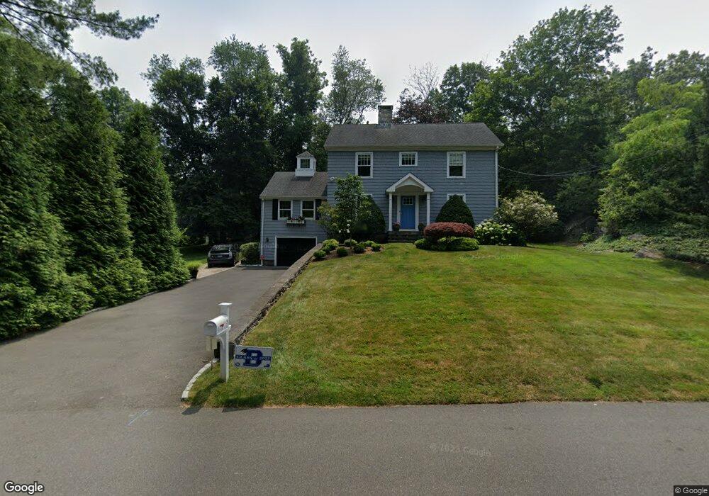
5 Queens Ln Darien, CT 06820
Estimated Value: $2,008,000 - $2,140,000
4
Beds
2
Baths
2,731
Sq Ft
$760/Sq Ft
Est. Value
About This Home
This home is located at 5 Queens Ln, Darien, CT 06820 and is currently estimated at $2,074,933, approximately $759 per square foot. 5 Queens Ln is a home located in Fairfield County with nearby schools including Tokeneke Elementary School, Middlesex Middle School, and Darien High School.
Ownership History
Date
Name
Owned For
Owner Type
Purchase Details
Closed on
Jun 7, 2007
Sold by
Johnson Paul Dg and Johnson Stacy E
Bought by
Bedny Kristen L and Perkins Jonathan D
Current Estimated Value
Purchase Details
Closed on
May 20, 1999
Sold by
Huttar James E and Huttar Emily G
Bought by
Johnson Paul Dg and Johnson Stacey E
Create a Home Valuation Report for This Property
The Home Valuation Report is an in-depth analysis detailing your home's value as well as a comparison with similar homes in the area
Home Values in the Area
Average Home Value in this Area
Purchase History
| Date | Buyer | Sale Price | Title Company |
|---|---|---|---|
| Bedny Kristen L | $985,000 | -- | |
| Johnson Paul Dg | $445,000 | -- |
Source: Public Records
Mortgage History
| Date | Status | Borrower | Loan Amount |
|---|---|---|---|
| Open | Johnson Paul Dg | $500,000 | |
| Closed | Johnson Paul Dg | $295,000 | |
| Closed | Johnson Paul Dg | $299,000 |
Source: Public Records
Tax History
| Year | Tax Paid | Tax Assessment Tax Assessment Total Assessment is a certain percentage of the fair market value that is determined by local assessors to be the total taxable value of land and additions on the property. | Land | Improvement |
|---|---|---|---|---|
| 2025 | $15,987 | $1,032,780 | $631,400 | $401,380 |
| 2024 | $15,172 | $1,032,780 | $631,400 | $401,380 |
| 2023 | $13,779 | $782,460 | $451,010 | $331,450 |
| 2022 | $13,482 | $782,460 | $451,010 | $331,450 |
| 2021 | $13,177 | $782,460 | $451,010 | $331,450 |
| 2020 | $12,801 | $782,460 | $451,010 | $331,450 |
| 2019 | $12,887 | $782,460 | $451,010 | $331,450 |
| 2018 | $12,280 | $763,700 | $359,870 | $403,830 |
| 2017 | $12,341 | $763,700 | $359,870 | $403,830 |
| 2016 | $12,044 | $763,700 | $359,870 | $403,830 |
| 2015 | $11,723 | $763,700 | $359,870 | $403,830 |
| 2014 | $11,463 | $763,700 | $359,870 | $403,830 |
Source: Public Records
Map
Nearby Homes
- 1 Queens Ln
- 20 Goodwives River Rd
- 7 Queens Ln
- 2 Queens Ln
- 1 Goodwives River Rd
- 145 Old Kings Hwy N
- 149 Old Kings Hwy S
- 17 Goodwives River Rd
- 145 Old Kings Hwy S
- 10 Queens Ln
- 121 Old Kings Hwy S
- 155 Kings Hwy S
- 30 Goodwives River Rd
- 130 Old Kings Hwy S
- 132 Old Kings Hwy S
- 155 Old Kings Hwy S
- 11 Queens Ln
- 11 Queens Ln Unit 11
- 11 Queens Ln Unit RENTAL
- 115 Kings Hwy S
Your Personal Tour Guide
Ask me questions while you tour the home.