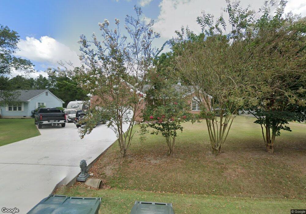
5 Riverside Dr Smithfield, VA 23430
Estimated Value: $479,000 - $583,000
3
Beds
3
Baths
2,640
Sq Ft
$195/Sq Ft
Est. Value
About This Home
This home is located at 5 Riverside Dr, Smithfield, VA 23430 and is currently estimated at $513,608, approximately $194 per square foot. 5 Riverside Dr is a home located in Isle of Wight County with nearby schools including Hardy Elementary School, Smithfield Middle School, and Smithfield High School.
Ownership History
Date
Name
Owned For
Owner Type
Purchase Details
Closed on
Jan 23, 2017
Sold by
Steele Norah J
Bought by
Michael Hailey B and Michael Linda Hailey
Current Estimated Value
Home Financials for this Owner
Home Financials are based on the most recent Mortgage that was taken out on this home.
Original Mortgage
$257,880
Outstanding Balance
$212,759
Interest Rate
4.16%
Mortgage Type
New Conventional
Estimated Equity
$300,849
Purchase Details
Closed on
Jun 20, 2001
Sold by
Pierce Joseph W Trustee
Create a Home Valuation Report for This Property
The Home Valuation Report is an in-depth analysis detailing your home's value as well as a comparison with similar homes in the area
Home Values in the Area
Average Home Value in this Area
Purchase History
| Date | Buyer | Sale Price | Title Company |
|---|---|---|---|
| Michael Hailey B | $287,880 | -- | |
| -- | $35,000 | -- |
Source: Public Records
Mortgage History
| Date | Status | Borrower | Loan Amount |
|---|---|---|---|
| Open | Michael Hailey B | $257,880 |
Source: Public Records
Tax History
| Year | Tax Paid | Tax Assessment Tax Assessment Total Assessment is a certain percentage of the fair market value that is determined by local assessors to be the total taxable value of land and additions on the property. | Land | Improvement |
|---|---|---|---|---|
| 2025 | $3,483 | $449,400 | $60,000 | $389,400 |
| 2024 | $3,281 | $449,400 | $60,000 | $389,400 |
| 2023 | $3,245 | $449,400 | $60,000 | $389,400 |
| 2022 | $2,958 | $341,700 | $60,000 | $281,700 |
| 2021 | $2,958 | $341,700 | $60,000 | $281,700 |
| 2020 | $2,958 | $341,700 | $60,000 | $281,700 |
| 2019 | $2,958 | $341,700 | $60,000 | $281,700 |
| 2018 | $3,144 | $363,500 | $60,000 | $303,500 |
| 2016 | $2,162 | $363,500 | $60,000 | $303,500 |
| 2015 | $1,970 | $363,500 | $60,000 | $303,500 |
| 2014 | $1,970 | $340,900 | $60,000 | $280,900 |
| 2013 | -- | $340,900 | $60,000 | $280,900 |
Source: Public Records
Map
Nearby Homes
- 13 Jamesview Cir
- 192 Royal Black Heath
- 307 Ridgeland Dr
- 219 Smith Dr
- 803 Lakeview Cove
- 103 Clipper Creek Ln
- 101 Lakeview Cove
- 221 Richmond Ave
- 224 Richmond Ave
- 224 Saint Paul's Ave Unit 32-3
- 224 St Pauls Ave
- 212 St Pauls Ave
- 212 St Pauls Ave Unit 30-4
- 203 Winterberry Ln
- 209 Oxford Ave
- 209 Oxford Ave Unit 40-1
- 214 Oxford Ave Unit 48-2
- 205 Oxford Ave
- 205 Oxford Ave Unit 39-2
- 203 Oxford Ave
- 5 Riverside Dr
- 5 Riverside Dr
- 3 Riverside Dr
- 7 Riverside Dr
- 96 Moonefield Dr
- 198 Azalea Dr
- 2 Riverside Dr
- 92 Moonefield Dr
- 92 Moonefield Dr
- 3 Jamesview Cir
- 4 Riverside Dr
- 1 Jamesview Cir
- 100 Azalea Dr
- 20 Moonefield Dr
- 6 Riverside Dr
- 5 Jamesview Cir
- 202 Azalea Dr
- 8 Riverside Dr
- 201 Azalea Dr
- 203 Azalea Dr
Your Personal Tour Guide
Ask me questions while you tour the home.