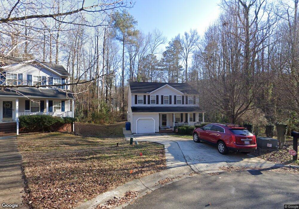
5 Rockwood Cir Durham, NC 27707
Estimated Value: $500,000 - $548,000
3
Beds
3
Baths
1,884
Sq Ft
$280/Sq Ft
Est. Value
About This Home
This home is located at 5 Rockwood Cir, Durham, NC 27707 and is currently estimated at $526,919, approximately $279 per square foot. 5 Rockwood Cir is a home located in Durham County with nearby schools including C. C. Spaulding Elementary, Morehead Montessori, and Sherwood Githens Middle.
Ownership History
Date
Name
Owned For
Owner Type
Purchase Details
Closed on
Nov 5, 2001
Sold by
Anderson Homes Inc
Bought by
Francis Paul N and Brown Francis Carolyn S
Current Estimated Value
Home Financials for this Owner
Home Financials are based on the most recent Mortgage that was taken out on this home.
Original Mortgage
$154,281
Interest Rate
6.49%
Mortgage Type
FHA
Purchase Details
Closed on
Sep 24, 2001
Sold by
Anderson Homes Development Inc
Bought by
Anderson Homes Inc
Home Financials for this Owner
Home Financials are based on the most recent Mortgage that was taken out on this home.
Original Mortgage
$154,281
Interest Rate
6.49%
Mortgage Type
FHA
Create a Home Valuation Report for This Property
The Home Valuation Report is an in-depth analysis detailing your home's value as well as a comparison with similar homes in the area
Purchase History
| Date | Buyer | Sale Price | Title Company |
|---|---|---|---|
| Francis Paul N | $155,500 | -- | |
| Anderson Homes Inc | $24,000 | -- |
Source: Public Records
Mortgage History
| Date | Status | Borrower | Loan Amount |
|---|---|---|---|
| Previous Owner | Francis Paul N | $154,281 |
Source: Public Records
Tax History
| Year | Tax Paid | Tax Assessment Tax Assessment Total Assessment is a certain percentage of the fair market value that is determined by local assessors to be the total taxable value of land and additions on the property. | Land | Improvement |
|---|---|---|---|---|
| 2025 | $4,467 | $450,647 | $133,954 | $316,693 |
| 2024 | $4,025 | $288,519 | $65,349 | $223,170 |
| 2023 | $3,779 | $288,519 | $65,349 | $223,170 |
| 2022 | $3,693 | $288,519 | $65,349 | $223,170 |
| 2021 | $3,675 | $288,519 | $65,349 | $223,170 |
| 2020 | $3,589 | $288,519 | $65,349 | $223,170 |
| 2019 | $3,589 | $288,519 | $65,349 | $223,170 |
| 2018 | $3,309 | $243,948 | $37,720 | $206,228 |
| 2017 | $3,285 | $302,290 | $75,440 | $226,850 |
| 2016 | $3,933 | $302,290 | $75,440 | $226,850 |
| 2015 | $3,236 | $233,772 | $43,899 | $189,873 |
| 2014 | $3,236 | $233,772 | $43,899 | $189,873 |
Source: Public Records
Map
Nearby Homes
- 2146 Charles St Unit 12
- 2146 Charles St Unit 40
- 2203 University Dr
- 4 Chantilly Place
- 2106 University Dr
- 2720 Augusta Dr
- 313 W Cornwallis Rd
- 212 Barnhill St
- 134 Nelson St
- 226 Barnhill St
- Custom Plans Available! at Pinecrest
- 2201 Otis St
- 106 Montrose Dr
- 2810 Beechwood Dr
- 3014 Hope Valley Rd
- 2708 Sarah Ave
- 1518 Echo Rd
- 1427 Bivins St
- 2003 Wa Ave
- 2209 Concord St
- 1 Rockwood Cir
- 2207 Meade Ln
- 2304 Parkside Dr
- 4 Rockwood Cir
- 2306 Parkside Dr
- 2211 Meade Ln
- 2204 Meade Ln
- 2210 Meade Ln
- 2308 Parkside Dr
- 2308 Parkside Dr Unit 30
- 2226 Parkside Dr
- 2215 Meade Ln
- 2220 Parkside Dr
- 2301 Parkside Dr
- 2 Medearis Ct
- 2305 Parkside Dr
- 2310 Parkside Dr
- 2310 Parkside Dr Unit 31
- 2221 Meade Ln
- 2227 Parkside Dr