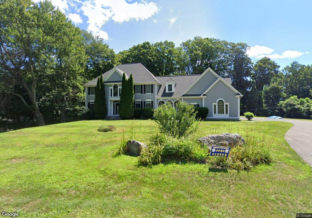
5 Ruthie's Ln Simsbury, CT 06092
Estimated Value: $876,184 - $984,000
4
Beds
5
Baths
4,162
Sq Ft
$223/Sq Ft
Est. Value
About This Home
This home is located at 5 Ruthie's Ln, Simsbury, CT 06092 and is currently estimated at $928,546, approximately $223 per square foot. 5 Ruthie's Ln is a home located in Hartford County with nearby schools including Tootin' Hills School, Henry James Memorial School, and Simsbury High School.
Ownership History
Date
Name
Owned For
Owner Type
Purchase Details
Closed on
Jul 30, 2021
Sold by
Dave Santosh and Dave Shail
Bought by
Restituyo Jose and Restituyo Monique
Current Estimated Value
Home Financials for this Owner
Home Financials are based on the most recent Mortgage that was taken out on this home.
Original Mortgage
$489,600
Outstanding Balance
$445,398
Interest Rate
2.93%
Mortgage Type
Purchase Money Mortgage
Estimated Equity
$483,148
Purchase Details
Closed on
May 1, 2001
Sold by
Beaudry Const Llc
Bought by
Wildman Peter W and Wildman Katherine D
Purchase Details
Closed on
Oct 13, 1999
Sold by
Cgr Associates Llc
Bought by
Beaudry Constr Llc
Create a Home Valuation Report for This Property
The Home Valuation Report is an in-depth analysis detailing your home's value as well as a comparison with similar homes in the area
Home Values in the Area
Average Home Value in this Area
Purchase History
| Date | Buyer | Sale Price | Title Company |
|---|---|---|---|
| Restituyo Jose | $612,000 | None Available | |
| Wildman Peter W | $535,000 | -- | |
| Beaudry Constr Llc | $120,000 | -- |
Source: Public Records
Mortgage History
| Date | Status | Borrower | Loan Amount |
|---|---|---|---|
| Open | Restituyo Jose | $489,600 | |
| Previous Owner | Beaudry Constr Llc | $360,000 | |
| Previous Owner | Beaudry Constr Llc | $365,000 | |
| Previous Owner | Beaudry Constr Llc | $250,001 | |
| Previous Owner | Beaudry Constr Llc | $312,000 |
Source: Public Records
Tax History Compared to Growth
Tax History
| Year | Tax Paid | Tax Assessment Tax Assessment Total Assessment is a certain percentage of the fair market value that is determined by local assessors to be the total taxable value of land and additions on the property. | Land | Improvement |
|---|---|---|---|---|
| 2025 | $19,024 | $556,920 | $119,490 | $437,430 |
| 2024 | $18,551 | $556,920 | $119,490 | $437,430 |
| 2023 | $17,721 | $556,920 | $119,490 | $437,430 |
| 2022 | $15,987 | $413,850 | $113,870 | $299,980 |
| 2021 | $15,987 | $413,850 | $113,870 | $299,980 |
| 2020 | $15,350 | $413,850 | $113,870 | $299,980 |
| 2019 | $15,445 | $413,850 | $113,870 | $299,980 |
| 2018 | $15,557 | $413,850 | $113,870 | $299,980 |
| 2017 | $16,927 | $436,710 | $132,770 | $303,940 |
| 2016 | $16,211 | $436,710 | $132,770 | $303,940 |
| 2015 | $16,211 | $436,710 | $132,770 | $303,940 |
| 2014 | $16,219 | $436,710 | $132,770 | $303,940 |
Source: Public Records
Map
Nearby Homes
- 21 Christmas Tree Hill
- 537 Cherry Brook Rd
- 143 N Mountain Rd
- 35 Rustle Meadow Ln
- 391 Cherry Brook Rd
- 8 Quorn Hunt Rd
- 18 Meadowlark Rd
- 10 Sachems Trail
- 11 Timbercrest Dr
- 247 Old Farms Rd
- 23 Red Fox Run
- 15 Red Fox Run
- 15 Bunker Hill Rd
- 265 E Hill Rd
- 42 Garrett Rd
- 121 Gracey Rd
- 27 Ridge Rd
- 715 Cherry Brook Rd
- 175 Case St
- 207 Cherry Brook Rd