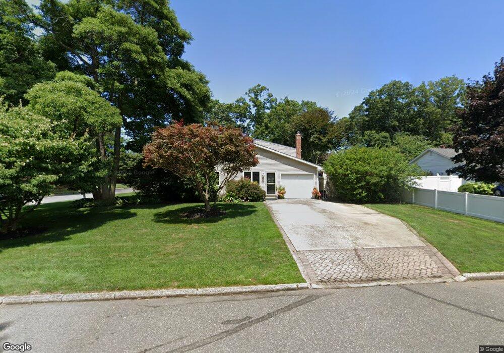
5 Sage Rd Port Jefferson Station, NY 11776
Estimated Value: $727,000 - $742,000
5
Beds
3
Baths
2,495
Sq Ft
$294/Sq Ft
Est. Value
About This Home
This home is located at 5 Sage Rd, Port Jefferson Station, NY 11776 and is currently estimated at $733,383, approximately $293 per square foot. 5 Sage Rd is a home located in Suffolk County with nearby schools including John F Kennedy Middle School and Comsewogue High School.
Ownership History
Date
Name
Owned For
Owner Type
Purchase Details
Closed on
May 22, 2003
Sold by
Mcaleer Kevin G
Bought by
Manzo Robert D and Grigorians Catherine T
Current Estimated Value
Home Financials for this Owner
Home Financials are based on the most recent Mortgage that was taken out on this home.
Original Mortgage
$259,900
Outstanding Balance
$112,793
Interest Rate
5.77%
Mortgage Type
Purchase Money Mortgage
Estimated Equity
$620,590
Purchase Details
Closed on
Oct 29, 1998
Sold by
Crowe Elizabeth Ann
Bought by
Mcaleer Kevin G
Home Financials for this Owner
Home Financials are based on the most recent Mortgage that was taken out on this home.
Original Mortgage
$115,000
Interest Rate
6.68%
Create a Home Valuation Report for This Property
The Home Valuation Report is an in-depth analysis detailing your home's value as well as a comparison with similar homes in the area
Home Values in the Area
Average Home Value in this Area
Purchase History
| Date | Buyer | Sale Price | Title Company |
|---|---|---|---|
| Manzo Robert D | $359,900 | Commonwealth Land Title Ins | |
| Mcaleer Kevin G | $100,000 | Chicago Title Insurance Co |
Source: Public Records
Mortgage History
| Date | Status | Borrower | Loan Amount |
|---|---|---|---|
| Open | Manzo Robert D | $259,900 | |
| Previous Owner | Mcaleer Kevin G | $115,000 |
Source: Public Records
Tax History Compared to Growth
Tax History
| Year | Tax Paid | Tax Assessment Tax Assessment Total Assessment is a certain percentage of the fair market value that is determined by local assessors to be the total taxable value of land and additions on the property. | Land | Improvement |
|---|---|---|---|---|
| 2024 | $13,178 | $3,100 | $325 | $2,775 |
| 2023 | $13,178 | $3,100 | $325 | $2,775 |
| 2022 | $10,731 | $3,100 | $325 | $2,775 |
| 2021 | $10,731 | $3,100 | $325 | $2,775 |
| 2020 | $11,001 | $3,100 | $325 | $2,775 |
| 2019 | $11,001 | $0 | $0 | $0 |
| 2018 | $10,473 | $3,100 | $325 | $2,775 |
| 2017 | $10,473 | $3,100 | $325 | $2,775 |
| 2016 | $10,383 | $3,100 | $325 | $2,775 |
| 2015 | -- | $3,100 | $325 | $2,775 |
| 2014 | -- | $3,100 | $325 | $2,775 |
Source: Public Records
Map
Nearby Homes
- 4 Linda St
- 37 Deer Ln
- 4 Forest Ave
- 203 Sterling St
- 24 Kennedy Rd
- 105 Commodore Cir
- 26 Forest Ave
- 148 Captains Way
- 22 Washington Ave
- 29 Erin Ln
- 34 Thomas Ln
- 30 Bunny Ln
- 12 Deer Ln
- 460 Old Town Rd Unit 7G
- 460 Old Town Rd Unit 24E
- 460 Old Town Rd Unit 7K
- 460 Old Town Rd Unit 8H
- 460 Old Town Rd Unit 25L Upper Unit
- 460 Old Town Rd Unit 26P
- 460 Old Town Rd Unit 25M