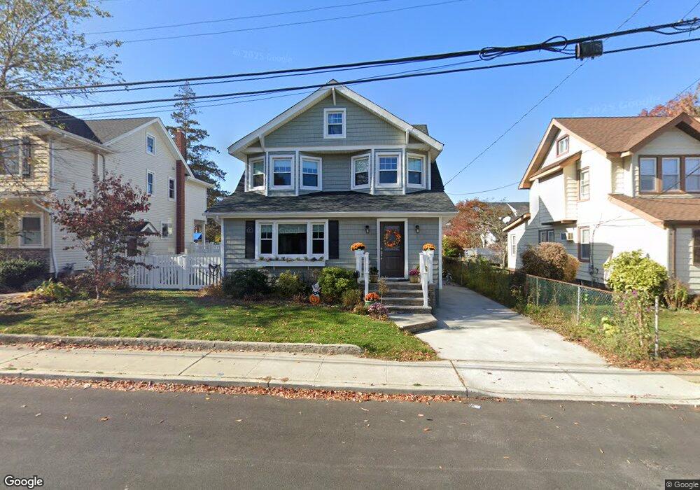
5 Samuel Place Lynbrook, NY 11563
Estimated Value: $770,839 - $911,000
4
Beds
2
Baths
1,874
Sq Ft
$449/Sq Ft
Est. Value
About This Home
This home is located at 5 Samuel Place, Lynbrook, NY 11563 and is currently estimated at $840,920, approximately $448 per square foot. 5 Samuel Place is a home located in Nassau County with nearby schools including Lynbrook Senior High School and Our Lady Of Peace School.
Ownership History
Date
Name
Owned For
Owner Type
Purchase Details
Closed on
Jul 19, 2017
Sold by
5 Samuel Place Inc
Bought by
Morrissey Ryan and Morrissey Caroline
Current Estimated Value
Home Financials for this Owner
Home Financials are based on the most recent Mortgage that was taken out on this home.
Original Mortgage
$512,000
Outstanding Balance
$425,502
Interest Rate
3.9%
Mortgage Type
New Conventional
Estimated Equity
$415,418
Purchase Details
Closed on
Dec 28, 2016
Sold by
Dadone George and Dadone Diane
Bought by
5 Samuel Place Inc
Create a Home Valuation Report for This Property
The Home Valuation Report is an in-depth analysis detailing your home's value as well as a comparison with similar homes in the area
Home Values in the Area
Average Home Value in this Area
Purchase History
| Date | Buyer | Sale Price | Title Company |
|---|---|---|---|
| Morrissey Ryan | $640,000 | Langdon Title Agency Llc | |
| 5 Samuel Place Inc | $295,000 | Mac Gregor Abstract Corp |
Source: Public Records
Mortgage History
| Date | Status | Borrower | Loan Amount |
|---|---|---|---|
| Open | Morrissey Ryan | $512,000 |
Source: Public Records
Tax History
| Year | Tax Paid | Tax Assessment Tax Assessment Total Assessment is a certain percentage of the fair market value that is determined by local assessors to be the total taxable value of land and additions on the property. | Land | Improvement |
|---|---|---|---|---|
| 2025 | $10,475 | $485 | $177 | $308 |
| 2024 | $1,092 | $526 | $192 | $334 |
Source: Public Records
Map
Nearby Homes
- 185 Atlantic Ave Unit C-1
- 185 Atlantic Ave Unit B8
- 185 Atlantic Ave Unit C-3
- 85 Oakland Ave
- 161 Union Ave Unit 5
- 161 Union Ave Unit 10
- 200 Atlantic Ave Unit 123
- 200 Atlantic Ave Unit 223
- 200 Atlantic Ave Unit 212
- 200 Atlantic Ave Unit 226
- 200 Atlantic Ave Unit 417
- 200 Atlantic Ave Unit 331
- 200 Atlantic Ave Unit 138
- 29 Grant Ave
- 23 Thompson Place
- 725 Scranton Ave
- 25 Davison Ave
- 280 Atlantic Ave Unit 140
- 280 Atlantic Ave Unit 316
- 315 Atlantic Ave
- 3 Samuel Place
- 7 Samuel Place
- 9 Samuel Place
- 40 Watts Place
- 44 Watts Place
- 1 Samuel Place
- 6 Samuel Place
- 34 Watts Place
- 4 Samuel Place
- 50 Watts Place
- 2 Samuel Place
- 10 Samuel Place
- 30 Watts Place
- 8 Samuel Place
- 641 Scranton Ave
- 637 Scranton Ave
- 50 Clinton Ave
- 633 Scranton Ave
- 643 Scranton Ave
- 37 Clinton Ave
Your Personal Tour Guide
Ask me questions while you tour the home.