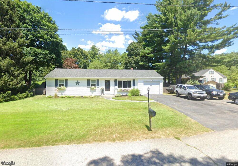
5 Shady Ln Seekonk, MA 02771
Estimated Value: $399,000 - $481,000
3
Beds
1
Bath
1,056
Sq Ft
$422/Sq Ft
Est. Value
About This Home
This home is located at 5 Shady Ln, Seekonk, MA 02771 and is currently estimated at $445,890, approximately $422 per square foot. 5 Shady Ln is a home located in Bristol County with nearby schools including Seekonk High School, St Margaret School, and The Wolf School.
Ownership History
Date
Name
Owned For
Owner Type
Purchase Details
Closed on
Jun 6, 2001
Sold by
Townsend Eileen M
Bought by
Desmarais Greg P and Desmarais Donna M
Current Estimated Value
Home Financials for this Owner
Home Financials are based on the most recent Mortgage that was taken out on this home.
Original Mortgage
$80,000
Interest Rate
7.08%
Mortgage Type
Purchase Money Mortgage
Create a Home Valuation Report for This Property
The Home Valuation Report is an in-depth analysis detailing your home's value as well as a comparison with similar homes in the area
Home Values in the Area
Average Home Value in this Area
Purchase History
| Date | Buyer | Sale Price | Title Company |
|---|---|---|---|
| Desmarais Greg P | $159,000 | -- |
Source: Public Records
Mortgage History
| Date | Status | Borrower | Loan Amount |
|---|---|---|---|
| Open | Desmarais Greg P | $83,943 | |
| Closed | Desmarais Greg P | $80,000 |
Source: Public Records
Tax History Compared to Growth
Tax History
| Year | Tax Paid | Tax Assessment Tax Assessment Total Assessment is a certain percentage of the fair market value that is determined by local assessors to be the total taxable value of land and additions on the property. | Land | Improvement |
|---|---|---|---|---|
| 2025 | $4,756 | $385,100 | $167,200 | $217,900 |
| 2024 | $4,590 | $371,700 | $167,200 | $204,500 |
| 2023 | $4,482 | $341,900 | $149,700 | $192,200 |
| 2022 | $4,126 | $309,300 | $144,900 | $164,400 |
| 2021 | $3,847 | $283,500 | $122,400 | $161,100 |
| 2020 | $3,601 | $273,400 | $122,400 | $151,000 |
| 2019 | $3,316 | $253,900 | $122,400 | $131,500 |
| 2018 | $3,244 | $243,000 | $117,900 | $125,100 |
| 2017 | $3,045 | $226,200 | $117,900 | $108,300 |
| 2016 | $3,021 | $225,300 | $117,900 | $107,400 |
| 2015 | $2,962 | $223,900 | $117,900 | $106,000 |
Source: Public Records
Map
Nearby Homes
- 442 Taunton Ave
- 62 Chestnut St
- 0 Patterson St Unit 73348933
- 0 Pleasant St
- 12 Arthur St
- 181 Hope St
- 224 Arcade Ave
- 296 Fall River Ave
- 0 Milton St Unit 72633661
- 824 Taunton Ave
- 0 Taunton Ave
- 181 Sherman Ave
- 39 John Alden Rd
- 24 Morra Way
- 420 Chestnut St
- 0 Arcade Ave Unit 73446971
- 349 County St
- 524 County St
- 62 Byron Ave
- 25 Lincoln St