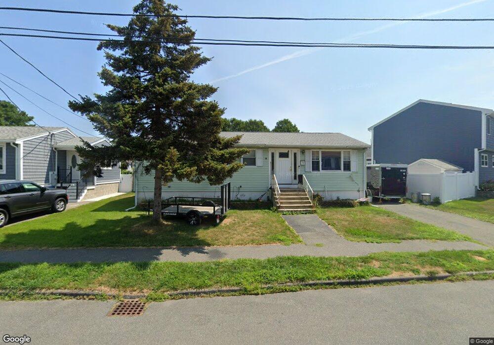
5 Sheffield Dr Peabody, MA 01960
Estimated Value: $615,386 - $694,000
3
Beds
1
Bath
1,400
Sq Ft
$471/Sq Ft
Est. Value
About This Home
This home is located at 5 Sheffield Dr, Peabody, MA 01960 and is currently estimated at $659,097, approximately $470 per square foot. 5 Sheffield Dr is a home located in Essex County with nearby schools including Peabody Veterans Memorial High School, St John The Baptist School, and Bishop Fenwick High School.
Ownership History
Date
Name
Owned For
Owner Type
Purchase Details
Closed on
Jun 3, 2016
Sold by
Anderson Edward P
Bought by
Anderson Cory J
Current Estimated Value
Home Financials for this Owner
Home Financials are based on the most recent Mortgage that was taken out on this home.
Original Mortgage
$253,600
Outstanding Balance
$201,969
Interest Rate
3.59%
Mortgage Type
New Conventional
Estimated Equity
$457,128
Purchase Details
Closed on
Nov 24, 1999
Sold by
Palmisano P J and Palmisano Michelle
Bought by
Oshea-Sousa Arminda
Purchase Details
Closed on
Jun 11, 1997
Sold by
Shulman Peter J
Bought by
Danforth Carey&Co Inc
Purchase Details
Closed on
May 1, 1996
Sold by
Fleming John M and Fleming Diane
Bought by
Palmisano Patrick and Palmisano Michelle
Create a Home Valuation Report for This Property
The Home Valuation Report is an in-depth analysis detailing your home's value as well as a comparison with similar homes in the area
Home Values in the Area
Average Home Value in this Area
Purchase History
| Date | Buyer | Sale Price | Title Company |
|---|---|---|---|
| Anderson Cory J | $317,000 | -- | |
| Oshea-Sousa Arminda | $200,000 | -- | |
| Danforth Carey&Co Inc | $270,000 | -- | |
| Palmisano Patrick | $165,000 | -- |
Source: Public Records
Mortgage History
| Date | Status | Borrower | Loan Amount |
|---|---|---|---|
| Open | Anderson Cory J | $253,600 | |
| Previous Owner | Palmisano Patrick | $265,000 | |
| Previous Owner | Palmisano Patrick | $265,000 |
Source: Public Records
Tax History Compared to Growth
Tax History
| Year | Tax Paid | Tax Assessment Tax Assessment Total Assessment is a certain percentage of the fair market value that is determined by local assessors to be the total taxable value of land and additions on the property. | Land | Improvement |
|---|---|---|---|---|
| 2025 | $4,586 | $495,200 | $228,000 | $267,200 |
| 2024 | $4,295 | $470,900 | $228,000 | $242,900 |
| 2023 | $4,143 | $435,200 | $203,600 | $231,600 |
| 2022 | $3,799 | $376,100 | $181,800 | $194,300 |
| 2021 | $3,742 | $356,700 | $165,300 | $191,400 |
| 2020 | $4,034 | $375,600 | $165,300 | $210,300 |
| 2019 | $3,711 | $337,100 | $165,300 | $171,800 |
| 2018 | $3,554 | $310,100 | $150,300 | $159,800 |
| 2017 | $3,434 | $292,000 | $150,300 | $141,700 |
| 2016 | $3,382 | $283,700 | $150,300 | $133,400 |
| 2015 | $3,020 | $245,500 | $146,500 | $99,000 |
Source: Public Records
Map
Nearby Homes
- 28 Sabino Farm Rd
- 29 Reynolds Rd
- 152 Endicott St
- 27 Pulaski St
- 55 Pulaski St
- 26 Colonial Rd
- 68 Prospect St Unit 14
- 5 Colonial Rd
- 7 Rainbow Terrace
- 0 Willowdale Ave Unit 73387007
- 9 Endicott St Unit B
- 21 Emerson St
- 90 Water St
- 4R Forest St
- 33 Water St Unit 7
- 8R Elm St Unit 2
- 5 Tremont Place
- 108 Abington Rd Unit 108
- 112 Abington Rd
- 4 Northend St