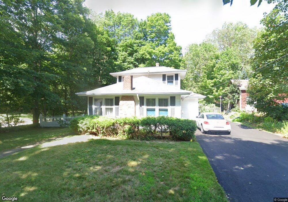
5 Sherman St Foxboro, MA 02035
Estimated Value: $509,660 - $716,000
3
Beds
2
Baths
1,244
Sq Ft
$490/Sq Ft
Est. Value
About This Home
This home is located at 5 Sherman St, Foxboro, MA 02035 and is currently estimated at $609,415, approximately $489 per square foot. 5 Sherman St is a home located in Norfolk County with nearby schools including Foxborough High School, Foxborough Regional Charter School, and The Sage School.
Ownership History
Date
Name
Owned For
Owner Type
Purchase Details
Closed on
Dec 10, 2024
Sold by
Rice Beth M
Bought by
Chicoine Shirley G and Rice
Current Estimated Value
Purchase Details
Closed on
Dec 6, 2023
Sold by
Chicoine Shirley G
Bought by
Rice Beth M
Purchase Details
Closed on
May 4, 2004
Sold by
Chicoine Ramona E and Chicoine Shirley G
Bought by
Chicoine Shirley G
Purchase Details
Closed on
Dec 10, 1982
Bought by
Chicoine Shirley G
Create a Home Valuation Report for This Property
The Home Valuation Report is an in-depth analysis detailing your home's value as well as a comparison with similar homes in the area
Home Values in the Area
Average Home Value in this Area
Purchase History
| Date | Buyer | Sale Price | Title Company |
|---|---|---|---|
| Chicoine Shirley G | -- | None Available | |
| Elwood Rt | -- | None Available | |
| Chicoine Shirley G | -- | None Available | |
| Rice Beth M | -- | None Available | |
| Rice Beth M | -- | None Available | |
| Chicoine Shirley G | -- | -- | |
| Chicoine Shirley G | -- | -- | |
| Chicoine Shirley G | -- | -- |
Source: Public Records
Tax History
| Year | Tax Paid | Tax Assessment Tax Assessment Total Assessment is a certain percentage of the fair market value that is determined by local assessors to be the total taxable value of land and additions on the property. | Land | Improvement |
|---|---|---|---|---|
| 2025 | $4,893 | $370,100 | $202,000 | $168,100 |
| 2024 | $4,912 | $363,600 | $202,000 | $161,600 |
| 2023 | $4,799 | $337,700 | $192,400 | $145,300 |
| 2022 | $4,747 | $326,900 | $184,100 | $142,800 |
| 2021 | $4,569 | $310,000 | $167,300 | $142,700 |
| 2020 | $4,517 | $310,000 | $167,300 | $142,700 |
| 2019 | $4,348 | $295,800 | $159,400 | $136,400 |
| 2018 | $4,091 | $280,800 | $159,400 | $121,400 |
| 2017 | $3,841 | $255,400 | $149,000 | $106,400 |
| 2016 | $3,738 | $252,200 | $143,300 | $108,900 |
| 2015 | $3,606 | $237,400 | $121,000 | $116,400 |
| 2014 | $3,526 | $235,200 | $118,600 | $116,600 |
Source: Public Records
Map
Nearby Homes
- 26 Fuller Rd Unit 6
- 13 Summerville Rd Unit 13
- 14 Baker St
- 84 South St
- 157 Central St
- 54 Main St Unit A
- 2 Eisenhauer
- 165 Chestnut St Unit 2
- 147 Chestnut St Unit A
- 147 Chestnut St Unit B
- 233 Central St
- 155 South St
- 22 Villa Dr
- 73 Ridge Rd
- 5 Post Rd
- 6 Cross St
- 16 County St
- 356 Central St
- 24 Eastman Ave
- 1 Maura Elizabeth Ln
- 8 Sherman St
- 41 Cocasset St
- 39 Cocasset St
- 37 Cocasset St
- 45 Cocasset St
- 10 Sherman St
- 00-00 Club Life St
- 40 Cocasset St
- 35 Cocasset St
- 47 Cocasset St Unit 1
- 47 Cocasset St Unit 6
- 47 Cocasset St
- 47 Cocasset St Unit 4
- 47 Cocasset St Unit 3
- 31 Cocasset St Unit 7
- 31 Cocasset St Unit 6
- 31 Cocasset St Unit 5
- 31 Cocasset St Unit 4
- 31 Cocasset St Unit 3
- 31 Cocasset St Unit 2
Your Personal Tour Guide
Ask me questions while you tour the home.