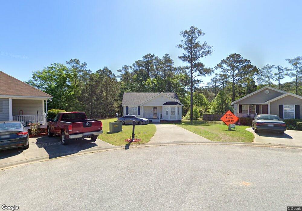
5 Shoreham Ct Columbia, SC 29210
Saint Andrews NeighborhoodEstimated Value: $180,531 - $213,000
3
Beds
2
Baths
1,270
Sq Ft
$154/Sq Ft
Est. Value
About This Home
This home is located at 5 Shoreham Ct, Columbia, SC 29210 and is currently estimated at $195,383, approximately $153 per square foot. 5 Shoreham Ct is a home located in Richland County with nearby schools including Sandel Elementary School, St. Andrews Middle School, and Columbia High School.
Ownership History
Date
Name
Owned For
Owner Type
Purchase Details
Closed on
Sep 24, 2014
Sold by
Buchanan Pauline S and Buchanan Patrick F
Bought by
Ginn Bridgette D
Current Estimated Value
Home Financials for this Owner
Home Financials are based on the most recent Mortgage that was taken out on this home.
Original Mortgage
$84,638
Outstanding Balance
$64,868
Interest Rate
4.17%
Mortgage Type
New Conventional
Estimated Equity
$130,515
Create a Home Valuation Report for This Property
The Home Valuation Report is an in-depth analysis detailing your home's value as well as a comparison with similar homes in the area
Home Values in the Area
Average Home Value in this Area
Purchase History
| Date | Buyer | Sale Price | Title Company |
|---|---|---|---|
| Ginn Bridgette D | $36,596 | -- |
Source: Public Records
Mortgage History
| Date | Status | Borrower | Loan Amount |
|---|---|---|---|
| Open | Ginn Bridgette D | $84,638 |
Source: Public Records
Tax History Compared to Growth
Tax History
| Year | Tax Paid | Tax Assessment Tax Assessment Total Assessment is a certain percentage of the fair market value that is determined by local assessors to be the total taxable value of land and additions on the property. | Land | Improvement |
|---|---|---|---|---|
| 2024 | $1,124 | $110,100 | $0 | $0 |
| 2023 | $1,079 | $3,828 | $0 | $0 |
| 2022 | $980 | $95,700 | $12,500 | $83,200 |
| 2021 | $972 | $3,830 | $0 | $0 |
| 2020 | $987 | $3,830 | $0 | $0 |
| 2019 | $959 | $3,830 | $0 | $0 |
| 2018 | $869 | $3,450 | $0 | $0 |
| 2017 | $852 | $3,450 | $0 | $0 |
| 2016 | $849 | $3,450 | $0 | $0 |
| 2015 | $828 | $3,450 | $0 | $0 |
| 2014 | $2,532 | $90,500 | $0 | $0 |
| 2013 | -- | $5,430 | $0 | $0 |
Source: Public Records
Map
Nearby Homes
- 1509 Nunamaker Dr
- 1533 Westchester Dr
- 1605 Kathleen Dr
- 1618 van Lingle Ave
- 1204 Old Manor Rd
- 1101 Menlo Dr
- 1825 Woodsboro Dr
- 1810 Saint Michaels Rd
- 1917 Chandler Ave
- 104 Menlo Dr
- 506 Menlo Dr
- 101 Menlo Dr
- 2006 Mary Hill Dr
- 1917 Kathleen Dr
- 1900 Rolling Hills Rd
- 1127 Shirlington Rd
- 2225 Hertford Dr
- 2229 Hertford Dr
- 2116 Chandler Ave
- 2135 Rolling Hills Rd
- 9 Shoreham Ct
- 120 St Andrews Place Ct
- 124 St Andrews Place Dr
- 10 Shoreham Ct
- 124 Saint Andrews Place Dr
- 120 Saint Andrews Place Dr
- 128 Saint Andrews Place Dr
- 1427 Nunamaker Dr
- 1431 Nunamaker Dr
- 6 Shoreham Ct
- 132 St Andrews Place Dr
- 1423 Nunamaker Dr
- 1435 Nunamaker Dr
- 121 Saint Andrews Place Dr
- 125 Saint Andrews Place Dr
- 112 Saint Andrews Place Dr
- 136 Saint Andrews Place Dr
- 129 Saint Andrews Place Dr
- 121 Saint Andrews Place Rd
- 136 St Andrew's Place Dr