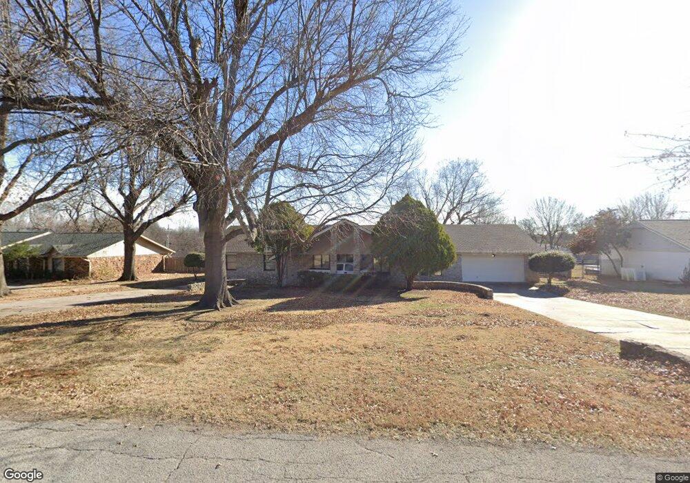
5 St Andrews Cir Broken Arrow, OK 74011
Cedar Ridge NeighborhoodEstimated Value: $387,000 - $474,000
3
Beds
3
Baths
2,591
Sq Ft
$166/Sq Ft
Est. Value
About This Home
This home is located at 5 St Andrews Cir, Broken Arrow, OK 74011 and is currently estimated at $430,379, approximately $166 per square foot. 5 St Andrews Cir is a home located in Tulsa County with nearby schools including Cedar Ridge Elementary School, Union 8th Grade Center, and Union 6th-7th Grade Center.
Ownership History
Date
Name
Owned For
Owner Type
Purchase Details
Closed on
Aug 11, 2001
Sold by
Kletzker Wallace S and Kletzker Cheryl L
Bought by
Cendant Mobility Financial Corp
Current Estimated Value
Purchase Details
Closed on
Apr 22, 2001
Sold by
Cendant Mobility Financial Corp
Bought by
Curtis Donald L and Curtis Debbie K
Purchase Details
Closed on
Oct 1, 1998
Sold by
Swan Doris Jean and Sower Doris Jean
Bought by
Kletzker Wallace S and Kletzker Cheryl L
Create a Home Valuation Report for This Property
The Home Valuation Report is an in-depth analysis detailing your home's value as well as a comparison with similar homes in the area
Home Values in the Area
Average Home Value in this Area
Purchase History
| Date | Buyer | Sale Price | Title Company |
|---|---|---|---|
| Cendant Mobility Financial Corp | $184,500 | -- | |
| Curtis Donald L | $158,000 | Firstitle & Abstract Svcs In | |
| Kletzker Wallace S | $163,500 | Guaranty Abstract Company |
Source: Public Records
Tax History
| Year | Tax Paid | Tax Assessment Tax Assessment Total Assessment is a certain percentage of the fair market value that is determined by local assessors to be the total taxable value of land and additions on the property. | Land | Improvement |
|---|---|---|---|---|
| 2025 | $3,868 | $29,463 | $4,244 | $25,219 |
| 2024 | $3,449 | $28,059 | $4,026 | $24,033 |
| 2023 | $3,449 | $26,723 | $3,722 | $23,001 |
| 2022 | $3,312 | $25,451 | $5,787 | $19,664 |
| 2021 | $3,164 | $24,239 | $5,511 | $18,728 |
| 2020 | $3,185 | $24,239 | $5,511 | $18,728 |
| 2019 | $3,082 | $23,494 | $5,342 | $18,152 |
| 2018 | $2,927 | $22,375 | $5,087 | $17,288 |
| 2017 | $2,825 | $21,310 | $4,845 | $16,465 |
| 2016 | $2,655 | $20,295 | $5,511 | $14,784 |
| 2015 | $2,656 | $20,295 | $5,511 | $14,784 |
| 2014 | $2,640 | $20,295 | $5,511 | $14,784 |
Source: Public Records
Map
Nearby Homes
- 4309 S Mimosa Ave
- 4609 W Charleston St
- 5716 W Austin St
- 10628 E 100th St
- 11106 S 108th East Place
- 2416 W Birmingham St
- 3259 E 169th St S
- 3276 E 169th St S
- 3227 E 169th St S
- 3243 E 169th St S
- 5904 W Orlando Cir
- 6009 W Utica Cir
- 4529 S Retana Ave
- 6101 W Birmingham Cir
- 11309 S 107th East Ave
- 4607 S Retana Place
- 3816 S Yellow Pine Ave
- 4311 S Sweet Gum Ave
- 4405 W Ithica St
- 4401 S Yellow Pine Ave
- 9 St Andrews Cir
- 1 St Andrews Cir
- 9 Saint Andrews Cir
- 13 St Andrews Cir
- 6 St Andrews Cir
- 10439 S Garnett Rd
- 10 Saint Andrews Cir
- 10 St Andrews Cir
- 10437 S Garnett Rd
- 10435 S Garnett Rd
- 15 Cedar Ridge Rd
- 2 Cedar Ridge Rd
- 10 Cedar Ridge Rd
- 6 Cedar Ridge Rd
- 10501 S Garnett Rd
- 17 St Andrews Cir
- 14 St Andrews Cir
- 19 Cedar Ridge Rd
- 14 Cedar Ridge Rd
- 54 St Andrews Cir
