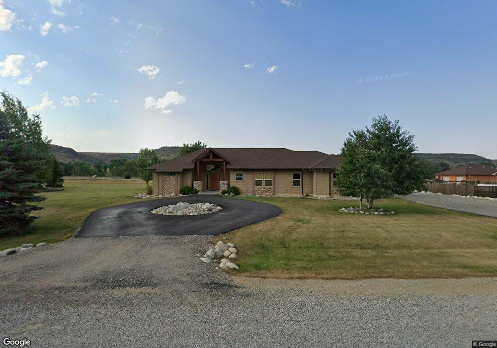
5 Star Haven Dr Absarokee, MT 59001
Estimated Value: $520,000 - $716,000
3
Beds
3
Baths
1,868
Sq Ft
$315/Sq Ft
Est. Value
About This Home
This home is located at 5 Star Haven Dr, Absarokee, MT 59001 and is currently estimated at $587,668, approximately $314 per square foot. 5 Star Haven Dr is a home located in Stillwater County with nearby schools including Absarokee School, Absarokee Junior High School, and Absarokee High School.
Ownership History
Date
Name
Owned For
Owner Type
Purchase Details
Closed on
Jan 31, 2013
Sold by
Smith Kevin J and Smith Paula L
Bought by
Sartori Olivia A
Current Estimated Value
Home Financials for this Owner
Home Financials are based on the most recent Mortgage that was taken out on this home.
Original Mortgage
$100,000
Outstanding Balance
$68,657
Interest Rate
3.33%
Estimated Equity
$519,011
Purchase Details
Closed on
Nov 16, 2005
Sold by
Gertulla Properties Llc
Bought by
Smith Kevin J and Smith Paula L
Create a Home Valuation Report for This Property
The Home Valuation Report is an in-depth analysis detailing your home's value as well as a comparison with similar homes in the area
Purchase History
| Date | Buyer | Sale Price | Title Company |
|---|---|---|---|
| Sartori Olivia A | -- | -- | |
| Smith Kevin J | -- | -- |
Source: Public Records
Mortgage History
| Date | Status | Borrower | Loan Amount |
|---|---|---|---|
| Open | Sartori Olivia A | $100,000 |
Source: Public Records
Tax History
| Year | Tax Paid | Tax Assessment Tax Assessment Total Assessment is a certain percentage of the fair market value that is determined by local assessors to be the total taxable value of land and additions on the property. | Land | Improvement |
|---|---|---|---|---|
| 2025 | $2,314 | $617,400 | $0 | $0 |
| 2024 | $2,691 | $455,700 | $0 | $0 |
| 2023 | $2,659 | $455,700 | $0 | $0 |
| 2022 | $2,093 | $321,500 | $0 | $0 |
| 2021 | $1,907 | $321,500 | $0 | $0 |
| 2020 | $1,847 | $278,000 | $0 | $0 |
| 2019 | $1,877 | $278,000 | $0 | $0 |
| 2018 | $2,183 | $310,500 | $0 | $0 |
| 2017 | $2,290 | $310,500 | $0 | $0 |
| 2016 | $1,835 | $265,300 | $0 | $0 |
| 2015 | $1,651 | $265,300 | $0 | $0 |
| 2014 | $1,628 | $138,595 | $0 | $0 |
Source: Public Records
Map
Nearby Homes
- A Johnson Dr Unit A
- 10 Alison Dr
- 119 S Woodard Ave
- 59 Abattoir Rd
- 21 & 23 S Woodard Ave Unit 2 -HOMES For Price o
- 30 Henry St
- 12 Avis St
- 12 Crow Child Trail
- 20 Crow Child Trail
- 41 Crow Child Trail
- 2994 Highway 78
- 15.9 Ac Buck Creek Rd
- 2825 & 2830 Highway 78 S
- 91 Upper Hawk Valley Rd
- 37 Barham Rd
- 79 Meyers Rd
- 79 Myers Rd
- TBD Brumfield RD Brumfield Rd
- 42 Bozeman Trail
- 26 Yates Rd
- 11 Star Haven Dr
- 45 Star Haven Dr
- NHN Star Haven Dr
- TBD Star Haven Rd
- 52 Star Haven Dr
- 50 Star Haven Dr
- 15 Star Haven Dr
- 46 Star Haven Dr
- 18 Star Haven Dr
- 42 Star Haven Dr
- 42 Star Haven Dr
- 42 Star Haven Dr
- 42 Star Haven Dr
- 42 Star Haven Dr
- 263 Stillwater River Rd
- 263 N Stillwater Rd
- 38 Star Haven Dr
- 259 N Stillwater Rd
- D38 Star Haven Dr
- 262 N Stillwater Rd
Your Personal Tour Guide
Ask me questions while you tour the home.