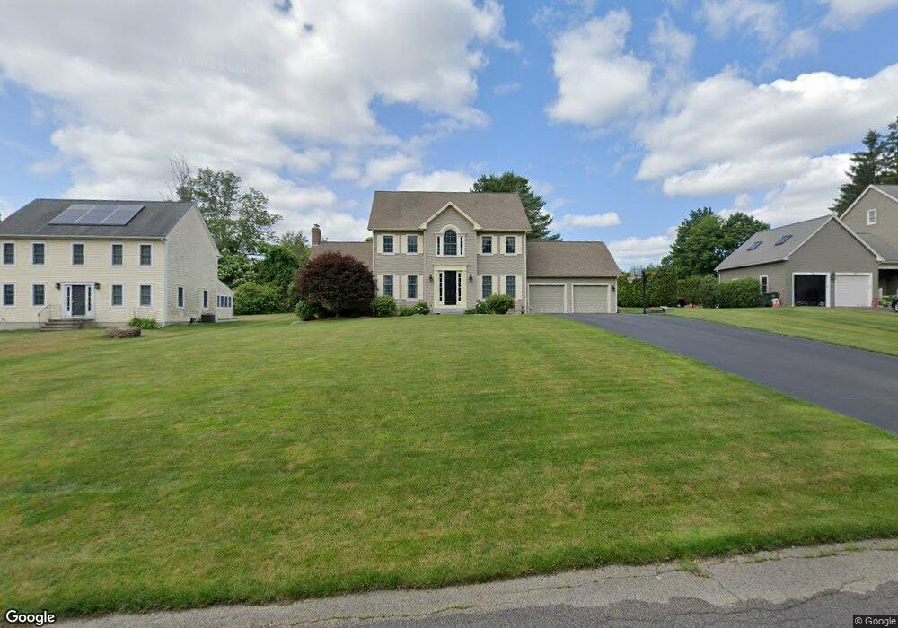
5 Stonebridge Rd Auburn, MA 01501
Pakachoag NeighborhoodEstimated Value: $680,381 - $757,000
4
Beds
3
Baths
2,384
Sq Ft
$297/Sq Ft
Est. Value
About This Home
This home is located at 5 Stonebridge Rd, Auburn, MA 01501 and is currently estimated at $707,345, approximately $296 per square foot. 5 Stonebridge Rd is a home located in Worcester County with nearby schools including Auburn Senior High School and Shrewsbury Montessori School - Auburn Campus.
Ownership History
Date
Name
Owned For
Owner Type
Purchase Details
Closed on
Jun 18, 2025
Sold by
Jackson
Bought by
Jackson Ft and Jackson
Current Estimated Value
Purchase Details
Closed on
Jan 2, 2025
Sold by
Jackson Shayne and Jackson Ann M
Bought by
Shayne & A M Jackson Irt and Jackson
Purchase Details
Closed on
Dec 1, 2005
Sold by
Emerson Homes Inc
Bought by
Jackson Ann Marie and Jackson Shayne C
Purchase Details
Closed on
Jun 4, 2002
Sold by
Emerson Dev Llp
Bought by
Emerson Homes Inc
Purchase Details
Closed on
May 21, 2002
Sold by
Emerson Dev Llp
Bought by
Emerson Home Inc
Create a Home Valuation Report for This Property
The Home Valuation Report is an in-depth analysis detailing your home's value as well as a comparison with similar homes in the area
Home Values in the Area
Average Home Value in this Area
Purchase History
| Date | Buyer | Sale Price | Title Company |
|---|---|---|---|
| Jackson Ft | -- | None Available | |
| Jackson Ft | -- | None Available | |
| Shayne & A M Jackson Irt | -- | None Available | |
| Shayne & A M Jackson Irt | -- | None Available | |
| Shayne & A M Jackson Irt | -- | None Available | |
| Jackson Ann Marie | $487,900 | -- | |
| Emerson Homes Inc | $185,000 | -- | |
| Emerson Homes Inc | $120,000 | -- | |
| Emerson Home Inc | $120,000 | -- | |
| Jackson Ann Marie | $487,900 | -- | |
| Emerson Homes Inc | $120,000 | -- | |
| Emerson Home Inc | $120,000 | -- |
Source: Public Records
Mortgage History
| Date | Status | Borrower | Loan Amount |
|---|---|---|---|
| Previous Owner | Emerson Home Inc | $56,000 | |
| Previous Owner | Emerson Home Inc | $248,000 |
Source: Public Records
Tax History
| Year | Tax Paid | Tax Assessment Tax Assessment Total Assessment is a certain percentage of the fair market value that is determined by local assessors to be the total taxable value of land and additions on the property. | Land | Improvement |
|---|---|---|---|---|
| 2025 | $8,138 | $569,500 | $137,100 | $432,400 |
| 2024 | $8,450 | $566,000 | $131,800 | $434,200 |
| 2023 | $8,053 | $507,100 | $119,900 | $387,200 |
| 2022 | $7,455 | $443,200 | $119,900 | $323,300 |
| 2021 | $7,339 | $404,600 | $106,400 | $298,200 |
| 2020 | $7,275 | $404,600 | $106,400 | $298,200 |
| 2019 | $7,184 | $390,000 | $104,500 | $285,500 |
| 2018 | $7,096 | $384,800 | $97,800 | $287,000 |
| 2017 | $6,889 | $375,600 | $88,600 | $287,000 |
| 2016 | $6,719 | $371,400 | $91,500 | $279,900 |
| 2015 | $6,436 | $372,900 | $91,500 | $281,400 |
| 2014 | $6,333 | $366,300 | $86,900 | $279,400 |
Source: Public Records
Map
Nearby Homes
- 2 Breezy Bend
- 29 Manor Rd
- 501 Forest Park Dr Unit 501
- 301 Forest Park Dr
- 6 Newton St
- 2 Mystic St
- 557 SW Cutoff Unit 17
- 557 SW Cutoff Unit 55
- 73 Sophia Dr
- 72 Sophia Dr
- 29 Steele St
- 6 Epworth St
- 2 Victoria Dr Unit 1
- 31 Walsh Ave
- 31-33 Walsh Ave
- 33 Walsh Ave
- 6 Beckman St
- 30 Ekman St
- 25 Vinal St Unit 26
- 25 Vinal St Unit 29
Your Personal Tour Guide
Ask me questions while you tour the home.