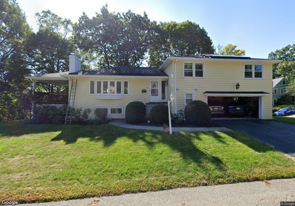
5 Stony Brook Rd Arlington, MA 02476
Arlington Center NeighborhoodEstimated Value: $1,486,000 - $1,611,000
4
Beds
3
Baths
2,500
Sq Ft
$617/Sq Ft
Est. Value
About This Home
This home is located at 5 Stony Brook Rd, Arlington, MA 02476 and is currently estimated at $1,541,686, approximately $616 per square foot. 5 Stony Brook Rd is a home located in Middlesex County with nearby schools including Brackett Elementary School, Bishop Elementary School, and Ottoson Middle School.
Ownership History
Date
Name
Owned For
Owner Type
Purchase Details
Closed on
Aug 5, 2025
Sold by
Li Nan and Ouyang Lian
Bought by
Ji And Ouyang Ft and Ouyang
Current Estimated Value
Purchase Details
Closed on
Feb 18, 2009
Sold by
Brown Rt and Brown
Bought by
Ouyang Lian and Ji Nan
Create a Home Valuation Report for This Property
The Home Valuation Report is an in-depth analysis detailing your home's value as well as a comparison with similar homes in the area
Home Values in the Area
Average Home Value in this Area
Purchase History
| Date | Buyer | Sale Price | Title Company |
|---|---|---|---|
| Ji And Ouyang Ft | -- | -- | |
| Ji And Ouyang Ft | -- | -- | |
| Ouyang Lian | $575,000 | -- | |
| Ouyang Lian | $575,000 | -- |
Source: Public Records
Mortgage History
| Date | Status | Borrower | Loan Amount |
|---|---|---|---|
| Previous Owner | Ouyang Lian | $415,000 | |
| Previous Owner | Ouyang Lian | $416,000 | |
| Previous Owner | Ouyang Lian | $417,000 |
Source: Public Records
Tax History
| Year | Tax Paid | Tax Assessment Tax Assessment Total Assessment is a certain percentage of the fair market value that is determined by local assessors to be the total taxable value of land and additions on the property. | Land | Improvement |
|---|---|---|---|---|
| 2025 | $13,649 | $1,267,300 | $805,300 | $462,000 |
| 2024 | $12,523 | $1,182,500 | $776,000 | $406,500 |
| 2023 | $12,282 | $1,095,600 | $710,100 | $385,500 |
| 2022 | $11,391 | $997,500 | $658,900 | $338,600 |
| 2021 | $11,185 | $986,300 | $658,900 | $327,400 |
| 2020 | $10,908 | $986,300 | $658,900 | $327,400 |
| 2019 | $11,162 | $991,300 | $695,500 | $295,800 |
| 2018 | $9,803 | $808,200 | $512,400 | $295,800 |
| 2017 | $9,876 | $786,300 | $490,500 | $295,800 |
| 2016 | $9,596 | $749,700 | $453,900 | $295,800 |
| 2015 | $8,538 | $630,100 | $380,700 | $249,400 |
Source: Public Records
Map
Nearby Homes
- 31 Brunswick Rd
- 9 Venner Rd
- 384 Brighton St
- 93 Churchill Ave
- 315 Lake St
- 2 Bellevue Rd
- 108 Radcliffe Rd
- 115 Gloucester St
- 27 Little Pond Rd
- 27 Stella Rd
- 23 Stearns Rd
- 32 Colonial Dr
- 23 Newman Way Unit 1
- 16 Cheswick Rd
- 33 Lombard Rd
- 40 Pleasant St Unit 2
- 14 Albermarle St Unit 14
- 10 Lamoine St
- 21 Avon Place
- 16-18 Pondview Rd
- 5 Stoney Brook Rd
- 52 Hillsdale Rd
- 10 Stony Brook Rd
- 56 Hillsdale Rd
- 4 Stoney Brook Rd
- 7 Stoney Brook Rd
- 4 Stony Brook Rd
- Ten Stony Brook Rd
- 45 Hillsdale Rd
- 49 Hillsdale Rd
- 9 Stony Brook Rd
- 41 Hillsdale Rd
- 8 Stoney Brook Rd
- 8 Stony Brook Rd
- 37 Brunswick Rd
- 11 Stoney Brook Rd
- 33 Brunswick Rd
- 20 Pleasant View Rd
- 16 Pleasant View Rd
- 31 Hillsdale Rd
Your Personal Tour Guide
Ask me questions while you tour the home.