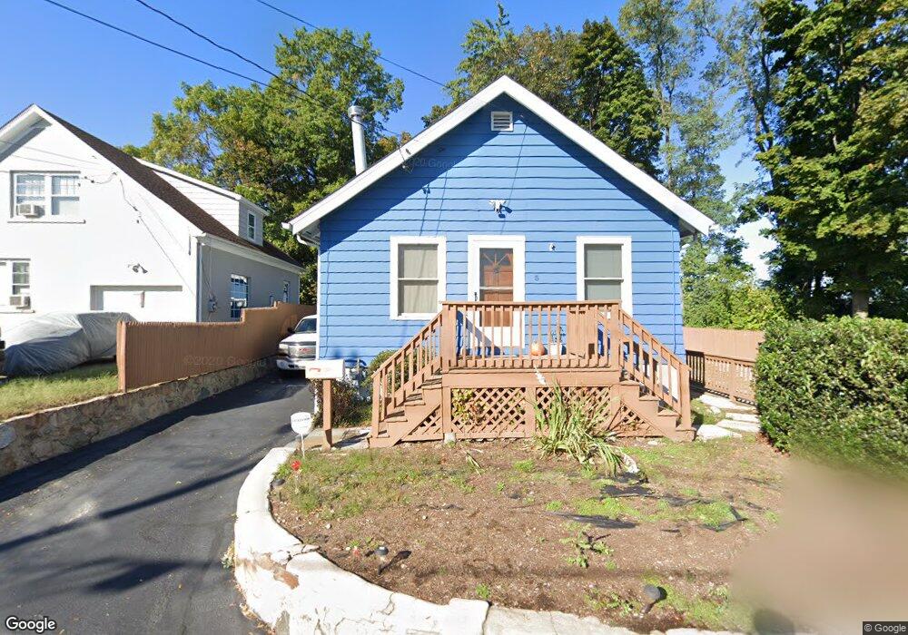
5 Summitt Ave Norwalk, CT 06854
Brookside NeighborhoodEstimated Value: $307,000 - $490,000
1
Bed
1
Bath
802
Sq Ft
$512/Sq Ft
Est. Value
About This Home
This home is located at 5 Summitt Ave, Norwalk, CT 06854 and is currently estimated at $410,350, approximately $511 per square foot. 5 Summitt Ave is a home located in Fairfield County with nearby schools including Kendall Elementary School, Ponus Ridge Middle School, and Brien Mcmahon High School.
Ownership History
Date
Name
Owned For
Owner Type
Purchase Details
Closed on
Oct 14, 2009
Sold by
Bonanni Genie and Hains Jeffrey
Bought by
English Brian A and Sibilia Carmela P
Current Estimated Value
Home Financials for this Owner
Home Financials are based on the most recent Mortgage that was taken out on this home.
Original Mortgage
$197,000
Outstanding Balance
$129,031
Interest Rate
5.14%
Estimated Equity
$281,319
Create a Home Valuation Report for This Property
The Home Valuation Report is an in-depth analysis detailing your home's value as well as a comparison with similar homes in the area
Home Values in the Area
Average Home Value in this Area
Purchase History
| Date | Buyer | Sale Price | Title Company |
|---|---|---|---|
| English Brian A | $250,000 | -- | |
| English Brian A | $250,000 | -- |
Source: Public Records
Mortgage History
| Date | Status | Borrower | Loan Amount |
|---|---|---|---|
| Open | English Brian A | $197,000 | |
| Closed | English Brian A | $197,000 | |
| Previous Owner | English Brian A | $109,000 | |
| Previous Owner | English Brian A | $112,000 |
Source: Public Records
Tax History Compared to Growth
Tax History
| Year | Tax Paid | Tax Assessment Tax Assessment Total Assessment is a certain percentage of the fair market value that is determined by local assessors to be the total taxable value of land and additions on the property. | Land | Improvement |
|---|---|---|---|---|
| 2025 | $5,330 | $223,020 | $105,840 | $117,180 |
| 2024 | $5,251 | $223,020 | $105,840 | $117,180 |
| 2023 | $3,618 | $144,220 | $72,770 | $71,450 |
| 2022 | $3,540 | $144,220 | $72,770 | $71,450 |
| 2021 | $3,457 | $144,220 | $72,770 | $71,450 |
| 2020 | $3,455 | $144,220 | $72,770 | $71,450 |
| 2019 | $3,362 | $144,220 | $72,770 | $71,450 |
| 2018 | $3,274 | $123,050 | $65,360 | $57,690 |
| 2017 | $3,160 | $123,050 | $65,360 | $57,690 |
| 2016 | $3,130 | $123,050 | $65,360 | $57,690 |
| 2015 | $3,110 | $122,590 | $65,360 | $57,230 |
| 2014 | $3,070 | $122,590 | $65,360 | $57,230 |
Source: Public Records
Map
Nearby Homes
- 8 Crown Ave
- 14 Ferris Ave Unit 9
- 59 Taylor Ave
- 47 Taylor Ave
- 6 W Couch St
- 1 Horizon Dr Unit 2
- 187 Flax Hill Rd Unit D5
- 42 Stuart Ave Unit A1
- 63 Ferris Ave
- 10 Ann St Unit 206
- 32 Pine St Unit 27
- 32 Pine St Unit 26
- 39 Chatham Dr
- 17 Woodlawn Ave
- 15 Madison St Unit F9
- 15 Madison St Unit G11
- 33 N Water St Unit 506
- 33 N Water St Unit 505
- 33 N Water St
- 33 N Water St Unit 804
- 7 Summitt Ave
- 11 Summitt Ave
- 18 Allview Ave
- 16 Allview Ave
- 15 Summitt Ave
- 92 Cedar St
- 20 Allview Ave
- 17 Summitt Ave
- 22 Allview Ave
- 23 Allview Ave
- 24 Allview Ave
- 8 Summitt Ave
- 8 Summitt Ave Unit 1
- 8 Summitt Ave Unit 1stFL
- 26 Allview Ave
- 25 Allview Ave
- 135 Connecticut Ave Unit A
- 135 Connecticut Ave Unit D
- 135 Connecticut Ave Unit E
- 135 Connecticut Ave Unit B